Property Record
Groveland Station Rd, Groveland, NY 14462
NEARBY LISTINGS FOR SALE OR LEASE
-
-
View all Groveland listings for sale on LoopNet.com
Property Detail
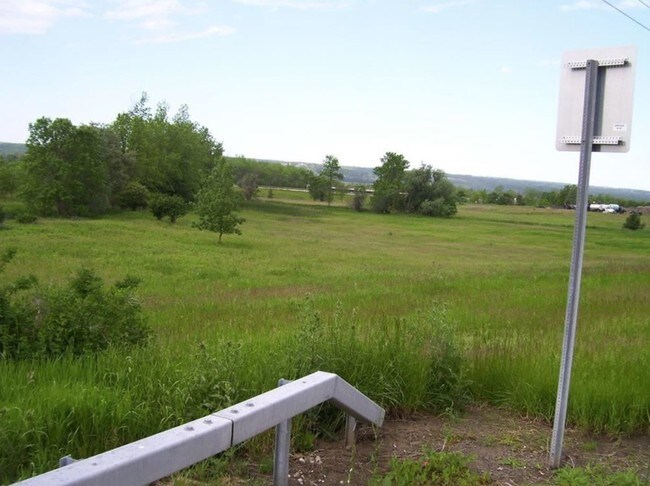
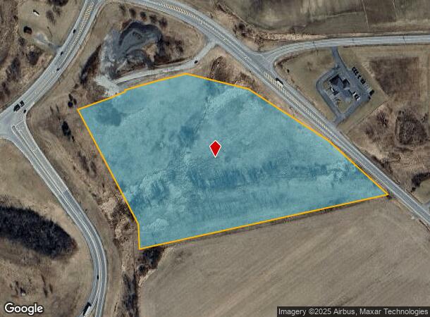
Groveland Station Rd
Rochester, NY
Livingston
242800-107-000-0001-002-011-0000
New York
Residentialacreage
2.011
2025
12.85 AC
2024
Livingston County
030800
Rochester
DEMOGRAPHICS near Groveland Station Rd
1 Mile
3 Mile
5 Mile
2024 Total Population
33
3,537
12,155
2029 Population
34
3,521
12,087
Pop Growth 2024-2029
+ 3.03%
(0.45%)
(0.56%)
Average Age
40
41
41
2024 Total Households
13
1,510
4,627
HH Growth 2024-2029
0.00%
(0.46%)
(0.63%)
Median Household Inc
$91,666
$55,129
$56,631
Avg Household Size
2.40
2.20
2.30
2024 Avg HH Vehicles
2.00
2.00
2.00
Median Home Value
$199,999
$77,460
$149,954
Median Year Built
1954
1950
1966
Nearby Places
- Restaurants
- Banks
- Shops
- Fitness
- Groceries
PUBLIC TRANSPORTATION
AIRPORT
Frederick Douglass/Greater Rochester International
DRIVE
WALK
Distance
Frederick Douglass/Greater Rochester International
44 min
34.7 mi
Freight Ports
Albany, NY Port
DRIVE
WALK
Distance
Albany, NY Port
294 min
251.1 mi
SALE & LEASE HISTORY
LISTING DATE
SALE/LEASE

Mar 05, 2019
For Sale
Nearby Properties
Address
Land Use
TOTAL SIZE
Lot Size
Zoning
Address
Land Use
TOTAL SIZE
Lot Size
Zoning
143,315 SF
138.14 AC
05 - COMME
Address
Land Use
TOTAL SIZE
Lot Size
Zoning
9,600 SF
118.01 AC
05 - COMME
Address
Land Use
TOTAL SIZE
Lot Size
Zoning
23 AC
04 - FARM
Address
Land Use
TOTAL SIZE
Lot Size
Zoning
Address
Land Use
TOTAL SIZE
Lot Size
Zoning
05 - COMME
Address
Land Use
TOTAL SIZE
Lot Size
Zoning
73,878 SF
34.30 AC
05 - COMME
Address
Land Use
TOTAL SIZE
Lot Size
Zoning
15,000 SF
51.60 AC
05 - COMME
Address
Land Use
TOTAL SIZE
Lot Size
Zoning
38,900 SF
62 AC
05 - COMME
Address
Land Use
TOTAL SIZE
Lot Size
Zoning
Address
Land Use
TOTAL SIZE
Lot Size
Zoning
Address
Land Use
TOTAL SIZE
Lot Size
Zoning
195,885 SF
36.10 AC
05 - COMME
Address
Land Use
TOTAL SIZE
Lot Size
Zoning
33,220 SF
13.30 AC
05 - COMME
Address
Land Use
TOTAL SIZE
Lot Size
Zoning
18,772 SF
2.66 AC
05 - COMME
Address
Land Use
TOTAL SIZE
Lot Size
Zoning
Address
Land Use
TOTAL SIZE
Lot Size
Zoning
430.20 AC
04 - FARM
Address
Land Use
TOTAL SIZE
Lot Size
Zoning
135.70 AC
05 - COMME
Address
Land Use
TOTAL SIZE
Lot Size
Zoning
348.70 AC
04 - FARM
Address
Land Use
TOTAL SIZE
Lot Size
Zoning
235.70 AC
04 - FARM
Address
Land Use
TOTAL SIZE
Lot Size
Zoning
Address
Land Use
TOTAL SIZE
Lot Size
Zoning
271.80 AC
04 - FARM
Address
Land Use
TOTAL SIZE
Lot Size
Zoning
924 SF
11.15 AC
05 - COMME
Address
Land Use
TOTAL SIZE
Lot Size
Zoning
228.40 AC
04 - FARM
Address
Land Use
TOTAL SIZE
Lot Size
Zoning
Address
Land Use
TOTAL SIZE
Lot Size
Zoning
227.50 AC
A
Address
Land Use
TOTAL SIZE
Lot Size
Zoning
311.70 AC
A
Address
Land Use
TOTAL SIZE
Lot Size
Zoning
10,320 SF
1.98 AC
05 - COMME
Address
Land Use
TOTAL SIZE
Lot Size
Zoning
30,000 SF
17.90 AC
05 - COMME
Address
Land Use
TOTAL SIZE
Lot Size
Zoning
8,940 SF
8.87 AC
05 - COMME
Address
Land Use
TOTAL SIZE
Lot Size
Zoning
67,840 SF
8.50 AC
06 - INDUS
Address
Land Use
TOTAL SIZE
Lot Size
Zoning
The World's #1 Commercial Real Estate Marketplace
Connect with us
© 2025 CoStar Group
The information above has been obtained from sources believed reliable. While we do not doubt its accuracy we have not verified it and make no guarantee, warranty or representation about it. It is your responsibility to independently confirm its accuracy and completeness. Any projections, opinions, assumptions, or estimates used are for example only and do not represent the current or future performance of the property. The value of this transaction to you depends on tax and other factors which should be evaluated by your tax, financial, and legal advisors. You and your advisors should conduct a careful, independent investigation of the property to determine to your satisfaction the suitability of the property for your needs.