Property Record
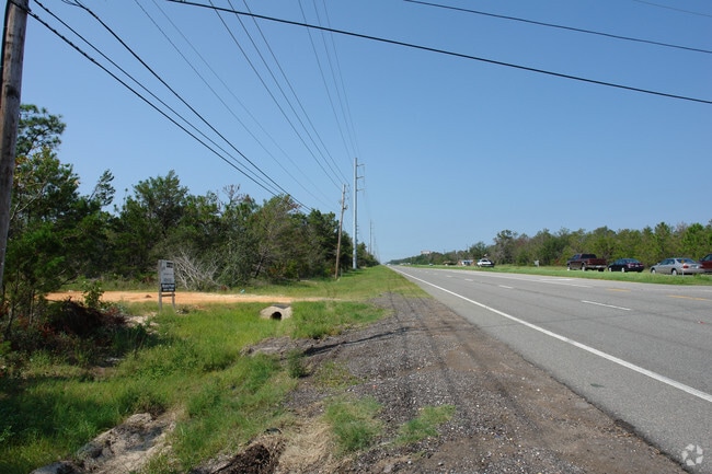
Gulf Breeze Pkwy, Gulf Breeze, FL 32563


NEARBY LISTINGS FOR SALE OR LEASE
Property Detail
Gulf Breeze Pkwy
25-2S-28-0000-00202-0000
COM AT NW CORN TH S 00*05 36 E 445.61 FT TO S R/W OF HWY 98 TH N 79*30 E 1341.35 FT TO W LINE OF LOT 3 TH CONT 300 FT TO POB TH CONT 851.03 FT TO N LINE OF SEC TH N 89*4757 E 187.08 FT TO E LINE OF LOT 3 T H CONT S 89*5916 E 1321.32 FT TO E LINE OF L
University
Santa Rosa
X
Florida
12113C0538H
3
0
100.31 AC
2025
Navarre
010814
Pensacola
36,404 SF
Pensacola-Ferry Pass-Brent, FL
DEMOGRAPHICS near Gulf Breeze Pkwy
1 Mile
3 Mile
5 Mile
2024 Total Population
4,096
13,563
30,926
2029 Population
4,752
15,770
35,782
Pop Growth 2024-2029
+ 16.02%
+ 16.27%
+ 15.70%
Average Age
42
42
41
2024 Total Households
1,591
5,337
11,962
HH Growth 2024-2029
+ 16.28%
+ 16.56%
+ 16.03%
Median Household Inc
$102,787
$90,230
$92,977
Avg Household Size
2.60
2.50
2.60
2024 Avg HH Vehicles
2.00
2.00
2.00
Median Home Value
$370,561
$339,802
$335,209
Median Year Built
2005
2001
2000
Nearby Places
Map Layers
Map Styles
 Street
 Aerial
- Restaurants
- Banks
- Shops
- Fitness
- Groceries
PUBLIC TRANSPORTATION
AIRPORT
Pensacola International
DRIVE
WALK
Distance
Pensacola International
39 min
21.0 mi
Eglin AFB/Destin-Ft Walton Beach
DRIVE
WALK
Distance
Eglin AFB/Destin-Ft Walton Beach
66 min
35.7 mi
Freight Ports
Port of Mobile
DRIVE
WALK
Distance
Port of Mobile
92 min
76.8 mi
Nearby Properties
Address
Land Use
TOTAL SIZE
Lot Size
Zoning
Address
Land Use
TOTAL SIZE
Lot Size
Zoning
5,101 SF
144.24 AC
NONE
Address
Land Use
TOTAL SIZE
Lot Size
Zoning
80,353 SF
14.53 AC
PBD
Address
Land Use
TOTAL SIZE
Lot Size
Zoning
99,670 SF
4.10 AC
HCD
Address
Land Use
TOTAL SIZE
Lot Size
Zoning
30,061 SF
4.50 AC
HCD
Address
Land Use
TOTAL SIZE
Lot Size
Zoning
1,360 SF
50.97 AC
R1
Address
Land Use
TOTAL SIZE
Lot Size
Zoning
91,391 SF
4.28 AC
PBD
Address
Land Use
TOTAL SIZE
Lot Size
Zoning
14,748 SF
28.19 AC
PBD
Address
Land Use
TOTAL SIZE
Lot Size
Zoning
47,724 SF
12.13 AC
HCD
Address
Land Use
TOTAL SIZE
Lot Size
Zoning
54,123 SF
6.05 AC
PBD
Address
Land Use
TOTAL SIZE
Lot Size
Zoning
62,068 SF
4.64 AC
M1
Address
Land Use
TOTAL SIZE
Lot Size
Zoning
73,433 SF
33.98 AC
HCD
Address
Land Use
TOTAL SIZE
Lot Size
Zoning
24,565 SF
17.03 AC
HCD
Address
Land Use
TOTAL SIZE
Lot Size
Zoning
45,438 SF
4.85 AC
HCD
Address
Land Use
TOTAL SIZE
Lot Size
Zoning
20,488 SF
14.34 AC
PBD
Address
Land Use
TOTAL SIZE
Lot Size
Zoning
25.10 AC
HCD
Address
Land Use
TOTAL SIZE
Lot Size
Zoning
50,950 SF
3.13 AC
HCD
Address
Land Use
TOTAL SIZE
Lot Size
Zoning
17,299 SF
1.66 AC
PBD
Address
Land Use
TOTAL SIZE
Lot Size
Zoning
62,960 SF
4.59 AC
HCD
Address
Land Use
TOTAL SIZE
Lot Size
Zoning
45,800 SF
3.45 AC
HCD
Address
Land Use
TOTAL SIZE
Lot Size
Zoning
3,589 SF
18 AC
PBD
Address
Land Use
TOTAL SIZE
Lot Size
Zoning
31,699 SF
4.39 AC
HCD
Address
Land Use
TOTAL SIZE
Lot Size
Zoning
48,285 SF
2.62 AC
HCD
Address
Land Use
TOTAL SIZE
Lot Size
Zoning
31,710 SF
1.76 AC
HCD
Address
Land Use
TOTAL SIZE
Lot Size
Zoning
40,963 SF
8.36 AC
HCD
Address
Land Use
TOTAL SIZE
Lot Size
Zoning
22,042 SF
4.17 AC
HCD
Address
Land Use
TOTAL SIZE
Lot Size
Zoning
16,169 SF
8.80 AC
HCD
Address
Land Use
TOTAL SIZE
Lot Size
Zoning
20.66 AC
PBD
Address
Land Use
TOTAL SIZE
Lot Size
Zoning
19.59 AC
HCD
The World's #1 Commercial Real Estate Marketplace
Connect with us
© 2025 CoStar Group
The information above has been obtained from sources believed reliable. While we do not doubt its accuracy we have not verified it and make no guarantee, warranty or representation about it. It is your responsibility to independently confirm its accuracy and completeness. Any projections, opinions, assumptions, or estimates used are for example only and do not represent the current or future performance of the property. The value of this transaction to you depends on tax and other factors which should be evaluated by your tax, financial, and legal advisors. You and your advisors should conduct a careful, independent investigation of the property to determine to your satisfaction the suitability of the property for your needs.