Property Record
H6/Vic Trevor Ave, Lancaster, CA 93534
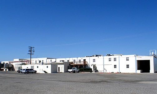
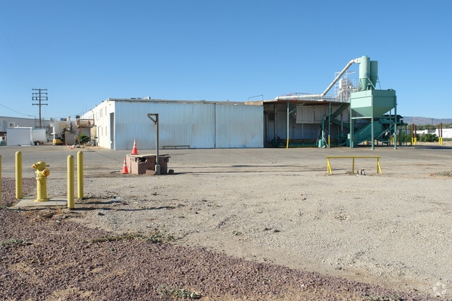

Property Detail
H6/Vic Trevor Ave
Los Angeles-Long Beach-Glendale, CA
TR=51841 LOT 12
3137-012-021
LOS ANGELES
Industrialacreage
California
LRHI
12
2024
1 AC
2025
Antelope Valley
900703
Los Angeles
NEARBY LISTINGS FOR SALE OR LEASE
DEMOGRAPHICS near H6/Vic Trevor Ave
1 mile
3 mile
5 mile
2025 Total Population
11,372
85,666
155,390
2030 Population
11,269
85,399
155,682
Pop Growth 2025-2030
(0.91%)
(0.31%)
+ 0.19%
Average Age
37
37
37
2025 Total Households
3,743
26,766
49,356
HH Growth 2025-2030
(0.96%)
(0.44%)
+ 0.29%
Median Household Inc
$46,271
$64,336
$70,644
Avg Household Size
3.00
3.10
3.00
2025 Avg HH Vehicles
2.00
2.00
2.00
Median Home Value
$325,186
$350,277
$405,482
Median Year Built
1974
1981
1985
Nearby Places
Map Layers
Map Styles
 Street
 Aerial
Layers
 Traffic
 Biking
Places
Listings with unknown addresses are not visible on the map
- Restaurants
- Banks
- Shops
- Fitness
- Groceries
PUBLIC TRANSPORTATION
COMMUTER RAIL
Lancaster (Antelope Valley Line - Southern California Regional Rail Authority (Metrolink))
Drive
Walk
Distance
Lancaster (Antelope Valley Line - Southern California Regional Rail Authority (Metrolink))
4 min
1.4 mi
Palmdale (Antelope Valley Line - Southern California Regional Rail Authority (Metrolink))
Drive
Walk
Distance
Palmdale (Antelope Valley Line - Southern California Regional Rail Authority (Metrolink))
16 min
9.2 mi
Freight Ports
Port of Long Beach
Drive
Walk
Distance
Port of Long Beach
115 min
95.7 mi
Nearby Properties
Address
Land Use
TOTAL SIZE
Lot Size
Zoning
Address
Land Use
TOTAL SIZE
Lot Size
Zoning
2,922,905 SF
85.01 AC
LRLI
Address
Land Use
TOTAL SIZE
Lot Size
Zoning
153,117 SF
14.12 AC
LRSP80-01*
Address
Land Use
TOTAL SIZE
Lot Size
Zoning
552,178 SF
17.77 AC
LRHI*
Address
Land Use
TOTAL SIZE
Lot Size
Zoning
212,198 SF
18.27 AC
LRSP80-01*
Address
Land Use
TOTAL SIZE
Lot Size
Zoning
129,896 SF
9.10 AC
LRRPD70001
Address
Land Use
TOTAL SIZE
Lot Size
Zoning
74,213 SF
4.46 AC
LRA17000*
Address
Land Use
TOTAL SIZE
Lot Size
Zoning
185,527 SF
9.65 AC
LRR325U*
Address
Land Use
TOTAL SIZE
Lot Size
Zoning
81,668 SF
5.67 AC
LRRPD65002
Address
Land Use
TOTAL SIZE
Lot Size
Zoning
876,730 SF
20.85 AC
LRCP
Address
Land Use
TOTAL SIZE
Lot Size
Zoning
60,113 SF
2.03 AC
LRCPD
Address
Land Use
TOTAL SIZE
Lot Size
Zoning
89,351 SF
17.97 AC
LRMDR
Address
Land Use
TOTAL SIZE
Lot Size
Zoning
166,272 SF
8.71 AC
LRRA7000*
Address
Land Use
TOTAL SIZE
Lot Size
Zoning
90,429 SF
4.59 AC
LRHDR*
Address
Land Use
TOTAL SIZE
Lot Size
Zoning
90,429 SF
4.38 AC
LRHDR*
Address
Land Use
TOTAL SIZE
Lot Size
Zoning
214,178 SF
13.95 AC
LRRA7000*
Address
Land Use
TOTAL SIZE
Lot Size
Zoning
145,593 SF
5.18 AC
LRC3*
Address
Land Use
TOTAL SIZE
Lot Size
Zoning
76,093 SF
1.37 AC
LRC3*
Address
Land Use
TOTAL SIZE
Lot Size
Zoning
481,066 SF
11.88 AC
LRRA7500*
Address
Land Use
TOTAL SIZE
Lot Size
Zoning
97,566 SF
8.81 AC
LRC3*
Address
Land Use
TOTAL SIZE
Lot Size
Zoning
73,248 SF
3.56 AC
LRR325UDP*
Address
Land Use
TOTAL SIZE
Lot Size
Zoning
127,975 SF
4.77 AC
LRC3DP*
Address
Land Use
TOTAL SIZE
Lot Size
Zoning
70,456 SF
3.05 AC
LRRC
Address
Land Use
TOTAL SIZE
Lot Size
Zoning
183,296 SF
11.75 AC
LRRPD25U*
Address
Land Use
TOTAL SIZE
Lot Size
Zoning
81,606 SF
3.55 AC
LRSP80-02*
Address
Land Use
TOTAL SIZE
Lot Size
Zoning
103,824 SF
3.58 AC
LRSP80-02*
Address
Land Use
TOTAL SIZE
Lot Size
Zoning
135,028 SF
12.10 AC
LRC3*
Address
Land Use
TOTAL SIZE
Lot Size
Zoning
81,668 SF
5.47 AC
LRSP80-01*
Address
Land Use
TOTAL SIZE
Lot Size
Zoning
137,190 SF
11.24 AC
LRSP80-01*
Address
Land Use
TOTAL SIZE
Lot Size
Zoning
58,986 SF
4.11 AC
LRRPD65002
The World's #1 Commercial Real Estate Marketplace
Connect with us
© 2026 CoStar Group
The information above has been obtained from sources believed reliable. While we do not doubt its accuracy we have not verified it and make no guarantee, warranty or representation about it. It is your responsibility to independently confirm its accuracy and completeness. Any projections, opinions, assumptions, or estimates used are for example only and do not represent the current or future performance of the property. The value of this transaction to you depends on tax and other factors which should be evaluated by your tax, financial, and legal advisors. You and your advisors should conduct a careful, independent investigation of the property to determine to your satisfaction the suitability of the property for your needs.