Property Record
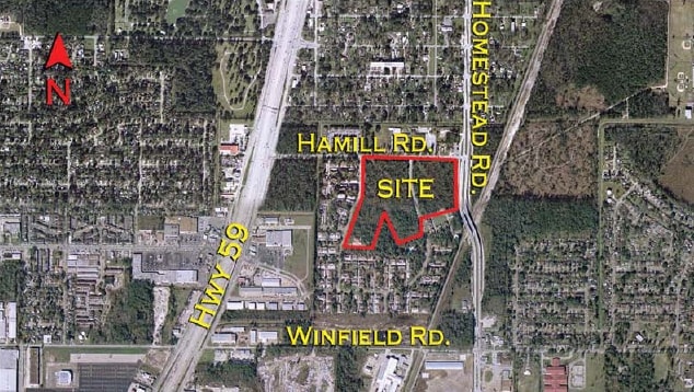
0 Hamill Rd, Houston, TX 77039

Property Detail
0 Hamill Rd
Houston-Pasadena-The Woodlands, TX
RES C15 PINE VILLAGE NORTH T/H SEC 3A
1064500000013
HARRIS
Outdoorrecreationbeachmountaindesert
Texas
B and X Area of moderate flood hazard, usually the area between the limits of the 100-year and 500-year floods.
9.63 AC
2024
Northeast Near
2025
Houston
222900
NEARBY LISTINGS FOR SALE OR LEASE
DEMOGRAPHICS near 0 Hamill Rd
1 mile
3 mile
5 mile
2024 Total Population
10,649
77,030
193,140
2029 Population
11,307
81,712
205,600
Pop Growth 2024-2029
+ 6.18%
+ 6.08%
+ 6.45%
Average Age
35
35
35
2024 Total Households
3,166
23,051
58,641
HH Growth 2024-2029
+ 6.32%
+ 6.23%
+ 6.66%
Median Household Inc
$43,113
$46,519
$49,422
Avg Household Size
3.30
3.30
3.20
2024 Avg HH Vehicles
2.00
2.00
2.00
Median Home Value
$164,334
$162,861
$167,854
Median Year Built
1969
1974
1977
Nearby Places
Map Layers
Map Styles
 Street
 Aerial
Transit
 Traffic
 Biking
Places
Listings with unknown addresses are not visible on the map
- Restaurants
- Banks
- Shops
- Fitness
- Groceries
PUBLIC TRANSPORTATION
AIRPORT
George Bush Intcntl/Houston
Drive
Walk
Distance
George Bush Intcntl/Houston
12 min
7.7 mi
William P Hobby
Drive
Walk
Distance
William P Hobby
38 min
23.5 mi
Freight Ports
Port of Houston
Drive
Walk
Distance
Port of Houston
27 min
17.1 mi
Nearby Properties
Address
Land Use
TOTAL SIZE
Lot Size
Zoning
Address
Land Use
TOTAL SIZE
Lot Size
Zoning
523,480 SF
29.22 AC
Address
Land Use
TOTAL SIZE
Lot Size
Zoning
379,570 SF
30.12 AC
Address
Land Use
TOTAL SIZE
Lot Size
Zoning
431,400 SF
30.88 AC
Address
Land Use
TOTAL SIZE
Lot Size
Zoning
338,700 SF
22.99 AC
Address
Land Use
TOTAL SIZE
Lot Size
Zoning
361,919 SF
23.59 AC
Address
Land Use
TOTAL SIZE
Lot Size
Zoning
73,500 SF
115.96 AC
Address
Land Use
TOTAL SIZE
Lot Size
Zoning
321,604 SF
16.68 AC
Address
Land Use
TOTAL SIZE
Lot Size
Zoning
264,300 SF
15.89 AC
Address
Land Use
TOTAL SIZE
Lot Size
Zoning
170,407 SF
26.31 AC
Address
Land Use
TOTAL SIZE
Lot Size
Zoning
90,033 SF
46.96 AC
Address
Land Use
TOTAL SIZE
Lot Size
Zoning
181,720 SF
15.28 AC
Address
Land Use
TOTAL SIZE
Lot Size
Zoning
113,604 SF
10.70 AC
Address
Land Use
TOTAL SIZE
Lot Size
Zoning
160,930 SF
9.18 AC
Address
Land Use
TOTAL SIZE
Lot Size
Zoning
182,000 SF
8.88 AC
Address
Land Use
TOTAL SIZE
Lot Size
Zoning
150,750 SF
18.33 AC
Address
Land Use
TOTAL SIZE
Lot Size
Zoning
154,389 SF
9.27 AC
Address
Land Use
TOTAL SIZE
Lot Size
Zoning
110,250 SF
8.84 AC
Address
Land Use
TOTAL SIZE
Lot Size
Zoning
118,739 SF
12.49 AC
Address
Land Use
TOTAL SIZE
Lot Size
Zoning
123,440 SF
13.58 AC
Address
Land Use
TOTAL SIZE
Lot Size
Zoning
192,012 SF
10.10 AC
Address
Land Use
TOTAL SIZE
Lot Size
Zoning
150,000 SF
10.37 AC
Address
Land Use
TOTAL SIZE
Lot Size
Zoning
180,094 SF
8.53 AC
Address
Land Use
TOTAL SIZE
Lot Size
Zoning
122,000 SF
14.03 AC
Address
Land Use
TOTAL SIZE
Lot Size
Zoning
129,410 SF
6.95 AC
Address
Land Use
TOTAL SIZE
Lot Size
Zoning
110,080 SF
11.32 AC
Address
Land Use
TOTAL SIZE
Lot Size
Zoning
173,370 SF
13.52 AC
Address
Land Use
TOTAL SIZE
Lot Size
Zoning
139,252 SF
4.55 AC
Address
Land Use
TOTAL SIZE
Lot Size
Zoning
132,902 SF
6.12 AC
Address
Land Use
TOTAL SIZE
Lot Size
Zoning
91,623 SF
9.09 AC
Address
Land Use
TOTAL SIZE
Lot Size
Zoning
200,186 SF
13.20 AC
The World's #1 Commercial Real Estate Marketplace
Connect with us
© 2026 CoStar Group
The information above has been obtained from sources believed reliable. While we do not doubt its accuracy we have not verified it and make no guarantee, warranty or representation about it. It is your responsibility to independently confirm its accuracy and completeness. Any projections, opinions, assumptions, or estimates used are for example only and do not represent the current or future performance of the property. The value of this transaction to you depends on tax and other factors which should be evaluated by your tax, financial, and legal advisors. You and your advisors should conduct a careful, independent investigation of the property to determine to your satisfaction the suitability of the property for your needs.