Property Record
Hampton Rd, Red Oak, TX 75154


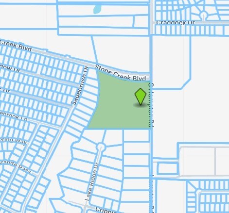
Property Detail
Hampton Rd
Dallas-Fort Worth-Arlington, TX
211 J J CLAYTON 10.00 ACRES
242701
ELLIS
Agriculturalland
Texas
B and X Area of moderate flood hazard, usually the area between the limits of the 100-year and 500-year floods.
10 AC
2024
Ellis County
2025
Dallas/Ft Worth
060206
NEARBY LISTINGS FOR SALE OR LEASE
DEMOGRAPHICS near Hampton Rd
1 mile
3 mile
5 mile
2025 Total Population
8,968
53,680
119,513
2030 Population
10,195
58,843
129,558
Pop Growth 2025-2030
+ 13.68%
+ 9.62%
+ 8.40%
Average Age
36
37
38
2025 Total Households
3,037
17,747
40,172
HH Growth 2025-2030
+ 13.76%
+ 9.80%
+ 8.37%
Median Household Inc
$101,521
$93,508
$97,041
Avg Household Size
2.90
3.00
2.90
2025 Avg HH Vehicles
2.00
2.00
2.00
Median Home Value
$333,628
$331,266
$344,291
Median Year Built
2005
2001
1999
Nearby Places
Map Layers
Map Styles
 Street
 Aerial
Transit
 Traffic
 Biking
Places
Listings with unknown addresses are not visible on the map
- Restaurants
- Banks
- Shops
- Fitness
- Groceries
PUBLIC TRANSPORTATION
AIRPORT
Dallas Love Field
Drive
Walk
Distance
Dallas Love Field
36 min
24.8 mi
Dallas-Fort Worth International
Drive
Walk
Distance
Dallas-Fort Worth International
49 min
38.9 mi
Nearby Properties
Address
Land Use
TOTAL SIZE
Lot Size
Zoning
Address
Land Use
TOTAL SIZE
Lot Size
Zoning
316,312 SF
17.09 AC
Address
Land Use
TOTAL SIZE
Lot Size
Zoning
332,510 SF
18.45 AC
Address
Land Use
TOTAL SIZE
Lot Size
Zoning
345,348 SF
19.22 AC
Address
Land Use
TOTAL SIZE
Lot Size
Zoning
227,423 SF
13.86 AC
Z236
Address
Land Use
TOTAL SIZE
Lot Size
Zoning
281,669 SF
16.02 AC
Z312
Address
Land Use
TOTAL SIZE
Lot Size
Zoning
330,541 SF
14.85 AC
Address
Land Use
TOTAL SIZE
Lot Size
Zoning
140,590 SF
4.90 AC
Z236
Address
Land Use
TOTAL SIZE
Lot Size
Zoning
190,592 SF
101.54 AC
Z370
Address
Land Use
TOTAL SIZE
Lot Size
Zoning
55,213 SF
11.83 AC
Z197
Address
Land Use
TOTAL SIZE
Lot Size
Zoning
383 SF
56.48 AC
Z07
Address
Land Use
TOTAL SIZE
Lot Size
Zoning
196,670 SF
47.43 AC
Address
Land Use
TOTAL SIZE
Lot Size
Zoning
109,500 SF
12.13 AC
Z370
Address
Land Use
TOTAL SIZE
Lot Size
Zoning
80,000 SF
8.37 AC
Address
Land Use
TOTAL SIZE
Lot Size
Zoning
276,880 SF
14.17 AC
Address
Land Use
TOTAL SIZE
Lot Size
Zoning
327,382 SF
15.68 AC
Address
Land Use
TOTAL SIZE
Lot Size
Zoning
111,715 SF
4.81 AC
Address
Land Use
TOTAL SIZE
Lot Size
Zoning
117,564 SF
25.59 AC
Address
Land Use
TOTAL SIZE
Lot Size
Zoning
116,318 SF
14.92 AC
Address
Land Use
TOTAL SIZE
Lot Size
Zoning
159,860 SF
24.03 AC
Address
Land Use
TOTAL SIZE
Lot Size
Zoning
158 SF
27.05 AC
RC
Address
Land Use
TOTAL SIZE
Lot Size
Zoning
141 SF
20.35 AC
AO
Address
Land Use
TOTAL SIZE
Lot Size
Zoning
148 SF
20.14 AC
Z159
Address
Land Use
TOTAL SIZE
Lot Size
Zoning
119 SF
31.32 AC
Z155
Address
Land Use
TOTAL SIZE
Lot Size
Zoning
51,744 SF
1.88 AC
Address
Land Use
TOTAL SIZE
Lot Size
Zoning
50,428 SF
14.25 AC
Z313
Address
Land Use
TOTAL SIZE
Lot Size
Zoning
81,535 SF
5.65 AC
Z125
Address
Land Use
TOTAL SIZE
Lot Size
Zoning
85,050 SF
4.98 AC
Z370
Address
Land Use
TOTAL SIZE
Lot Size
Zoning
151 SF
10.89 AC
Z159
Address
Land Use
TOTAL SIZE
Lot Size
Zoning
21,550 SF
2.25 AC
Address
Land Use
TOTAL SIZE
Lot Size
Zoning
26,547 SF
3.52 AC
The World's #1 Commercial Real Estate Marketplace
Connect with us
© 2026 CoStar Group
The information above has been obtained from sources believed reliable. While we do not doubt its accuracy we have not verified it and make no guarantee, warranty or representation about it. It is your responsibility to independently confirm its accuracy and completeness. Any projections, opinions, assumptions, or estimates used are for example only and do not represent the current or future performance of the property. The value of this transaction to you depends on tax and other factors which should be evaluated by your tax, financial, and legal advisors. You and your advisors should conduct a careful, independent investigation of the property to determine to your satisfaction the suitability of the property for your needs.