Property Record
Hanging Rock Rd, Boiling Springs, SC 29316


NEARBY LISTINGS FOR SALE OR LEASE
Property Detail
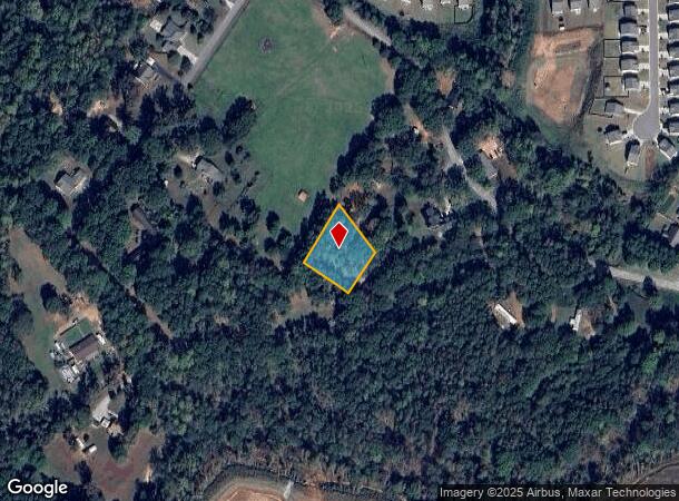
Hanging Rock Rd
Spartanburg, SC
Charles W Smith And Harrier Smith Abnd C
2-50-00-123.00
P/O LOT 4 & ADJACENT LOT G V HEATHERINGTON PROP PB 82-885 PB 37-61 PB 37-601 DB 46G-690
Residentialacreage
Spartanburg
X
South Carolina
45083C0163D
4,g
2024
0.62 AC
2025
Upper Spartanburg County
022406
Greenville/Spartanburg
DEMOGRAPHICS near Hanging Rock Rd
1 Mile
3 Mile
5 Mile
2024 Total Population
5,064
38,584
74,771
2029 Population
5,724
43,599
84,744
Pop Growth 2024-2029
+ 13.03%
+ 13.00%
+ 13.34%
Average Age
38
37
37
2024 Total Households
1,908
14,223
27,928
HH Growth 2024-2029
+ 13.21%
+ 13.37%
+ 13.72%
Median Household Inc
$74,866
$60,645
$55,782
Avg Household Size
2.60
2.50
2.50
2024 Avg HH Vehicles
2.00
2.00
2.00
Median Home Value
$212,200
$183,196
$176,681
Median Year Built
2005
1998
1992
Nearby Places
Map Layers
Map Styles
 Street
 Aerial
- Restaurants
- Banks
- Shops
- Fitness
- Groceries
PUBLIC TRANSPORTATION
COMMUTER RAIL
Spartanburg Amtrak Station (Crescent - Amtrak)
DRIVE
WALK
Distance
Spartanburg Amtrak Station (Crescent - Amtrak)
13 min
6.5 mi
AIRPORT
Greenville Spartanburg International
DRIVE
WALK
Distance
Greenville Spartanburg International
31 min
20.2 mi
Freight Ports
North Charleston Terminal
DRIVE
WALK
Distance
North Charleston Terminal
227 min
200.7 mi
SALE & LEASE HISTORY
LISTING DATE
SALE/LEASE

Nov 09, 2022
For Sale
Nearby Properties
Address
Land Use
TOTAL SIZE
Lot Size
Zoning
Address
Land Use
TOTAL SIZE
Lot Size
Zoning
4,172 SF
15.98 AC
Address
Land Use
TOTAL SIZE
Lot Size
Zoning
5,547 SF
6.58 AC
Address
Land Use
TOTAL SIZE
Lot Size
Zoning
22,955 SF
5.05 AC
Address
Land Use
TOTAL SIZE
Lot Size
Zoning
3,406 SF
13.10 AC
Address
Land Use
TOTAL SIZE
Lot Size
Zoning
3,412 SF
21.60 AC
Address
Land Use
TOTAL SIZE
Lot Size
Zoning
122,626 SF
7.70 AC
Address
Land Use
TOTAL SIZE
Lot Size
Zoning
5,034 SF
17.60 AC
Address
Land Use
TOTAL SIZE
Lot Size
Zoning
81,040 SF
15.39 AC
Address
Land Use
TOTAL SIZE
Lot Size
Zoning
24,738 SF
34.52 AC
Address
Land Use
TOTAL SIZE
Lot Size
Zoning
20,976 SF
23.72 AC
Address
Land Use
TOTAL SIZE
Lot Size
Zoning
62,000 SF
10.17 AC
Address
Land Use
TOTAL SIZE
Lot Size
Zoning
41,694 SF
4.01 AC
Address
Land Use
TOTAL SIZE
Lot Size
Zoning
2,328 SF
16.99 AC
Address
Land Use
TOTAL SIZE
Lot Size
Zoning
3,112 SF
20.17 AC
Address
Land Use
TOTAL SIZE
Lot Size
Zoning
8,911 SF
23.64 AC
Address
Land Use
TOTAL SIZE
Lot Size
Zoning
6,816 SF
14.16 AC
Address
Land Use
TOTAL SIZE
Lot Size
Zoning
9,649 SF
9.67 AC
Address
Land Use
TOTAL SIZE
Lot Size
Zoning
7,000 SF
3 AC
Address
Land Use
TOTAL SIZE
Lot Size
Zoning
184,015 SF
19.23 AC
Address
Land Use
TOTAL SIZE
Lot Size
Zoning
42,657 SF
11.57 AC
Address
Land Use
TOTAL SIZE
Lot Size
Zoning
64,471 SF
18.66 AC
Address
Land Use
TOTAL SIZE
Lot Size
Zoning
641,891 SF
16.26 AC
Address
Land Use
TOTAL SIZE
Lot Size
Zoning
2,220 SF
14.09 AC
Address
Land Use
TOTAL SIZE
Lot Size
Zoning
76,325 SF
17.28 AC
Address
Land Use
TOTAL SIZE
Lot Size
Zoning
102,400 SF
25.19 AC
Address
Land Use
TOTAL SIZE
Lot Size
Zoning
108,060 SF
2.95 AC
Address
Land Use
TOTAL SIZE
Lot Size
Zoning
Address
Land Use
TOTAL SIZE
Lot Size
Zoning
5,236 SF
0.65 AC
Address
Land Use
TOTAL SIZE
Lot Size
Zoning
6,695 SF
0.30 AC
Address
Land Use
TOTAL SIZE
Lot Size
Zoning
25,214 SF
4.48 AC
The World's #1 Commercial Real Estate Marketplace
Connect with us
© 2025 CoStar Group
The information above has been obtained from sources believed reliable. While we do not doubt its accuracy we have not verified it and make no guarantee, warranty or representation about it. It is your responsibility to independently confirm its accuracy and completeness. Any projections, opinions, assumptions, or estimates used are for example only and do not represent the current or future performance of the property. The value of this transaction to you depends on tax and other factors which should be evaluated by your tax, financial, and legal advisors. You and your advisors should conduct a careful, independent investigation of the property to determine to your satisfaction the suitability of the property for your needs.