Property Record
0 Unassigned, Andover, MN 55304

NEARBY LISTINGS FOR SALE OR LEASE
Property Detail
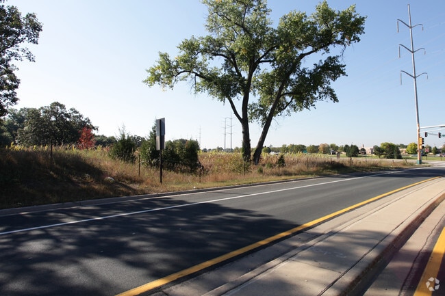
0 Unassigned
23-32-24-33-0002
SW1/4 OF SW1/4 SEC 23 T32 R24; EX PRT PLATTED AS WINSLOW HILLS; ALSO EX RD; SUBJ TO EASE OF REC
Commercialacreage
Anoka
X
Minnesota
27053C0100F
6.95 AC
2024
Anoka County Outlying
2025
Minneapolis/St Paul
050239
Minneapolis-St. Paul-Bloomington, MN-WI
DEMOGRAPHICS near 0 Unassigned
1 Mile
3 Mile
5 Mile
2024 Total Population
6,996
32,567
105,355
2029 Population
7,279
33,747
109,067
Pop Growth 2024-2029
+ 4.05%
+ 3.62%
+ 3.52%
Average Age
38
40
40
2024 Total Households
2,247
10,855
37,675
HH Growth 2024-2029
+ 4.09%
+ 3.64%
+ 3.52%
Median Household Inc
$155,898
$123,973
$98,701
Avg Household Size
3.10
3.00
2.70
2024 Avg HH Vehicles
2.00
2.00
2.00
Median Home Value
$366,666
$355,715
$309,702
Median Year Built
1999
1994
1987
Nearby Places
Map Layers
Map Styles
 Street
 Aerial
- Restaurants
- Banks
- Shops
- Fitness
- Groceries
PUBLIC TRANSPORTATION
COMMUTER RAIL
Coon Rapids-Riverdale Station (Northstar Corridor - Northstar Commuter Rail)
DRIVE
WALK
Distance
Coon Rapids-Riverdale Station (Northstar Corridor - Northstar Commuter Rail)
14 min
7.7 mi
Anoka Station (Northstar Corridor - Northstar Commuter Rail)
DRIVE
WALK
Distance
Anoka Station (Northstar Corridor - Northstar Commuter Rail)
16 min
7.7 mi
AIRPORT
Minneapolis-St Paul International/Wold-Chamberlain
DRIVE
WALK
Distance
Minneapolis-St Paul International/Wold-Chamberlain
52 min
35.0 mi
Freight Ports
Port Milwaukee
DRIVE
WALK
Distance
Port Milwaukee
398 min
357.2 mi
SALE & LEASE HISTORY
LISTING DATE
SALE/LEASE

Sep 24, 2016
For Sale
Aug 02, 2017
For Sale
Nearby Properties
Address
Land Use
TOTAL SIZE
Lot Size
Zoning
Address
Land Use
TOTAL SIZE
Lot Size
Zoning
447,671 SF
78.33 AC
Address
Land Use
TOTAL SIZE
Lot Size
Zoning
133,906 SF
34.37 AC
Address
Land Use
TOTAL SIZE
Lot Size
Zoning
7,888 SF
40 AC
Address
Land Use
TOTAL SIZE
Lot Size
Zoning
164,472 SF
10.95 AC
Address
Land Use
TOTAL SIZE
Lot Size
Zoning
104,477 SF
18 AC
Address
Land Use
TOTAL SIZE
Lot Size
Zoning
172,335 SF
13.41 AC
Address
Land Use
TOTAL SIZE
Lot Size
Zoning
84,924 SF
12.49 AC
Address
Land Use
TOTAL SIZE
Lot Size
Zoning
124,951 SF
12.67 AC
Address
Land Use
TOTAL SIZE
Lot Size
Zoning
152,040 SF
20.71 AC
Address
Land Use
TOTAL SIZE
Lot Size
Zoning
129,726 SF
40 AC
Address
Land Use
TOTAL SIZE
Lot Size
Zoning
73,862 SF
2.86 AC
Address
Land Use
TOTAL SIZE
Lot Size
Zoning
70,304 SF
Address
Land Use
TOTAL SIZE
Lot Size
Zoning
Address
Land Use
TOTAL SIZE
Lot Size
Zoning
49,646 SF
9.40 AC
Address
Land Use
TOTAL SIZE
Lot Size
Zoning
76,013 SF
19.28 AC
Address
Land Use
TOTAL SIZE
Lot Size
Zoning
77,272 SF
3.09 AC
Address
Land Use
TOTAL SIZE
Lot Size
Zoning
51,200 SF
6.85 AC
Address
Land Use
TOTAL SIZE
Lot Size
Zoning
29,785 SF
4.45 AC
Address
Land Use
TOTAL SIZE
Lot Size
Zoning
82,494 SF
6.81 AC
Address
Land Use
TOTAL SIZE
Lot Size
Zoning
53,180 SF
30.46 AC
Address
Land Use
TOTAL SIZE
Lot Size
Zoning
4,686 SF
40 AC
Address
Land Use
TOTAL SIZE
Lot Size
Zoning
58,977 SF
5.65 AC
Address
Land Use
TOTAL SIZE
Lot Size
Zoning
38,177 SF
4.90 AC
Address
Land Use
TOTAL SIZE
Lot Size
Zoning
55,932 SF
5.39 AC
Address
Land Use
TOTAL SIZE
Lot Size
Zoning
40,074 SF
24.27 AC
Address
Land Use
TOTAL SIZE
Lot Size
Zoning
39,090 SF
1.59 AC
Address
Land Use
TOTAL SIZE
Lot Size
Zoning
Address
Land Use
TOTAL SIZE
Lot Size
Zoning
1,100 SF
41.96 AC
Address
Land Use
TOTAL SIZE
Lot Size
Zoning
1,182 SF
20.50 AC
The World's #1 Commercial Real Estate Marketplace
Connect with us
© 2026 CoStar Group
The information above has been obtained from sources believed reliable. While we do not doubt its accuracy we have not verified it and make no guarantee, warranty or representation about it. It is your responsibility to independently confirm its accuracy and completeness. Any projections, opinions, assumptions, or estimates used are for example only and do not represent the current or future performance of the property. The value of this transaction to you depends on tax and other factors which should be evaluated by your tax, financial, and legal advisors. You and your advisors should conduct a careful, independent investigation of the property to determine to your satisfaction the suitability of the property for your needs.