Property Record
Hardin Bridge Rd, Kingston, GA 30145
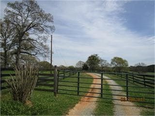

Property Detail
Hardin Bridge Rd
0035-0390-002
LL 329-333 388-392 TRACT 1A/B
Privatepreserveopenspacevacantlandforestlandconservation
BARTOW
A1
Georgia
AE The base floodplain where base flood elevations are provided. AE Zones are now used on new format FIRMs instead of A1-A30 Zones.
76.29 AC
2025
Bartow County
2025
Atlanta
960302
Atlanta-Sandy Springs-Roswell, GA
NEARBY LISTINGS FOR SALE OR LEASE
DEMOGRAPHICS near Hardin Bridge Rd
1 mile
3 mile
5 mile
2025 Total Population
2,372
7,420
15,628
2030 Population
2,531
7,947
16,717
Pop Growth 2025-2030
+ 6.70%
+ 7.10%
+ 6.97%
Average Age
38
39
40
2025 Total Households
775
2,519
5,405
HH Growth 2025-2030
+ 6.84%
+ 7.19%
+ 7.05%
Median Household Inc
$72,282
$84,923
$83,434
Avg Household Size
3.10
2.90
2.90
2025 Avg HH Vehicles
3.00
3.00
3.00
Median Home Value
$282,364
$297,919
$309,171
Median Year Built
1995
1995
1994
Nearby Places
Map Layers
Map Styles
 Street
 Aerial
Layers
 Traffic
 Biking
Places
Listings with unknown addresses are not visible on the map
- Restaurants
- Banks
- Shops
- Fitness
- Groceries
SALE & LEASE HISTORY
LISTING DATE
SALE/LEASE

May 10, 2019
For Sale
Nearby Properties
Address
Land Use
TOTAL SIZE
Lot Size
Zoning
Address
Land Use
TOTAL SIZE
Lot Size
Zoning
94,726 SF
34.82 AC
Address
Land Use
TOTAL SIZE
Lot Size
Zoning
132,946 SF
26.63 AC
Address
Land Use
TOTAL SIZE
Lot Size
Zoning
93,358 SF
22.63 AC
A1
Address
Land Use
TOTAL SIZE
Lot Size
Zoning
Address
Land Use
TOTAL SIZE
Lot Size
Zoning
79,144 SF
37.47 AC
A1
Address
Land Use
TOTAL SIZE
Lot Size
Zoning
152.21 AC
Address
Land Use
TOTAL SIZE
Lot Size
Zoning
2,962 SF
1,136.59 AC
A1
Address
Land Use
TOTAL SIZE
Lot Size
Zoning
23.28 AC
AGRICULTUR
Address
Land Use
TOTAL SIZE
Lot Size
Zoning
1,063 AC
A1
Address
Land Use
TOTAL SIZE
Lot Size
Zoning
6,000 SF
160 AC
A1
Address
Land Use
TOTAL SIZE
Lot Size
Zoning
21,446 SF
14.87 AC
Address
Land Use
TOTAL SIZE
Lot Size
Zoning
15,600 SF
4.25 AC
C1
Address
Land Use
TOTAL SIZE
Lot Size
Zoning
193.76 AC
A1
Address
Land Use
TOTAL SIZE
Lot Size
Zoning
34,440 SF
7.39 AC
C1
Address
Land Use
TOTAL SIZE
Lot Size
Zoning
8,840 SF
6 AC
A1
Address
Land Use
TOTAL SIZE
Lot Size
Zoning
2,052 SF
201.97 AC
Address
Land Use
TOTAL SIZE
Lot Size
Zoning
43.50 AC
Address
Land Use
TOTAL SIZE
Lot Size
Zoning
1,975 SF
17.63 AC
Address
Land Use
TOTAL SIZE
Lot Size
Zoning
138.04 AC
A1
Address
Land Use
TOTAL SIZE
Lot Size
Zoning
9,009 SF
2.57 AC
C1
Address
Land Use
TOTAL SIZE
Lot Size
Zoning
334.29 AC
Address
Land Use
TOTAL SIZE
Lot Size
Zoning
1,008 SF
10 AC
Address
Land Use
TOTAL SIZE
Lot Size
Zoning
1,250 SF
5.44 AC
C1
Address
Land Use
TOTAL SIZE
Lot Size
Zoning
Address
Land Use
TOTAL SIZE
Lot Size
Zoning
8,819 SF
4.77 AC
Address
Land Use
TOTAL SIZE
Lot Size
Zoning
532 SF
9.30 AC
Address
Land Use
TOTAL SIZE
Lot Size
Zoning
211.26 AC
A1
Address
Land Use
TOTAL SIZE
Lot Size
Zoning
63.03 AC
Address
Land Use
TOTAL SIZE
Lot Size
Zoning
7,278 SF
1.28 AC
Address
Land Use
TOTAL SIZE
Lot Size
Zoning
1,894 SF
37.58 AC
A1
The World's #1 Commercial Real Estate Marketplace
Connect with us
© 2026 CoStar Group
The information above has been obtained from sources believed reliable. While we do not doubt its accuracy we have not verified it and make no guarantee, warranty or representation about it. It is your responsibility to independently confirm its accuracy and completeness. Any projections, opinions, assumptions, or estimates used are for example only and do not represent the current or future performance of the property. The value of this transaction to you depends on tax and other factors which should be evaluated by your tax, financial, and legal advisors. You and your advisors should conduct a careful, independent investigation of the property to determine to your satisfaction the suitability of the property for your needs.