Property Record
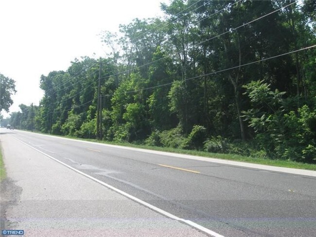
Harding Highway Rear Hwy, Pilesgrove, NJ 08098
NEARBY LISTINGS FOR SALE OR LEASE
Property Detail
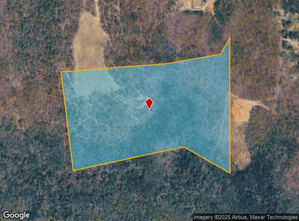
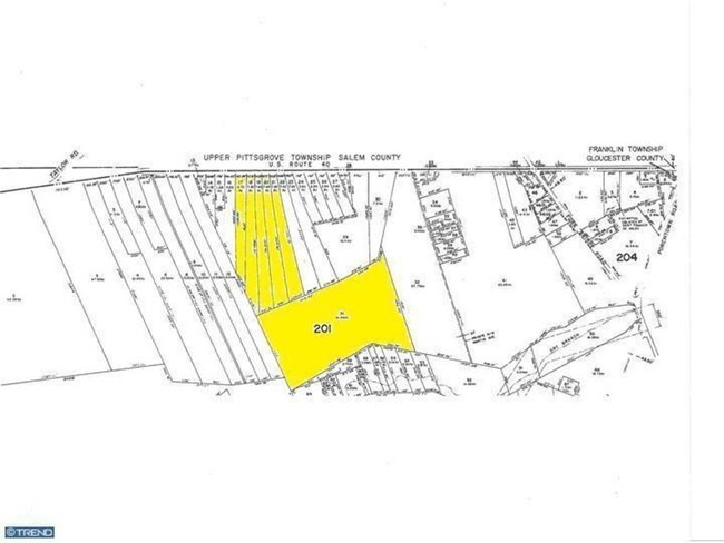
Harding Highway Rear Hwy
11-00201-0000-00031
Salem
Farms
New Jersey
X
31
34033C0230C
51.99 AC
2024
Salem County
2025
Philadelphia
020800
Philadelphia-Camden-Wilmington, PA-NJ-DE-MD
DEMOGRAPHICS near Harding Highway Rear Hwy
1 Mile
3 Mile
5 Mile
2024 Total Population
1,393
8,174
25,372
2029 Population
1,394
8,277
25,848
Pop Growth 2024-2029
+ 0.07%
+ 1.26%
+ 1.88%
Average Age
44
43
42
2024 Total Households
550
3,118
9,312
HH Growth 2024-2029
0.00%
+ 1.25%
+ 1.84%
Median Household Inc
$78,918
$73,856
$83,931
Avg Household Size
2.50
2.60
2.70
2024 Avg HH Vehicles
2.00
2.00
2.00
Median Home Value
$237,500
$235,447
$235,583
Median Year Built
1975
1976
1974
Nearby Places
Map Layers
Map Styles
 Street
 Aerial
- Restaurants
- Banks
- Shops
- Fitness
- Groceries
PUBLIC TRANSPORTATION
AIRPORT
Philadelphia International
DRIVE
WALK
Distance
Philadelphia International
53 min
34.9 mi
Atlantic City International
DRIVE
WALK
Distance
Atlantic City International
72 min
35.3 mi
Freight Ports
Broadway Terminal - Pier 5
DRIVE
WALK
Distance
Broadway Terminal - Pier 5
37 min
26.3 mi
Nearby Properties
Address
Land Use
TOTAL SIZE
Lot Size
Zoning
Address
Land Use
TOTAL SIZE
Lot Size
Zoning
84.63 AC
RA
Address
Land Use
TOTAL SIZE
Lot Size
Zoning
17.10 AC
RA
Address
Land Use
TOTAL SIZE
Lot Size
Zoning
3.11 AC
FV
Address
Land Use
TOTAL SIZE
Lot Size
Zoning
663.70 AC
Address
Land Use
TOTAL SIZE
Lot Size
Zoning
1.52 AC
MV
Address
Land Use
TOTAL SIZE
Lot Size
Zoning
4,732 SF
3.04 AC
FV
Address
Land Use
TOTAL SIZE
Lot Size
Zoning
32,451 SF
11 AC
Address
Land Use
TOTAL SIZE
Lot Size
Zoning
3,424 SF
37.08 AC
Address
Land Use
TOTAL SIZE
Lot Size
Zoning
30,000 SF
16.69 AC
Address
Land Use
TOTAL SIZE
Lot Size
Zoning
1,680 SF
4.69 AC
HC
Address
Land Use
TOTAL SIZE
Lot Size
Zoning
9.53 AC
HC
Address
Land Use
TOTAL SIZE
Lot Size
Zoning
1.52 AC
HC
Address
Land Use
TOTAL SIZE
Lot Size
Zoning
9,160 SF
2 AC
FV
Address
Land Use
TOTAL SIZE
Lot Size
Zoning
1.50 AC
FV
Address
Land Use
TOTAL SIZE
Lot Size
Zoning
1.89 AC
IC
Address
Land Use
TOTAL SIZE
Lot Size
Zoning
16,744 SF
5 AC
Address
Land Use
TOTAL SIZE
Lot Size
Zoning
1.41 AC
MV
Address
Land Use
TOTAL SIZE
Lot Size
Zoning
2.36 AC
HC
Address
Land Use
TOTAL SIZE
Lot Size
Zoning
33.09 AC
RA
Address
Land Use
TOTAL SIZE
Lot Size
Zoning
21,516 SF
19.96 AC
Address
Land Use
TOTAL SIZE
Lot Size
Zoning
1,710 SF
33.71 AC
HC
Address
Land Use
TOTAL SIZE
Lot Size
Zoning
0.55 AC
FV
Address
Land Use
TOTAL SIZE
Lot Size
Zoning
1.80 AC
MV
Address
Land Use
TOTAL SIZE
Lot Size
Zoning
3,600 SF
5.79 AC
RA
Address
Land Use
TOTAL SIZE
Lot Size
Zoning
2.23 AC
Address
Land Use
TOTAL SIZE
Lot Size
Zoning
1.70 AC
MV
Address
Land Use
TOTAL SIZE
Lot Size
Zoning
2.89 AC
HC
Address
Land Use
TOTAL SIZE
Lot Size
Zoning
2.66 AC
HC
Address
Land Use
TOTAL SIZE
Lot Size
Zoning
9,484 SF
16.11 AC
Address
Land Use
TOTAL SIZE
Lot Size
Zoning
1.85 AC
The World's #1 Commercial Real Estate Marketplace
Connect with us
© 2025 CoStar Group
The information above has been obtained from sources believed reliable. While we do not doubt its accuracy we have not verified it and make no guarantee, warranty or representation about it. It is your responsibility to independently confirm its accuracy and completeness. Any projections, opinions, assumptions, or estimates used are for example only and do not represent the current or future performance of the property. The value of this transaction to you depends on tax and other factors which should be evaluated by your tax, financial, and legal advisors. You and your advisors should conduct a careful, independent investigation of the property to determine to your satisfaction the suitability of the property for your needs.