Property Record
Harris Rd, Lodi, OH 44254


Save to a Folder
{{folder.Name}}
{{folder.ListingIds.length}} Properties
{{folder.ListingIds.length}} Property
Create a New Folder
Property Detail
Harris Rd
Cleveland-Elyria, OH
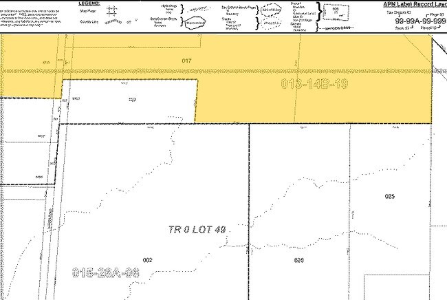
PART OF LOTS 39-50
013-14B-19-013
MEDINA
Farms
Ohio
B and X Area of moderate flood hazard, usually the area between the limits of the 100-year and 500-year floods.
82.35 AC
2025
Medina County
2025
Cleveland
411002
NEARBY LISTINGS FOR SALE OR LEASE
-
-
View all Lodi listings for sale on LoopNet.com
DEMOGRAPHICS near Harris Rd
1 mile
3 mile
5 mile
2025 Total Population
1,945
5,579
12,305
2030 Population
2,005
5,670
12,435
Pop Growth 2025-2030
+ 3.08%
+ 1.63%
+ 1.06%
Average Age
46
45
45
2025 Total Households
903
2,419
5,084
HH Growth 2025-2030
+ 3.10%
+ 1.74%
+ 1.12%
Median Household Inc
$51,458
$60,610
$70,857
Avg Household Size
2.10
2.30
2.40
2025 Avg HH Vehicles
2.00
2.00
2.00
Median Home Value
$188,827
$213,474
$241,741
Median Year Built
1969
1967
1971
Nearby Places
Map Layers
Map Styles
 Street
 Aerial
Layers
 Traffic
 Biking
Places
Listings with unknown addresses are not visible on the map
- Restaurants
- Banks
- Shops
- Fitness
- Groceries
PUBLIC TRANSPORTATION
AIRPORT
Akron-Canton Regional
Drive
Walk
Distance
Akron-Canton Regional
46 min
37.0 mi
Cleveland-Hopkins International
Drive
Walk
Distance
Cleveland-Hopkins International
50 min
38.1 mi
Freight Ports
Port of Toledo
Drive
Walk
Distance
Port of Toledo
145 min
108.0 mi
Nearby Properties
Address
Land Use
TOTAL SIZE
Lot Size
Zoning
Address
Land Use
TOTAL SIZE
Lot Size
Zoning
130,685 SF
36.02 AC
Address
Land Use
TOTAL SIZE
Lot Size
Zoning
69,112 SF
70.48 AC
Address
Land Use
TOTAL SIZE
Lot Size
Zoning
25,030 SF
7.37 AC
Address
Land Use
TOTAL SIZE
Lot Size
Zoning
34,140 SF
22.19 AC
Address
Land Use
TOTAL SIZE
Lot Size
Zoning
9,510 SF
98 AC
Address
Land Use
TOTAL SIZE
Lot Size
Zoning
Address
Land Use
TOTAL SIZE
Lot Size
Zoning
8,441 SF
55.70 AC
Address
Land Use
TOTAL SIZE
Lot Size
Zoning
12,876 SF
6.36 AC
Address
Land Use
TOTAL SIZE
Lot Size
Zoning
24,604 SF
27.10 AC
Address
Land Use
TOTAL SIZE
Lot Size
Zoning
9,382 SF
10.22 AC
Address
Land Use
TOTAL SIZE
Lot Size
Zoning
13,236 SF
36.21 AC
Address
Land Use
TOTAL SIZE
Lot Size
Zoning
30,018 SF
4 AC
Address
Land Use
TOTAL SIZE
Lot Size
Zoning
1,164 SF
106.26 AC
Address
Land Use
TOTAL SIZE
Lot Size
Zoning
13.14 AC
Address
Land Use
TOTAL SIZE
Lot Size
Zoning
27,853 SF
3.23 AC
Address
Land Use
TOTAL SIZE
Lot Size
Zoning
5,685 SF
58.32 AC
Address
Land Use
TOTAL SIZE
Lot Size
Zoning
181.59 AC
Address
Land Use
TOTAL SIZE
Lot Size
Zoning
4,996 SF
47.28 AC
Address
Land Use
TOTAL SIZE
Lot Size
Zoning
4,194 SF
4 AC
Address
Land Use
TOTAL SIZE
Lot Size
Zoning
9,144 SF
4.49 AC
Address
Land Use
TOTAL SIZE
Lot Size
Zoning
15,335 SF
4.95 AC
Address
Land Use
TOTAL SIZE
Lot Size
Zoning
2,160 SF
30.49 AC
Address
Land Use
TOTAL SIZE
Lot Size
Zoning
5,269 SF
5.71 AC
Address
Land Use
TOTAL SIZE
Lot Size
Zoning
10,777 SF
0.94 AC
Address
Land Use
TOTAL SIZE
Lot Size
Zoning
48,401 SF
14.57 AC
Address
Land Use
TOTAL SIZE
Lot Size
Zoning
4,707 SF
52.53 AC
Address
Land Use
TOTAL SIZE
Lot Size
Zoning
2,362 SF
104.50 AC
Address
Land Use
TOTAL SIZE
Lot Size
Zoning
3,578 SF
42.70 AC
Address
Land Use
TOTAL SIZE
Lot Size
Zoning
1,792 SF
100 AC
Address
Land Use
TOTAL SIZE
Lot Size
Zoning
2,839 SF
38.39 AC
The World's #1 Commercial Real Estate Marketplace
Connect with us
© 2026 CoStar Group
The information above has been obtained from sources believed reliable. While we do not doubt its accuracy we have not verified it and make no guarantee, warranty or representation about it. It is your responsibility to independently confirm its accuracy and completeness. Any projections, opinions, assumptions, or estimates used are for example only and do not represent the current or future performance of the property. The value of this transaction to you depends on tax and other factors which should be evaluated by your tax, financial, and legal advisors. You and your advisors should conduct a careful, independent investigation of the property to determine to your satisfaction the suitability of the property for your needs.