Property Record
Harrison-Br Rd, West Harrison, IN 47060

NEARBY LISTINGS FOR SALE OR LEASE
-
-
View all West Harrison listings for sale on LoopNet.com
Property Detail
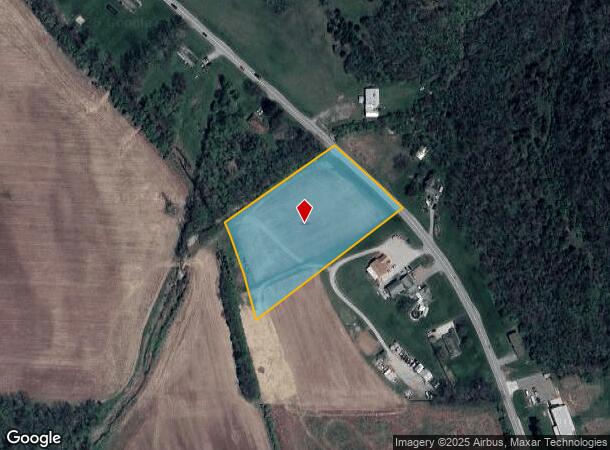
Harrison-Br Rd
15-01-10-200-006.004-006
7-04-06-02 PT NW 10-7-1 3.290A
Agriculturalland
Dearborn
X
Indiana
18029C0065C
3.29 AC
2024
Dearborn County
2024
Cincinnati/Dayton
080204
Cincinnati, OH-KY-IN
DEMOGRAPHICS near Harrison-Br Rd
1 Mile
3 Mile
5 Mile
2024 Total Population
285
3,365
19,772
2029 Population
293
3,442
19,879
Pop Growth 2024-2029
+ 2.81%
+ 2.29%
+ 0.54%
Average Age
44
43
41
2024 Total Households
120
1,309
7,809
HH Growth 2024-2029
+ 2.50%
+ 2.29%
+ 0.42%
Median Household Inc
$41,071
$84,671
$79,740
Avg Household Size
2.40
2.60
2.50
2024 Avg HH Vehicles
2.00
3.00
2.00
Median Home Value
$270,833
$287,804
$229,556
Median Year Built
1984
1991
1988
Nearby Places
Map Layers
Map Styles
 Street
 Aerial
- Restaurants
- Banks
- Shops
- Fitness
- Groceries
PUBLIC TRANSPORTATION
AIRPORT
Cincinnati/Northern Kentucky International
DRIVE
WALK
Distance
Cincinnati/Northern Kentucky International
48 min
34.1 mi
Freight Ports
Port of Toledo
DRIVE
WALK
Distance
Port of Toledo
253 min
218.0 mi
SALE & LEASE HISTORY
LISTING DATE
SALE/LEASE

Oct 24, 2016
For Sale
Dec 20, 2018
For Sale
Nearby Properties
Address
Land Use
TOTAL SIZE
Lot Size
Zoning
Address
Land Use
TOTAL SIZE
Lot Size
Zoning
85,849 SF
14.25 AC
Address
Land Use
TOTAL SIZE
Lot Size
Zoning
Address
Land Use
TOTAL SIZE
Lot Size
Zoning
5,320 SF
26.52 AC
Address
Land Use
TOTAL SIZE
Lot Size
Zoning
27,586 SF
8 AC
Address
Land Use
TOTAL SIZE
Lot Size
Zoning
Address
Land Use
TOTAL SIZE
Lot Size
Zoning
15,873 SF
3.15 AC
Address
Land Use
TOTAL SIZE
Lot Size
Zoning
28,471 SF
5.34 AC
Address
Land Use
TOTAL SIZE
Lot Size
Zoning
32,250 SF
4.25 AC
Address
Land Use
TOTAL SIZE
Lot Size
Zoning
10,640 SF
2 AC
Address
Land Use
TOTAL SIZE
Lot Size
Zoning
11.84 AC
Address
Land Use
TOTAL SIZE
Lot Size
Zoning
2,494 SF
399.94 AC
Address
Land Use
TOTAL SIZE
Lot Size
Zoning
11,056 SF
4.22 AC
Address
Land Use
TOTAL SIZE
Lot Size
Zoning
Address
Land Use
TOTAL SIZE
Lot Size
Zoning
10,800 SF
3.34 AC
Address
Land Use
TOTAL SIZE
Lot Size
Zoning
7,500 SF
2.35 AC
Address
Land Use
TOTAL SIZE
Lot Size
Zoning
3,751 SF
63.34 AC
Address
Land Use
TOTAL SIZE
Lot Size
Zoning
2,540 SF
17.10 AC
Address
Land Use
TOTAL SIZE
Lot Size
Zoning
Address
Land Use
TOTAL SIZE
Lot Size
Zoning
Address
Land Use
TOTAL SIZE
Lot Size
Zoning
0.18 AC
AA
Address
Land Use
TOTAL SIZE
Lot Size
Zoning
5,400 SF
2.50 AC
Address
Land Use
TOTAL SIZE
Lot Size
Zoning
5,250 SF
1.79 AC
Address
Land Use
TOTAL SIZE
Lot Size
Zoning
129.55 AC
Address
Land Use
TOTAL SIZE
Lot Size
Zoning
2,172 SF
2.50 AC
Address
Land Use
TOTAL SIZE
Lot Size
Zoning
15,748 SF
1.91 AC
Address
Land Use
TOTAL SIZE
Lot Size
Zoning
12,120 SF
2.13 AC
Address
Land Use
TOTAL SIZE
Lot Size
Zoning
13,744 SF
2 AC
Address
Land Use
TOTAL SIZE
Lot Size
Zoning
Address
Land Use
TOTAL SIZE
Lot Size
Zoning
Address
Land Use
TOTAL SIZE
Lot Size
Zoning
7,652 SF
1.40 AC
The World's #1 Commercial Real Estate Marketplace
Connect with us
© 2025 CoStar Group
The information above has been obtained from sources believed reliable. While we do not doubt its accuracy we have not verified it and make no guarantee, warranty or representation about it. It is your responsibility to independently confirm its accuracy and completeness. Any projections, opinions, assumptions, or estimates used are for example only and do not represent the current or future performance of the property. The value of this transaction to you depends on tax and other factors which should be evaluated by your tax, financial, and legal advisors. You and your advisors should conduct a careful, independent investigation of the property to determine to your satisfaction the suitability of the property for your needs.