Property Record
Hartledge Rd, Rosenberg, TX 77471
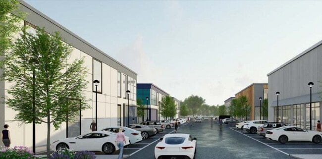

NEARBY LISTINGS FOR SALE OR LEASE
Property Detail
Hartledge Rd
Houston-Pasadena-The Woodlands, TX
H And Tc Ry
0211-00-009-0033-901
0211 H AND TC RY, TRACT 1 (PT), ACRES 3.978
Commercialnec
Fort Bend
X
Texas
48157C0240L
1
2024
3.98 AC
2025
Southwest Far
675300
Houston
DEMOGRAPHICS near Hartledge Rd
1 Mile
3 Mile
5 Mile
2024 Total Population
410
10,176
36,275
2029 Population
489
12,299
43,706
Pop Growth 2024-2029
+ 19.27%
+ 20.86%
+ 20.49%
Average Age
40
35
36
2024 Total Households
135
3,082
11,749
HH Growth 2024-2029
+ 20.00%
+ 21.41%
+ 21.00%
Median Household Inc
$98,610
$71,278
$62,377
Avg Household Size
3.00
3.30
3.00
2024 Avg HH Vehicles
2.00
2.00
2.00
Median Home Value
$350,000
$235,477
$192,208
Median Year Built
1984
2010
1992
Nearby Places
Map Layers
Map Styles
 Street
 Aerial
- Restaurants
- Banks
- Shops
- Fitness
- Groceries
PUBLIC TRANSPORTATION
AIRPORT
William P Hobby
DRIVE
WALK
Distance
William P Hobby
61 min
45.2 mi
Freight Ports
Port of Houston
DRIVE
WALK
Distance
Port of Houston
63 min
45.9 mi
SALE & LEASE HISTORY
LISTING DATE
SALE/LEASE

Nov 17, 2023
For Lease
Nov 17, 2023
For Sale
Nearby Properties
Address
Land Use
TOTAL SIZE
Lot Size
Zoning
Address
Land Use
TOTAL SIZE
Lot Size
Zoning
146.35 AC
ST
Address
Land Use
TOTAL SIZE
Lot Size
Zoning
44.35 AC
YOSN
Address
Land Use
TOTAL SIZE
Lot Size
Zoning
98,691 SF
29.37 AC
Address
Land Use
TOTAL SIZE
Lot Size
Zoning
672 SF
230.34 AC
YT
Address
Land Use
TOTAL SIZE
Lot Size
Zoning
Address
Land Use
TOTAL SIZE
Lot Size
Zoning
66,896 SF
18.60 AC
ZNY
Address
Land Use
TOTAL SIZE
Lot Size
Zoning
25.69 AC
Address
Land Use
TOTAL SIZE
Lot Size
Zoning
208.52 AC
OST
Address
Land Use
TOTAL SIZE
Lot Size
Zoning
194.64 AC
Address
Land Use
TOTAL SIZE
Lot Size
Zoning
145,000 SF
17.36 AC
YSNM
Address
Land Use
TOTAL SIZE
Lot Size
Zoning
11,800 SF
9.26 AC
S
Address
Land Use
TOTAL SIZE
Lot Size
Zoning
129.15 AC
Address
Land Use
TOTAL SIZE
Lot Size
Zoning
72,400 SF
10 AC
Address
Land Use
TOTAL SIZE
Lot Size
Zoning
85,000 SF
19.49 AC
SN
Address
Land Use
TOTAL SIZE
Lot Size
Zoning
1,064 SF
68.45 AC
OQY
Address
Land Use
TOTAL SIZE
Lot Size
Zoning
21,867 SF
70.17 AC
Address
Land Use
TOTAL SIZE
Lot Size
Zoning
10.06 AC
ST
Address
Land Use
TOTAL SIZE
Lot Size
Zoning
1,965 SF
170.82 AC
SOYK
Address
Land Use
TOTAL SIZE
Lot Size
Zoning
Address
Land Use
TOTAL SIZE
Lot Size
Zoning
10 AC
S
Address
Land Use
TOTAL SIZE
Lot Size
Zoning
10,737 SF
8.26 AC
Address
Land Use
TOTAL SIZE
Lot Size
Zoning
50,000 SF
13 AC
Address
Land Use
TOTAL SIZE
Lot Size
Zoning
49,725 SF
3.57 AC
Address
Land Use
TOTAL SIZE
Lot Size
Zoning
71.86 AC
Address
Land Use
TOTAL SIZE
Lot Size
Zoning
75.19 AC
Address
Land Use
TOTAL SIZE
Lot Size
Zoning
15.19 AC
Address
Land Use
TOTAL SIZE
Lot Size
Zoning
2.53 AC
Address
Land Use
TOTAL SIZE
Lot Size
Zoning
19.60 AC
Address
Land Use
TOTAL SIZE
Lot Size
Zoning
55,325 SF
2.50 AC
SY
Address
Land Use
TOTAL SIZE
Lot Size
Zoning
30,777 SF
12 AC
S
The World's #1 Commercial Real Estate Marketplace
Connect with us
© 2026 CoStar Group
The information above has been obtained from sources believed reliable. While we do not doubt its accuracy we have not verified it and make no guarantee, warranty or representation about it. It is your responsibility to independently confirm its accuracy and completeness. Any projections, opinions, assumptions, or estimates used are for example only and do not represent the current or future performance of the property. The value of this transaction to you depends on tax and other factors which should be evaluated by your tax, financial, and legal advisors. You and your advisors should conduct a careful, independent investigation of the property to determine to your satisfaction the suitability of the property for your needs.