Property Record
Hartneck Rd, Valley City, OH 44280
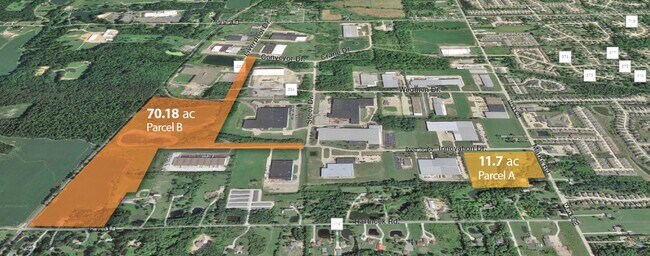


NEARBY LISTINGS FOR SALE OR LEASE
Property Detail
Hartneck Rd
Cleveland-Elyria, OH
TR 7 LOT 3 N PT LOT 4 N E COR 116.710A
025-01B-37-002
Medina
Timberlandforesttreesagricultural
Ohio
X
3-4
39103C0135D
116.71 AC
2024
Medina County
2024
Cleveland
402000
DEMOGRAPHICS near Hartneck Rd
1 Mile
3 Mile
5 Mile
2024 Total Population
317
17,895
63,209
2029 Population
321
18,168
63,625
Pop Growth 2024-2029
+ 1.26%
+ 1.53%
+ 0.66%
Average Age
47
43
43
2024 Total Households
137
6,826
24,486
HH Growth 2024-2029
+ 1.46%
+ 1.45%
+ 0.64%
Median Household Inc
$118,749
$93,493
$90,121
Avg Household Size
2.30
2.60
2.50
2024 Avg HH Vehicles
2.00
2.00
2.00
Median Home Value
$369,999
$263,441
$245,107
Median Year Built
1982
1991
1984
Nearby Places
Map Layers
Map Styles
 Street
 Aerial
- Restaurants
- Banks
- Shops
- Fitness
- Groceries
PUBLIC TRANSPORTATION
AIRPORT
Cleveland-Hopkins International
DRIVE
WALK
Distance
Cleveland-Hopkins International
34 min
16.7 mi
Freight Ports
Port of Toledo
DRIVE
WALK
Distance
Port of Toledo
134 min
107.4 mi
SALE & LEASE HISTORY
LISTING DATE
SALE/LEASE

Mar 02, 2022
For Sale
Nearby Properties
Address
Land Use
TOTAL SIZE
Lot Size
Zoning
Address
Land Use
TOTAL SIZE
Lot Size
Zoning
167,946 SF
33.22 AC
Address
Land Use
TOTAL SIZE
Lot Size
Zoning
156,667 SF
21.18 AC
Address
Land Use
TOTAL SIZE
Lot Size
Zoning
30,000 SF
13.96 AC
Address
Land Use
TOTAL SIZE
Lot Size
Zoning
5,000 SF
11.28 AC
Address
Land Use
TOTAL SIZE
Lot Size
Zoning
104,092 SF
22.45 AC
GI
Address
Land Use
TOTAL SIZE
Lot Size
Zoning
70,672 SF
24.27 AC
Address
Land Use
TOTAL SIZE
Lot Size
Zoning
101,531 SF
20.78 AC
Address
Land Use
TOTAL SIZE
Lot Size
Zoning
48,549 SF
7.87 AC
Address
Land Use
TOTAL SIZE
Lot Size
Zoning
85,329 SF
8.50 AC
Address
Land Use
TOTAL SIZE
Lot Size
Zoning
85,700 SF
15 AC
Address
Land Use
TOTAL SIZE
Lot Size
Zoning
37,632 SF
9.13 AC
Address
Land Use
TOTAL SIZE
Lot Size
Zoning
42,000 SF
10.15 AC
Address
Land Use
TOTAL SIZE
Lot Size
Zoning
9,163 SF
8.60 AC
Address
Land Use
TOTAL SIZE
Lot Size
Zoning
7,132 SF
7.03 AC
Address
Land Use
TOTAL SIZE
Lot Size
Zoning
45,344 SF
12.61 AC
Address
Land Use
TOTAL SIZE
Lot Size
Zoning
136,010 SF
6.67 AC
Address
Land Use
TOTAL SIZE
Lot Size
Zoning
5,584 SF
7.43 AC
Address
Land Use
TOTAL SIZE
Lot Size
Zoning
12,304 SF
5.62 AC
Address
Land Use
TOTAL SIZE
Lot Size
Zoning
3,344 SF
6.16 AC
Address
Land Use
TOTAL SIZE
Lot Size
Zoning
81,160 SF
5 AC
Address
Land Use
TOTAL SIZE
Lot Size
Zoning
162,636 SF
9.37 AC
Address
Land Use
TOTAL SIZE
Lot Size
Zoning
83,755 SF
8.09 AC
Address
Land Use
TOTAL SIZE
Lot Size
Zoning
7,854 SF
26.32 AC
Address
Land Use
TOTAL SIZE
Lot Size
Zoning
139.93 AC
GI
Address
Land Use
TOTAL SIZE
Lot Size
Zoning
24,920 SF
19.04 AC
Address
Land Use
TOTAL SIZE
Lot Size
Zoning
121,902 SF
13.85 AC
Address
Land Use
TOTAL SIZE
Lot Size
Zoning
4,800 SF
79.58 AC
Address
Land Use
TOTAL SIZE
Lot Size
Zoning
46,009 SF
11.56 AC
Address
Land Use
TOTAL SIZE
Lot Size
Zoning
572 SF
70.18 AC
Address
Land Use
TOTAL SIZE
Lot Size
Zoning
12,496 SF
7.78 AC
The World's #1 Commercial Real Estate Marketplace
Connect with us
© 2025 CoStar Group
The information above has been obtained from sources believed reliable. While we do not doubt its accuracy we have not verified it and make no guarantee, warranty or representation about it. It is your responsibility to independently confirm its accuracy and completeness. Any projections, opinions, assumptions, or estimates used are for example only and do not represent the current or future performance of the property. The value of this transaction to you depends on tax and other factors which should be evaluated by your tax, financial, and legal advisors. You and your advisors should conduct a careful, independent investigation of the property to determine to your satisfaction the suitability of the property for your needs.