Property Record
Harvest Way, Saugerties, NY 12477


NEARBY LISTINGS FOR SALE OR LEASE
Property Detail
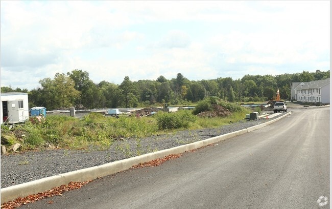
Harvest Way
4889-029.003-0001-015.200-0000
Ulster
Apartment
New York
X
15.200
36111C0315E
13.70 AC
2025
Hudson Valley Area
2024
Other Market Areas
950400
Kingston, NY
7,994 SF
DEMOGRAPHICS near Harvest Way
1 Mile
3 Mile
5 Mile
2024 Total Population
1,760
11,972
26,271
2029 Population
1,744
11,892
26,184
Pop Growth 2024-2029
(0.91%)
(0.67%)
(0.33%)
Average Age
44
43
44
2024 Total Households
767
5,077
10,911
HH Growth 2024-2029
(0.91%)
(0.65%)
(0.36%)
Median Household Inc
$83,283
$72,590
$79,305
Avg Household Size
2.30
2.30
2.30
2024 Avg HH Vehicles
2.00
2.00
2.00
Median Home Value
$301,190
$284,563
$309,862
Median Year Built
1975
1964
1965
Nearby Places
Map Layers
Map Styles
 Street
 Aerial
- Restaurants
- Banks
- Shops
- Fitness
- Groceries
Nearby Properties
Address
Land Use
TOTAL SIZE
Lot Size
Zoning
Address
Land Use
TOTAL SIZE
Lot Size
Zoning
2,688 SF
301.70 AC
I
Address
Land Use
TOTAL SIZE
Lot Size
Zoning
105,815 SF
91.70 AC
I
Address
Land Use
TOTAL SIZE
Lot Size
Zoning
52,880 SF
260.28 AC
I
Address
Land Use
TOTAL SIZE
Lot Size
Zoning
12,489 SF
15.10 AC
02 - SINGL
Address
Land Use
TOTAL SIZE
Lot Size
Zoning
81,289 SF
115.30 AC
I
Address
Land Use
TOTAL SIZE
Lot Size
Zoning
78.11 AC
WC
Address
Land Use
TOTAL SIZE
Lot Size
Zoning
7.90 AC
03 - MULTI
Address
Land Use
TOTAL SIZE
Lot Size
Zoning
4,788 SF
1.62 AC
R1.5
Address
Land Use
TOTAL SIZE
Lot Size
Zoning
41,213 SF
7.90 AC
02
Address
Land Use
TOTAL SIZE
Lot Size
Zoning
56,845 SF
17.70 AC
02 - SINGL
Address
Land Use
TOTAL SIZE
Lot Size
Zoning
21.70 AC
LC
Address
Land Use
TOTAL SIZE
Lot Size
Zoning
36,004 SF
7.10 AC
05 - COMME
Address
Land Use
TOTAL SIZE
Lot Size
Zoning
47,679 SF
14 AC
02 - SINGL
Address
Land Use
TOTAL SIZE
Lot Size
Zoning
5,225 SF
432.29 AC
RD5
Address
Land Use
TOTAL SIZE
Lot Size
Zoning
117,450 SF
14.20 AC
02 - SINGL
Address
Land Use
TOTAL SIZE
Lot Size
Zoning
5,664 SF
5.30 AC
WC
Address
Land Use
TOTAL SIZE
Lot Size
Zoning
9,524 SF
3.30 AC
02 - SINGL
Address
Land Use
TOTAL SIZE
Lot Size
Zoning
13,066 SF
149 AC
Address
Land Use
TOTAL SIZE
Lot Size
Zoning
37,172 SF
10.10 AC
06 - INDUS
Address
Land Use
TOTAL SIZE
Lot Size
Zoning
8,404 SF
161.07 AC
ABD
Address
Land Use
TOTAL SIZE
Lot Size
Zoning
18,225 SF
29.30 AC
02 - SINGL
Address
Land Use
TOTAL SIZE
Lot Size
Zoning
6,144 SF
3.30 AC
02 - SINGL
Address
Land Use
TOTAL SIZE
Lot Size
Zoning
17,736 SF
1.40 AC
02 - SINGL
Address
Land Use
TOTAL SIZE
Lot Size
Zoning
8,064 SF
3.20 AC
05 - COMME
Address
Land Use
TOTAL SIZE
Lot Size
Zoning
2.55 AC
R3A
Address
Land Use
TOTAL SIZE
Lot Size
Zoning
27,593 SF
7.40 AC
33
Address
Land Use
TOTAL SIZE
Lot Size
Zoning
Address
Land Use
TOTAL SIZE
Lot Size
Zoning
12,088 SF
1.50 AC
05 - COMME
Address
Land Use
TOTAL SIZE
Lot Size
Zoning
13,976 SF
5.91 AC
R1.5
The World's #1 Commercial Real Estate Marketplace
Connect with us
© 2025 CoStar Group
The information above has been obtained from sources believed reliable. While we do not doubt its accuracy we have not verified it and make no guarantee, warranty or representation about it. It is your responsibility to independently confirm its accuracy and completeness. Any projections, opinions, assumptions, or estimates used are for example only and do not represent the current or future performance of the property. The value of this transaction to you depends on tax and other factors which should be evaluated by your tax, financial, and legal advisors. You and your advisors should conduct a careful, independent investigation of the property to determine to your satisfaction the suitability of the property for your needs.