Property Record
Haven Rd, Wurtsboro, NY 12790


NEARBY LISTINGS FOR SALE OR LEASE
Property Detail
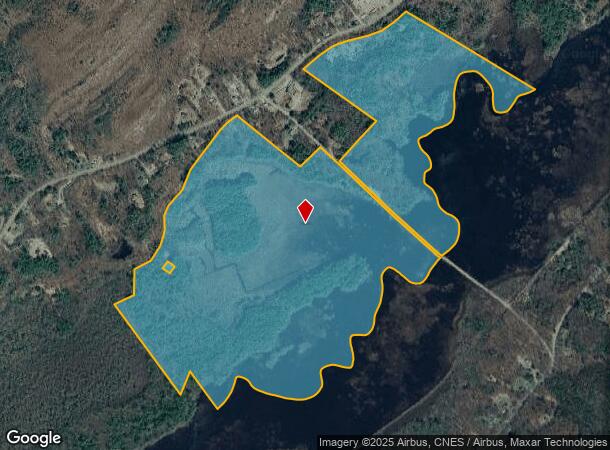
Haven Rd
4089-067-0-0001-007-001
BASHA KILL WETLANDS PROJECT 66
Forest
Sullivan
A
New York
36105C0642F
7.001
2025
247.63 AC
2024
Hudson Valley Area
951302
Other Market Areas
DEMOGRAPHICS near Haven Rd
1 Mile
3 Mile
5 Mile
2024 Total Population
112
1,713
12,076
2029 Population
108
1,710
12,316
Pop Growth 2024-2029
(3.57%)
(0.18%)
+ 1.99%
Average Age
44
44
41
2024 Total Households
46
484
3,997
HH Growth 2024-2029
(2.17%)
(0.83%)
+ 2.05%
Median Household Inc
$111,363
$106,481
$83,519
Avg Household Size
2.40
2.60
2.70
2024 Avg HH Vehicles
2.00
3.00
2.00
Median Home Value
$257,142
$251,308
$254,947
Median Year Built
1959
1974
1970
Nearby Places
- Restaurants
- Banks
- Shops
- Fitness
- Groceries
PUBLIC TRANSPORTATION
COMMUTER RAIL
Otisville (Bergen County/Port Jervis Line - NJ Transit Commuter Rail (NJ Transit), Main/Port Jervis Line - NJ Transit Commuter Rail (NJ Transit))
DRIVE
WALK
Distance
Otisville (Bergen County/Port Jervis Line - NJ Transit Commuter Rail (NJ Transit), Main/Port Jervis Line - NJ Transit Commuter Rail (NJ Transit))
12 min
7.5 mi
AIRPORT
New York Stewart International
DRIVE
WALK
Distance
New York Stewart International
41 min
27.3 mi
Freight Ports
Port Newark Container Terminal
DRIVE
WALK
Distance
Port Newark Container Terminal
108 min
84.3 mi
SALE & LEASE HISTORY
LISTING DATE
SALE/LEASE

Jun 03, 2019
For Sale
Nearby Properties
Address
Land Use
TOTAL SIZE
Lot Size
Zoning
Address
Land Use
TOTAL SIZE
Lot Size
Zoning
234.30 AC
Address
Land Use
TOTAL SIZE
Lot Size
Zoning
7,592 SF
13.78 AC
C
Address
Land Use
TOTAL SIZE
Lot Size
Zoning
924 SF
24.52 AC
R4
Address
Land Use
TOTAL SIZE
Lot Size
Zoning
1,568 SF
47.33 AC
RVP
Address
Land Use
TOTAL SIZE
Lot Size
Zoning
20,000 SF
5.17 AC
C
Address
Land Use
TOTAL SIZE
Lot Size
Zoning
10,560 SF
2.76 AC
C
Address
Land Use
TOTAL SIZE
Lot Size
Zoning
6,210 SF
45.16 AC
RAG2
Address
Land Use
TOTAL SIZE
Lot Size
Zoning
9,000 SF
17.67 AC
LNR
Address
Land Use
TOTAL SIZE
Lot Size
Zoning
294.80 AC
RAG1
Address
Land Use
TOTAL SIZE
Lot Size
Zoning
58.61 AC
RAG2
Address
Land Use
TOTAL SIZE
Lot Size
Zoning
6,846 SF
6.30 AC
RAG2
Address
Land Use
TOTAL SIZE
Lot Size
Zoning
2,119 SF
9.61 AC
RAG1
Address
Land Use
TOTAL SIZE
Lot Size
Zoning
58.60 AC
R4
Address
Land Use
TOTAL SIZE
Lot Size
Zoning
490.08 AC
RAG1
Address
Land Use
TOTAL SIZE
Lot Size
Zoning
2,900 SF
25.19 AC
RAG2
Address
Land Use
TOTAL SIZE
Lot Size
Zoning
4,850 SF
12 AC
RAG1
Address
Land Use
TOTAL SIZE
Lot Size
Zoning
324.46 AC
RAG2
Address
Land Use
TOTAL SIZE
Lot Size
Zoning
505.01 AC
RAG2
Address
Land Use
TOTAL SIZE
Lot Size
Zoning
5,697 SF
9 AC
RAG1
Address
Land Use
TOTAL SIZE
Lot Size
Zoning
1,848 SF
3.61 AC
RA
Address
Land Use
TOTAL SIZE
Lot Size
Zoning
672 SF
1.60 AC
R1C
Address
Land Use
TOTAL SIZE
Lot Size
Zoning
431.36 AC
RAG1
Address
Land Use
TOTAL SIZE
Lot Size
Zoning
4,149 SF
4 AC
C
Address
Land Use
TOTAL SIZE
Lot Size
Zoning
2,965 SF
12.55 AC
RAG1
Address
Land Use
TOTAL SIZE
Lot Size
Zoning
1,625 SF
11.75 AC
R1
Address
Land Use
TOTAL SIZE
Lot Size
Zoning
380.42 AC
RAG1
Address
Land Use
TOTAL SIZE
Lot Size
Zoning
6,000 SF
13.52 AC
C
Address
Land Use
TOTAL SIZE
Lot Size
Zoning
386.27 AC
RAG1
Address
Land Use
TOTAL SIZE
Lot Size
Zoning
2,400 SF
0.44 AC
C
Address
Land Use
TOTAL SIZE
Lot Size
Zoning
8,000 SF
270.77 AC
RAG1
The World's #1 Commercial Real Estate Marketplace
Connect with us
© 2025 CoStar Group
The information above has been obtained from sources believed reliable. While we do not doubt its accuracy we have not verified it and make no guarantee, warranty or representation about it. It is your responsibility to independently confirm its accuracy and completeness. Any projections, opinions, assumptions, or estimates used are for example only and do not represent the current or future performance of the property. The value of this transaction to you depends on tax and other factors which should be evaluated by your tax, financial, and legal advisors. You and your advisors should conduct a careful, independent investigation of the property to determine to your satisfaction the suitability of the property for your needs.