Property Record
Hawk Rd, Newcomerstown, OH 43832

NEARBY LISTINGS FOR SALE OR LEASE
-
-
View all Newcomerstown listings for sale on LoopNet.com
Property Detail
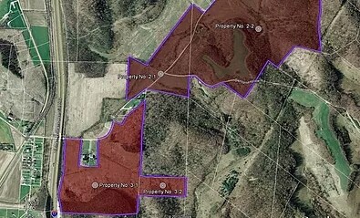
Hawk Rd
New Philadelphia-Dover, OH
3 6 4 PR 2 10.00A
5100070000
Tuscarawas
Agriculturalland
Ohio
X
2
39157C0335D
10 AC
0
Ohio North Area
2024
Other Market Areas
021700
DEMOGRAPHICS near Hawk Rd
1 mile
3 mile
5 mile
2024 Total Population
131
1,666
7,073
2029 Population
126
1,589
6,996
Pop Growth 2024-2029
(3.82%)
(4.62%)
(1.09%)
Average Age
46
45
42
2024 Total Households
52
658
2,920
HH Growth 2024-2029
(3.85%)
(4.71%)
(1.10%)
Median Household Inc
$59,999
$62,740
$50,090
Avg Household Size
2.30
2.40
2.30
2024 Avg HH Vehicles
3.00
3.00
2.00
Median Home Value
$158,333
$148,355
$92,915
Median Year Built
1967
1965
1959
Nearby Places
Map Layers
Map Styles
 Street
 Aerial
Transit
 Traffic
 Biking
Places
Listings with unknown addresses are not visible on the map
- Restaurants
- Banks
- Shops
- Fitness
- Groceries
SALE & LEASE HISTORY
LISTING DATE
SALE/LEASE

Sep 24, 2016
For Sale
Nearby Properties
Address
Land Use
TOTAL SIZE
Lot Size
Zoning
Address
Land Use
TOTAL SIZE
Lot Size
Zoning
180,000 SF
10.60 AC
Address
Land Use
TOTAL SIZE
Lot Size
Zoning
99,286 SF
12.35 AC
Address
Land Use
TOTAL SIZE
Lot Size
Zoning
61,078 SF
5.36 AC
Address
Land Use
TOTAL SIZE
Lot Size
Zoning
13,516 SF
2.50 AC
Address
Land Use
TOTAL SIZE
Lot Size
Zoning
76,512 SF
5 AC
Address
Land Use
TOTAL SIZE
Lot Size
Zoning
62,160 SF
5 AC
Address
Land Use
TOTAL SIZE
Lot Size
Zoning
Address
Land Use
TOTAL SIZE
Lot Size
Zoning
50,750 SF
1.29 AC
Address
Land Use
TOTAL SIZE
Lot Size
Zoning
2,946 SF
63.01 AC
Address
Land Use
TOTAL SIZE
Lot Size
Zoning
40,000 SF
7.25 AC
Address
Land Use
TOTAL SIZE
Lot Size
Zoning
12,822 SF
168.25 AC
Address
Land Use
TOTAL SIZE
Lot Size
Zoning
57,436 SF
6.29 AC
Address
Land Use
TOTAL SIZE
Lot Size
Zoning
100.69 AC
Address
Land Use
TOTAL SIZE
Lot Size
Zoning
25,595 SF
2.04 AC
Address
Land Use
TOTAL SIZE
Lot Size
Zoning
3,152 SF
1.06 AC
Address
Land Use
TOTAL SIZE
Lot Size
Zoning
32.72 AC
Address
Land Use
TOTAL SIZE
Lot Size
Zoning
144.17 AC
Address
Land Use
TOTAL SIZE
Lot Size
Zoning
7,985 SF
1.33 AC
Address
Land Use
TOTAL SIZE
Lot Size
Zoning
1,832 SF
82.96 AC
Address
Land Use
TOTAL SIZE
Lot Size
Zoning
219.37 AC
Address
Land Use
TOTAL SIZE
Lot Size
Zoning
10,191 SF
29.53 AC
Address
Land Use
TOTAL SIZE
Lot Size
Zoning
60.89 AC
Address
Land Use
TOTAL SIZE
Lot Size
Zoning
720 SF
109.92 AC
Address
Land Use
TOTAL SIZE
Lot Size
Zoning
5,248 SF
87.88 AC
Address
Land Use
TOTAL SIZE
Lot Size
Zoning
27,555 SF
1.73 AC
Address
Land Use
TOTAL SIZE
Lot Size
Zoning
Address
Land Use
TOTAL SIZE
Lot Size
Zoning
111.32 AC
Address
Land Use
TOTAL SIZE
Lot Size
Zoning
109.67 AC
Address
Land Use
TOTAL SIZE
Lot Size
Zoning
4,104 SF
231.48 AC
Address
Land Use
TOTAL SIZE
Lot Size
Zoning
5,278 SF
57.17 AC
The World's #1 Commercial Real Estate Marketplace
Connect with us
© 2026 CoStar Group
The information above has been obtained from sources believed reliable. While we do not doubt its accuracy we have not verified it and make no guarantee, warranty or representation about it. It is your responsibility to independently confirm its accuracy and completeness. Any projections, opinions, assumptions, or estimates used are for example only and do not represent the current or future performance of the property. The value of this transaction to you depends on tax and other factors which should be evaluated by your tax, financial, and legal advisors. You and your advisors should conduct a careful, independent investigation of the property to determine to your satisfaction the suitability of the property for your needs.