Property Record
Hawks Way, , AL
Property Detail
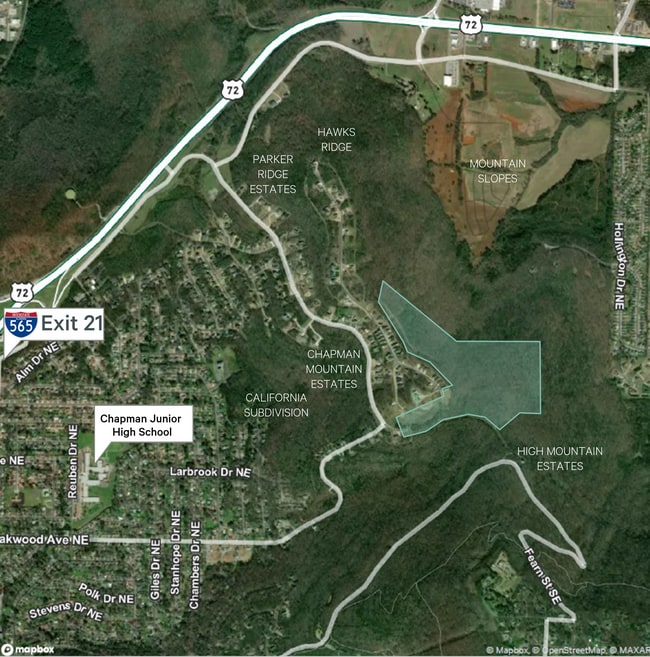
Hawks Way
Huntsville, AL
SEC 29 T3S R1E PART OF TRACT 13 CHAPMAN COVE & A RESUB OF LOT A OF SADDLETREE PB 21 PG 69-71 DESC AT COM AT NE COR OF SEC 29
13-09-29-1-000-001.000
MADISON
Residentialacreage
Alabama
B and X Area of moderate flood hazard, usually the area between the limits of the 100-year and 500-year floods.
a
2025
1.20 AC
2025
South Huntsville
0018013006
Huntsville
NEARBY LISTINGS FOR SALE OR LEASE
DEMOGRAPHICS near Hawks Way
1 mile
3 mile
5 mile
2025 Total Population
2,158
29,901
89,260
2030 Population
2,332
31,976
95,867
Pop Growth 2025-2030
+ 8.06%
+ 6.94%
+ 7.40%
Average Age
45
40
41
2025 Total Households
981
11,855
36,527
HH Growth 2025-2030
+ 8.26%
+ 8.00%
+ 7.92%
Median Household Inc
$100,888
$86,868
$73,827
Avg Household Size
2.20
2.20
2.20
2025 Avg HH Vehicles
2.00
2.00
2.00
Median Home Value
$305,904
$323,790
$302,089
Median Year Built
1995
1968
1974
Nearby Places
Map Layers
Map Styles
 Street
 Aerial
Layers
 Traffic
 Biking
Places
Listings with unknown addresses are not visible on the map
- Restaurants
- Banks
- Shops
- Fitness
- Groceries
PUBLIC TRANSPORTATION
AIRPORT
Huntsville International-Carl T Jones Field
Drive
Walk
Distance
Huntsville International-Carl T Jones Field
27 min
18.5 mi
SALE & LEASE HISTORY
LISTING DATE
SALE/LEASE

Oct 11, 2022
For Sale
Feb 10, 2020
For Sale
Nearby Properties
Address
Land Use
TOTAL SIZE
Lot Size
Zoning
Address
Land Use
TOTAL SIZE
Lot Size
Zoning
672 SF
105 AC
Address
Land Use
TOTAL SIZE
Lot Size
Zoning
20,160 SF
157 AC
Address
Land Use
TOTAL SIZE
Lot Size
Zoning
2,532 SF
22.76 AC
Address
Land Use
TOTAL SIZE
Lot Size
Zoning
71,695 SF
7.80 AC
Address
Land Use
TOTAL SIZE
Lot Size
Zoning
201,250 SF
15 AC
Address
Land Use
TOTAL SIZE
Lot Size
Zoning
1,740 SF
24 AC
Address
Land Use
TOTAL SIZE
Lot Size
Zoning
254,514 SF
20 AC
Address
Land Use
TOTAL SIZE
Lot Size
Zoning
90,690 SF
9.29 AC
Address
Land Use
TOTAL SIZE
Lot Size
Zoning
6,120 SF
10 AC
Address
Land Use
TOTAL SIZE
Lot Size
Zoning
141,120 SF
15 AC
Address
Land Use
TOTAL SIZE
Lot Size
Zoning
7,950 SF
63 AC
Address
Land Use
TOTAL SIZE
Lot Size
Zoning
21,827 SF
1.95 AC
Address
Land Use
TOTAL SIZE
Lot Size
Zoning
17,946 SF
5 AC
Address
Land Use
TOTAL SIZE
Lot Size
Zoning
Address
Land Use
TOTAL SIZE
Lot Size
Zoning
207,500 SF
25 AC
Address
Land Use
TOTAL SIZE
Lot Size
Zoning
223,500 SF
6.60 AC
Address
Land Use
TOTAL SIZE
Lot Size
Zoning
Address
Land Use
TOTAL SIZE
Lot Size
Zoning
4,812 SF
0.73 AC
Address
Land Use
TOTAL SIZE
Lot Size
Zoning
12,554 SF
1.69 AC
Address
Land Use
TOTAL SIZE
Lot Size
Zoning
10,080 SF
4.29 AC
Address
Land Use
TOTAL SIZE
Lot Size
Zoning
5,625 SF
5.81 AC
Address
Land Use
TOTAL SIZE
Lot Size
Zoning
23,944 SF
13 AC
Address
Land Use
TOTAL SIZE
Lot Size
Zoning
74,868 SF
7.02 AC
Address
Land Use
TOTAL SIZE
Lot Size
Zoning
5,905 SF
16 AC
Address
Land Use
TOTAL SIZE
Lot Size
Zoning
8,862 SF
6.40 AC
Address
Land Use
TOTAL SIZE
Lot Size
Zoning
3,450 SF
4.48 AC
Address
Land Use
TOTAL SIZE
Lot Size
Zoning
6,600 SF
8.58 AC
Address
Land Use
TOTAL SIZE
Lot Size
Zoning
Address
Land Use
TOTAL SIZE
Lot Size
Zoning
100,000 SF
11 AC
Address
Land Use
TOTAL SIZE
Lot Size
Zoning
44,925 SF
6.90 AC
The World's #1 Commercial Real Estate Marketplace
Connect with us
© 2026 CoStar Group
The information above has been obtained from sources believed reliable. While we do not doubt its accuracy we have not verified it and make no guarantee, warranty or representation about it. It is your responsibility to independently confirm its accuracy and completeness. Any projections, opinions, assumptions, or estimates used are for example only and do not represent the current or future performance of the property. The value of this transaction to you depends on tax and other factors which should be evaluated by your tax, financial, and legal advisors. You and your advisors should conduct a careful, independent investigation of the property to determine to your satisfaction the suitability of the property for your needs.