Property Record
Helendale Rd, Adelanto, CA 92301

Property Detail
Helendale Rd
Riverside-San Bernardino-Ontario, CA
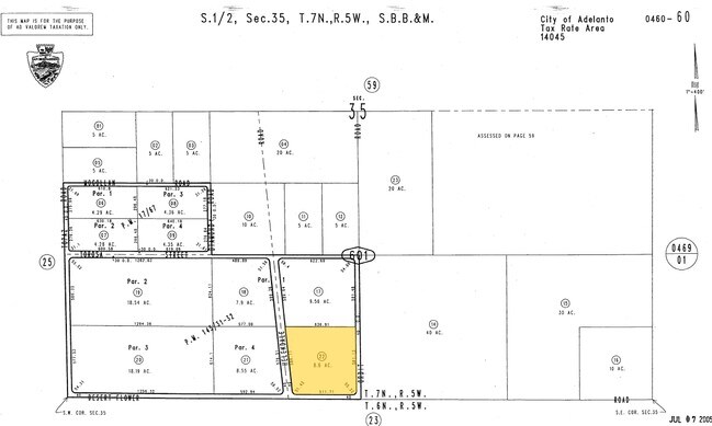
S 1/2 SW 1/4 SEC 35 TP 7N R 5W EX ST AND EX PARCEL MAP 12691
0460-601-22
SAN BERNARDINO
Vacantlandnec
California
D Areas with possible but undetermined flood hazards.
8.60 AC
2025
Mojave River Valley
2025
Inland Empire (California)
009133
NEARBY LISTINGS FOR SALE OR LEASE
DEMOGRAPHICS near Helendale Rd
1 mile
3 mile
5 mile
2025 Total Population
6
510
6,254
2030 Population
6
537
6,444
Pop Growth 2025-2030
0.00%
+ 5.29%
+ 3.04%
Average Age
0
40
32
2025 Total Households
2
165
1,943
HH Growth 2025-2030
0.00%
+ 5.45%
+ 3.09%
Median Household Inc
$0
$61,875
$36,442
Avg Household Size
2.00
2.60
3.10
2025 Avg HH Vehicles
2.00
2.00
2.00
Median Home Value
$0
$369,354
$262,499
Median Year Built
1974
1972
1979
Nearby Places
Map Layers
Map Styles
 Street
 Aerial
Layers
 Traffic
 Biking
Places
Listings with unknown addresses are not visible on the map
- Restaurants
- Banks
- Shops
- Fitness
- Groceries
Nearby Properties
Address
Land Use
TOTAL SIZE
Lot Size
Zoning
Address
Land Use
TOTAL SIZE
Lot Size
Zoning
Address
Land Use
TOTAL SIZE
Lot Size
Zoning
Address
Land Use
TOTAL SIZE
Lot Size
Zoning
129.09 AC
Address
Land Use
TOTAL SIZE
Lot Size
Zoning
40 AC
Address
Land Use
TOTAL SIZE
Lot Size
Zoning
55.14 AC
RL
Address
Land Use
TOTAL SIZE
Lot Size
Zoning
Address
Land Use
TOTAL SIZE
Lot Size
Zoning
162.55 AC
Address
Land Use
TOTAL SIZE
Lot Size
Zoning
197.24 AC
Address
Land Use
TOTAL SIZE
Lot Size
Zoning
19.55 AC
Address
Land Use
TOTAL SIZE
Lot Size
Zoning
Address
Land Use
TOTAL SIZE
Lot Size
Zoning
9.60 AC
Address
Land Use
TOTAL SIZE
Lot Size
Zoning
19.55 AC
Address
Land Use
TOTAL SIZE
Lot Size
Zoning
9.09 AC
Address
Land Use
TOTAL SIZE
Lot Size
Zoning
77.12 AC
Address
Land Use
TOTAL SIZE
Lot Size
Zoning
10,641 SF
10.70 AC
RL40
Address
Land Use
TOTAL SIZE
Lot Size
Zoning
9.29 AC
Address
Land Use
TOTAL SIZE
Lot Size
Zoning
9.28 AC
Address
Land Use
TOTAL SIZE
Lot Size
Zoning
9.28 AC
Address
Land Use
TOTAL SIZE
Lot Size
Zoning
Address
Land Use
TOTAL SIZE
Lot Size
Zoning
9.14 AC
Address
Land Use
TOTAL SIZE
Lot Size
Zoning
9.12 AC
Address
Land Use
TOTAL SIZE
Lot Size
Zoning
9.13 AC
Address
Land Use
TOTAL SIZE
Lot Size
Zoning
9.15 AC
Address
Land Use
TOTAL SIZE
Lot Size
Zoning
8.99 AC
Address
Land Use
TOTAL SIZE
Lot Size
Zoning
Address
Land Use
TOTAL SIZE
Lot Size
Zoning
9.01 AC
Address
Land Use
TOTAL SIZE
Lot Size
Zoning
9.55 AC
Address
Land Use
TOTAL SIZE
Lot Size
Zoning
8.98 AC
Address
Land Use
TOTAL SIZE
Lot Size
Zoning
8.98 AC
Address
Land Use
TOTAL SIZE
Lot Size
Zoning
78.18 AC
The World's #1 Commercial Real Estate Marketplace
Connect with us
© 2026 CoStar Group
The information above has been obtained from sources believed reliable. While we do not doubt its accuracy we have not verified it and make no guarantee, warranty or representation about it. It is your responsibility to independently confirm its accuracy and completeness. Any projections, opinions, assumptions, or estimates used are for example only and do not represent the current or future performance of the property. The value of this transaction to you depends on tax and other factors which should be evaluated by your tax, financial, and legal advisors. You and your advisors should conduct a careful, independent investigation of the property to determine to your satisfaction the suitability of the property for your needs.