Property Record
Hesperia Rd, Hesperia, CA 92345
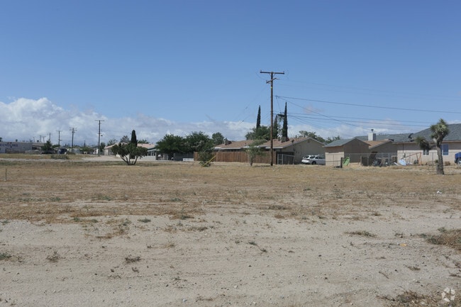


This Property Is For Sale
NEARBY LISTINGS FOR SALE OR LEASE
Property Detail
Hesperia Rd
Riverside-San Bernardino-Ontario, CA
City Of Hesperia
0407-183-15
TOWN OF HESPERIA LOTS 1 AND 2 BLK 6 EX WTR RTS AND EX 1/2 INT MIN RTS WOSE
Vacantlandnec
San Bernardino
X
California
06071C6495H
1,2
2024
0.18 AC
2025
Mojave River Valley
010019
Inland Empire (California)
DEMOGRAPHICS near Hesperia Rd
1 Mile
3 Mile
5 Mile
2024 Total Population
7,518
62,335
151,811
2029 Population
7,657
63,321
155,165
Pop Growth 2024-2029
+ 1.85%
+ 1.58%
+ 2.21%
Average Age
35
36
37
2024 Total Households
2,377
18,325
47,037
HH Growth 2024-2029
+ 1.77%
+ 1.58%
+ 2.26%
Median Household Inc
$36,038
$59,095
$67,772
Avg Household Size
3.20
3.30
3.20
2024 Avg HH Vehicles
2.00
2.00
2.00
Median Home Value
$263,345
$337,068
$350,152
Median Year Built
1977
1982
1988
Nearby Places
Map Layers
Map Styles
 Street
 Aerial
- Restaurants
- Banks
- Shops
- Fitness
- Groceries
PUBLIC TRANSPORTATION
COMMUTER RAIL
Victorville Amtrak (Southwest Chief - Amtrak)
DRIVE
WALK
Distance
Victorville Amtrak (Southwest Chief - Amtrak)
14 min
8.0 mi
Freight Ports
Port of Long Beach
DRIVE
WALK
Distance
Port of Long Beach
113 min
93.8 mi
Nearby Properties
Address
Land Use
TOTAL SIZE
Lot Size
Zoning
Address
Land Use
TOTAL SIZE
Lot Size
Zoning
213,482 SF
19.98 AC
Address
Land Use
TOTAL SIZE
Lot Size
Zoning
158,417 SF
9.66 AC
Address
Land Use
TOTAL SIZE
Lot Size
Zoning
174,855 SF
15.46 AC
Address
Land Use
TOTAL SIZE
Lot Size
Zoning
142,661 SF
14.21 AC
Address
Land Use
TOTAL SIZE
Lot Size
Zoning
80,080 SF
4.88 AC
Address
Land Use
TOTAL SIZE
Lot Size
Zoning
119,525 SF
6.42 AC
Address
Land Use
TOTAL SIZE
Lot Size
Zoning
125,694 SF
10.51 AC
Address
Land Use
TOTAL SIZE
Lot Size
Zoning
65,440 SF
12.70 AC
Address
Land Use
TOTAL SIZE
Lot Size
Zoning
41,249 SF
4.84 AC
Address
Land Use
TOTAL SIZE
Lot Size
Zoning
98,624 SF
8.23 AC
Address
Land Use
TOTAL SIZE
Lot Size
Zoning
59,841 SF
3.99 AC
Address
Land Use
TOTAL SIZE
Lot Size
Zoning
102,120 SF
11 AC
Address
Land Use
TOTAL SIZE
Lot Size
Zoning
70,023 SF
4.52 AC
Address
Land Use
TOTAL SIZE
Lot Size
Zoning
69,000 SF
3.17 AC
Address
Land Use
TOTAL SIZE
Lot Size
Zoning
152,482 SF
14.72 AC
R3
Address
Land Use
TOTAL SIZE
Lot Size
Zoning
86,852 SF
4.86 AC
Address
Land Use
TOTAL SIZE
Lot Size
Zoning
41,640 SF
4.06 AC
Address
Land Use
TOTAL SIZE
Lot Size
Zoning
82,584 SF
4.91 AC
Address
Land Use
TOTAL SIZE
Lot Size
Zoning
78,412 SF
4 AC
Address
Land Use
TOTAL SIZE
Lot Size
Zoning
37,601 SF
11.80 AC
Address
Land Use
TOTAL SIZE
Lot Size
Zoning
54,134 SF
5.10 AC
Address
Land Use
TOTAL SIZE
Lot Size
Zoning
97,236 SF
3.91 AC
Address
Land Use
TOTAL SIZE
Lot Size
Zoning
14,351 SF
1.24 AC
Address
Land Use
TOTAL SIZE
Lot Size
Zoning
Address
Land Use
TOTAL SIZE
Lot Size
Zoning
37,907 SF
1.24 AC
Address
Land Use
TOTAL SIZE
Lot Size
Zoning
68,877 SF
4.25 AC
Address
Land Use
TOTAL SIZE
Lot Size
Zoning
88,870 SF
5.97 AC
Address
Land Use
TOTAL SIZE
Lot Size
Zoning
49,766 SF
4.12 AC
Address
Land Use
TOTAL SIZE
Lot Size
Zoning
15,128 SF
1.10 AC
Address
Land Use
TOTAL SIZE
Lot Size
Zoning
41,278 SF
18.34 AC
The World's #1 Commercial Real Estate Marketplace
Connect with us
© 2026 CoStar Group
The information above has been obtained from sources believed reliable. While we do not doubt its accuracy we have not verified it and make no guarantee, warranty or representation about it. It is your responsibility to independently confirm its accuracy and completeness. Any projections, opinions, assumptions, or estimates used are for example only and do not represent the current or future performance of the property. The value of this transaction to you depends on tax and other factors which should be evaluated by your tax, financial, and legal advisors. You and your advisors should conduct a careful, independent investigation of the property to determine to your satisfaction the suitability of the property for your needs.