Property Record
High Bridge Rd, Bowie, MD 20715
NEARBY LISTINGS FOR SALE OR LEASE
Property Detail
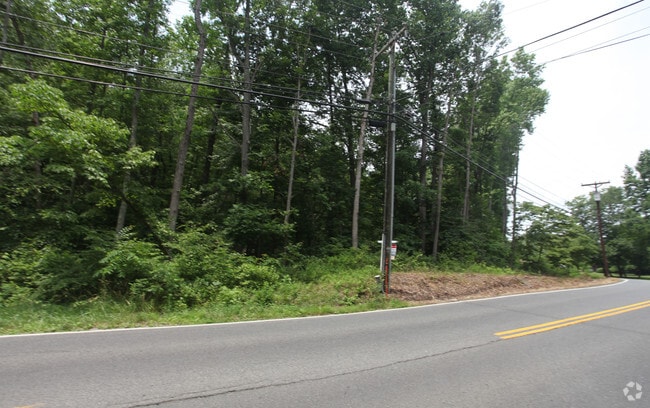
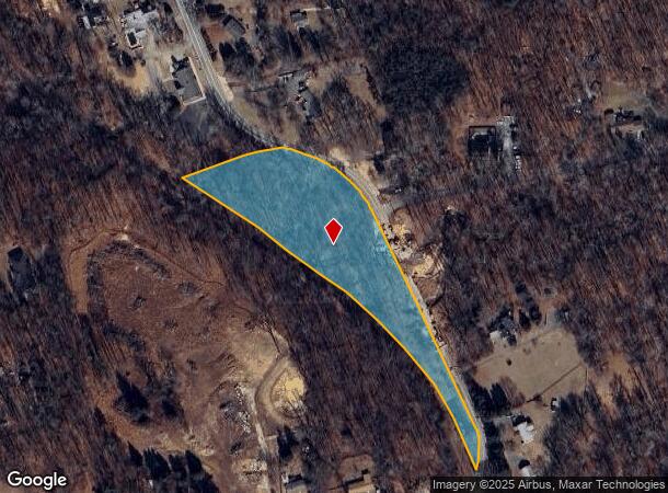
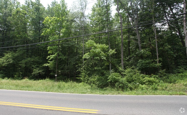
High Bridge Rd
Washington-Arlington-Alexandria, DC-VA-MD-WV
3.5000 ACRES
14-1627918
Prince George's
Taxexempt
Maryland
X
3
24033C0160E
3.50 AC
2023
Bowie
2025
Washington, DC
800402
DEMOGRAPHICS near High Bridge Rd
1 Mile
3 Mile
5 Mile
2024 Total Population
5,676
45,923
124,080
2029 Population
5,505
44,768
121,835
Pop Growth 2024-2029
(3.01%)
(2.52%)
(1.81%)
Average Age
40
42
41
2024 Total Households
1,640
14,578
42,039
HH Growth 2024-2029
(3.29%)
(2.67%)
(1.76%)
Median Household Inc
$145,723
$137,767
$120,330
Avg Household Size
2.90
3.00
2.80
2024 Avg HH Vehicles
3.00
2.00
2.00
Median Home Value
$471,965
$447,111
$430,571
Median Year Built
1991
1982
1983
Nearby Places
Map Layers
Map Styles
 Street
 Aerial
- Restaurants
- Banks
- Shops
- Fitness
- Groceries
PUBLIC TRANSPORTATION
COMMUTER RAIL
DRIVE
WALK
Distance
6 min
2.7 mi
DRIVE
WALK
Distance
7 min
2.7 mi
AIRPORT
Baltimore/Washington International Thurgood Marshall
DRIVE
WALK
Distance
Baltimore/Washington International Thurgood Marshall
34 min
21.1 mi
Ronald Reagan Washington Ntl
DRIVE
WALK
Distance
Ronald Reagan Washington Ntl
39 min
22.4 mi
Freight Ports
Port of Baltimore
DRIVE
WALK
Distance
Port of Baltimore
42 min
27.4 mi
Nearby Properties
Address
Land Use
TOTAL SIZE
Lot Size
Zoning
Address
Land Use
TOTAL SIZE
Lot Size
Zoning
104,397 SF
27.71 AC
AG
Address
Land Use
TOTAL SIZE
Lot Size
Zoning
80,321 SF
11.78 AC
CGO
Address
Land Use
TOTAL SIZE
Lot Size
Zoning
227.10 AC
NAC
Address
Land Use
TOTAL SIZE
Lot Size
Zoning
287,439 SF
19.97 AC
CGO
Address
Land Use
TOTAL SIZE
Lot Size
Zoning
1,296 SF
10.78 AC
RMF20
Address
Land Use
TOTAL SIZE
Lot Size
Zoning
1,012.55 AC
ROS
Address
Land Use
TOTAL SIZE
Lot Size
Zoning
101,475 SF
11.17 AC
CGO
Address
Land Use
TOTAL SIZE
Lot Size
Zoning
170,641 SF
4.30 AC
IE
Address
Land Use
TOTAL SIZE
Lot Size
Zoning
111,684 SF
10.93 AC
CGO
Address
Land Use
TOTAL SIZE
Lot Size
Zoning
102,545 SF
10.79 AC
CGO
Address
Land Use
TOTAL SIZE
Lot Size
Zoning
47,132 SF
3.53 AC
LMXC
Address
Land Use
TOTAL SIZE
Lot Size
Zoning
115,512 SF
12.82 AC
LMXC
Address
Land Use
TOTAL SIZE
Lot Size
Zoning
127,400 SF
8.75 AC
IE
Address
Land Use
TOTAL SIZE
Lot Size
Zoning
42,120 SF
9.33 AC
LCD
Address
Land Use
TOTAL SIZE
Lot Size
Zoning
93,226 SF
2.04 AC
IE
Address
Land Use
TOTAL SIZE
Lot Size
Zoning
254.42 AC
ROS
Address
Land Use
TOTAL SIZE
Lot Size
Zoning
157,440 SF
5 AC
IE
Address
Land Use
TOTAL SIZE
Lot Size
Zoning
80,970 SF
16.06 AC
RSF65
Address
Land Use
TOTAL SIZE
Lot Size
Zoning
315,825 SF
24.80 AC
IE
Address
Land Use
TOTAL SIZE
Lot Size
Zoning
24,864 SF
29.51 AC
RSF95
Address
Land Use
TOTAL SIZE
Lot Size
Zoning
32.28 AC
ROS
Address
Land Use
TOTAL SIZE
Lot Size
Zoning
72,749 SF
9.93 AC
RR
Address
Land Use
TOTAL SIZE
Lot Size
Zoning
59,778 SF
IE
Address
Land Use
TOTAL SIZE
Lot Size
Zoning
61,095 SF
IE
Address
Land Use
TOTAL SIZE
Lot Size
Zoning
85,848 SF
2.65 AC
CGO
Address
Land Use
TOTAL SIZE
Lot Size
Zoning
62,444 SF
18.50 AC
AG
Address
Land Use
TOTAL SIZE
Lot Size
Zoning
66,398 SF
2.91 AC
CS
Address
Land Use
TOTAL SIZE
Lot Size
Zoning
90,544 SF
8 AC
RSF95
Address
Land Use
TOTAL SIZE
Lot Size
Zoning
36,694 SF
4.48 AC
CGO
Address
Land Use
TOTAL SIZE
Lot Size
Zoning
45,331 SF
7.82 AC
RE
The World's #1 Commercial Real Estate Marketplace
Connect with us
© 2026 CoStar Group
The information above has been obtained from sources believed reliable. While we do not doubt its accuracy we have not verified it and make no guarantee, warranty or representation about it. It is your responsibility to independently confirm its accuracy and completeness. Any projections, opinions, assumptions, or estimates used are for example only and do not represent the current or future performance of the property. The value of this transaction to you depends on tax and other factors which should be evaluated by your tax, financial, and legal advisors. You and your advisors should conduct a careful, independent investigation of the property to determine to your satisfaction the suitability of the property for your needs.