Property Record
High Meadow Rd, Flower Mound, TX 75022


Save to a Folder
{{folder.Name}}
{{folder.ListingIds.length}} Properties
{{folder.ListingIds.length}} Property
Create a New Folder
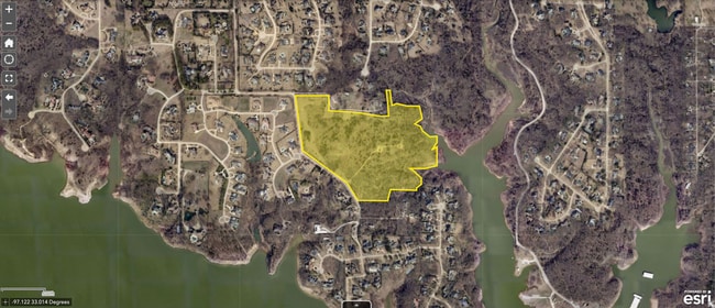
Property Detail
High Meadow Rd
Dallas-Fort Worth-Arlington, TX
A1064A J.M. RUIZ, TR 22, 40.0 ACRES
R17773
DENTON
Vacantlandnec
Texas
A Areas with a 1% annual chance of flooding and a 26% chance of flooding over the life of a 30-year mortgage.
40 AC
2024
Lewisville
2025
Dallas/Ft Worth
021750
NEARBY LISTINGS FOR SALE OR LEASE
-
-
View all Flower Mound listings for sale on LoopNet.com
DEMOGRAPHICS near High Meadow Rd
1 mile
3 mile
5 mile
2025 Total Population
2,044
38,254
139,086
2030 Population
2,298
42,166
152,949
Pop Growth 2025-2030
+ 12.43%
+ 10.23%
+ 9.97%
Average Age
42
41
41
2025 Total Households
627
12,554
49,026
HH Growth 2025-2030
+ 12.60%
+ 10.38%
+ 10.11%
Median Household Inc
$232,800
$192,127
$158,185
Avg Household Size
3.20
3.00
2.80
2025 Avg HH Vehicles
3.00
2.00
2.00
Median Home Value
$907,499
$727,557
$650,412
Median Year Built
2002
1997
1996
Nearby Places
Map Layers
Map Styles
 Street
 Aerial
Layers
 Traffic
 Biking
Places
Listings with unknown addresses are not visible on the map
- Restaurants
- Banks
- Shops
- Fitness
- Groceries
PUBLIC TRANSPORTATION
AIRPORT
Dallas-Fort Worth International
Drive
Walk
Distance
Dallas-Fort Worth International
26 min
13.8 mi
Dallas Love Field
Drive
Walk
Distance
Dallas Love Field
45 min
27.3 mi
Freight Ports
Port of Shreveport
Drive
Walk
Distance
Port of Shreveport
251 min
225.5 mi
SALE & LEASE HISTORY
LISTING DATE
SALE/LEASE

Jul 07, 2022
For Sale
Nearby Properties
Address
Land Use
TOTAL SIZE
Lot Size
Zoning
Address
Land Use
TOTAL SIZE
Lot Size
Zoning
428,117 SF
67.02 AC
Address
Land Use
TOTAL SIZE
Lot Size
Zoning
531,979 SF
4.54 AC
Address
Land Use
TOTAL SIZE
Lot Size
Zoning
Address
Land Use
TOTAL SIZE
Lot Size
Zoning
81,169 SF
2.23 AC
Address
Land Use
TOTAL SIZE
Lot Size
Zoning
186,089 SF
29.56 AC
Address
Land Use
TOTAL SIZE
Lot Size
Zoning
46,808 SF
39.37 AC
Address
Land Use
TOTAL SIZE
Lot Size
Zoning
33,940 SF
4.42 AC
Address
Land Use
TOTAL SIZE
Lot Size
Zoning
Address
Land Use
TOTAL SIZE
Lot Size
Zoning
79.30 AC
Address
Land Use
TOTAL SIZE
Lot Size
Zoning
85,795 SF
10 AC
Address
Land Use
TOTAL SIZE
Lot Size
Zoning
82,226 SF
11.80 AC
Address
Land Use
TOTAL SIZE
Lot Size
Zoning
88,289 SF
10.02 AC
Address
Land Use
TOTAL SIZE
Lot Size
Zoning
57,379 SF
9.91 AC
Address
Land Use
TOTAL SIZE
Lot Size
Zoning
48,976 SF
19.16 AC
Address
Land Use
TOTAL SIZE
Lot Size
Zoning
111.40 AC
Address
Land Use
TOTAL SIZE
Lot Size
Zoning
29,681 SF
5.24 AC
Address
Land Use
TOTAL SIZE
Lot Size
Zoning
43,508 SF
21.78 AC
Address
Land Use
TOTAL SIZE
Lot Size
Zoning
21,042 SF
10.40 AC
Address
Land Use
TOTAL SIZE
Lot Size
Zoning
73,483 SF
4.87 AC
Address
Land Use
TOTAL SIZE
Lot Size
Zoning
107,516 SF
13.77 AC
Address
Land Use
TOTAL SIZE
Lot Size
Zoning
Address
Land Use
TOTAL SIZE
Lot Size
Zoning
43,301 SF
13.95 AC
Address
Land Use
TOTAL SIZE
Lot Size
Zoning
82,647 SF
12.69 AC
Address
Land Use
TOTAL SIZE
Lot Size
Zoning
96.83 AC
Address
Land Use
TOTAL SIZE
Lot Size
Zoning
40,449 SF
4.34 AC
Address
Land Use
TOTAL SIZE
Lot Size
Zoning
Address
Land Use
TOTAL SIZE
Lot Size
Zoning
62,488 SF
17.30 AC
Address
Land Use
TOTAL SIZE
Lot Size
Zoning
60,082 SF
8.26 AC
Address
Land Use
TOTAL SIZE
Lot Size
Zoning
The World's #1 Commercial Real Estate Marketplace
Connect with us
© 2026 CoStar Group
The information above has been obtained from sources believed reliable. While we do not doubt its accuracy we have not verified it and make no guarantee, warranty or representation about it. It is your responsibility to independently confirm its accuracy and completeness. Any projections, opinions, assumptions, or estimates used are for example only and do not represent the current or future performance of the property. The value of this transaction to you depends on tax and other factors which should be evaluated by your tax, financial, and legal advisors. You and your advisors should conduct a careful, independent investigation of the property to determine to your satisfaction the suitability of the property for your needs.