Property Record
High St, Wadsworth, OH 44281


Save to a Folder
{{folder.Name}}
{{folder.ListingIds.length}} Properties
{{folder.ListingIds.length}} Property
Create a New Folder
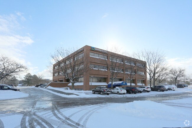
Property Detail
High St
Cleveland-Elyria, OH
PORTION CITY LOT5098
040-20B-05-041
MEDINA
Residentialacreage
Ohio
B and X Area of moderate flood hazard, usually the area between the limits of the 100-year and 500-year floods.
0.08 AC
0
Medina County
2025
Cleveland
417001
NEARBY LISTINGS FOR SALE OR LEASE
-
-
View all Wadsworth listings for lease on LoopNet.com
DEMOGRAPHICS near High St
1 mile
3 mile
5 mile
2025 Total Population
6,599
28,308
44,708
2030 Population
6,645
28,566
45,085
Pop Growth 2025-2030
+ 0.70%
+ 0.91%
+ 0.84%
Average Age
45
41
42
2025 Total Households
2,917
11,432
17,685
HH Growth 2025-2030
+ 0.75%
+ 0.88%
+ 0.82%
Median Household Inc
$74,308
$79,339
$84,518
Avg Household Size
2.20
2.40
2.50
2025 Avg HH Vehicles
2.00
2.00
2.00
Median Home Value
$278,296
$262,533
$266,150
Median Year Built
1980
1976
1975
Nearby Places
Map Layers
Map Styles
 Street
 Aerial
Layers
 Traffic
 Biking
Places
Listings with unknown addresses are not visible on the map
- Restaurants
- Banks
- Shops
- Fitness
- Groceries
PUBLIC TRANSPORTATION
AIRPORT
Akron-Canton Regional
Drive
Walk
Distance
Akron-Canton Regional
29 min
22.0 mi
Cleveland-Hopkins International
Drive
Walk
Distance
Cleveland-Hopkins International
45 min
31.8 mi
Freight Ports
Port of Toledo
Drive
Walk
Distance
Port of Toledo
158 min
127.8 mi
SALE & LEASE HISTORY
LISTING DATE
SALE/LEASE

Jan 15, 2019
For Lease
Nearby Properties
Address
Land Use
TOTAL SIZE
Lot Size
Zoning
Address
Land Use
TOTAL SIZE
Lot Size
Zoning
73,550 SF
100.93 AC
Address
Land Use
TOTAL SIZE
Lot Size
Zoning
3,832 SF
56.46 AC
Address
Land Use
TOTAL SIZE
Lot Size
Zoning
4,697 SF
32.26 AC
Address
Land Use
TOTAL SIZE
Lot Size
Zoning
16,281 SF
14.02 AC
Address
Land Use
TOTAL SIZE
Lot Size
Zoning
23,904 SF
4.36 AC
Address
Land Use
TOTAL SIZE
Lot Size
Zoning
54,910 SF
7.46 AC
Address
Land Use
TOTAL SIZE
Lot Size
Zoning
207,631 SF
17.18 AC
Address
Land Use
TOTAL SIZE
Lot Size
Zoning
5,306 SF
14.84 AC
Address
Land Use
TOTAL SIZE
Lot Size
Zoning
54,899 SF
11.04 AC
Address
Land Use
TOTAL SIZE
Lot Size
Zoning
29,256 SF
25.13 AC
Address
Land Use
TOTAL SIZE
Lot Size
Zoning
80,761 SF
57.17 AC
Address
Land Use
TOTAL SIZE
Lot Size
Zoning
138,251 SF
15.17 AC
Address
Land Use
TOTAL SIZE
Lot Size
Zoning
5,335 SF
8.59 AC
Address
Land Use
TOTAL SIZE
Lot Size
Zoning
51,320 SF
16.33 AC
Address
Land Use
TOTAL SIZE
Lot Size
Zoning
10,472 SF
13.10 AC
Address
Land Use
TOTAL SIZE
Lot Size
Zoning
51,022 SF
10.70 AC
Address
Land Use
TOTAL SIZE
Lot Size
Zoning
11,271 SF
9.07 AC
Address
Land Use
TOTAL SIZE
Lot Size
Zoning
102,088 SF
10.88 AC
Address
Land Use
TOTAL SIZE
Lot Size
Zoning
1,704 SF
5.37 AC
Address
Land Use
TOTAL SIZE
Lot Size
Zoning
15,486 SF
4.25 AC
Address
Land Use
TOTAL SIZE
Lot Size
Zoning
91,962 SF
15.90 AC
Address
Land Use
TOTAL SIZE
Lot Size
Zoning
26,804 SF
13.64 AC
Address
Land Use
TOTAL SIZE
Lot Size
Zoning
121,395 SF
10.63 AC
Address
Land Use
TOTAL SIZE
Lot Size
Zoning
20,252 SF
3.14 AC
Address
Land Use
TOTAL SIZE
Lot Size
Zoning
15,439 SF
3.27 AC
Address
Land Use
TOTAL SIZE
Lot Size
Zoning
31,042 SF
0.24 AC
Address
Land Use
TOTAL SIZE
Lot Size
Zoning
79,795 SF
2.13 AC
Address
Land Use
TOTAL SIZE
Lot Size
Zoning
15,358 SF
4.81 AC
Address
Land Use
TOTAL SIZE
Lot Size
Zoning
5,114 SF
3.53 AC
Address
Land Use
TOTAL SIZE
Lot Size
Zoning
89,373 SF
4.13 AC
The World's #1 Commercial Real Estate Marketplace
Connect with us
© 2026 CoStar Group
The information above has been obtained from sources believed reliable. While we do not doubt its accuracy we have not verified it and make no guarantee, warranty or representation about it. It is your responsibility to independently confirm its accuracy and completeness. Any projections, opinions, assumptions, or estimates used are for example only and do not represent the current or future performance of the property. The value of this transaction to you depends on tax and other factors which should be evaluated by your tax, financial, and legal advisors. You and your advisors should conduct a careful, independent investigation of the property to determine to your satisfaction the suitability of the property for your needs.