Property Record
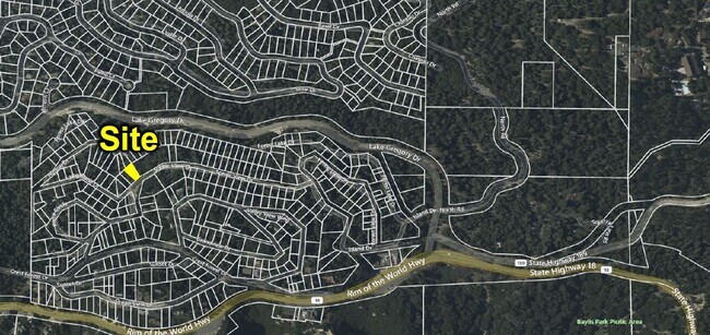
Highland Dr, Crestline, CA 92325

Property Detail
Highland Dr
Riverside-San Bernardino-Ontario, CA
TRACT 2333 LOT 78 BLOCK 2 TR NO 2333 ARROWHEAD HIGHLANDS LOT 78 BLK 2
0340-223-02
SAN BERNARDINO
Vacantlandnec
California
CFRS14M
78
D Areas with possible but undetermined flood hazards.
0.12 AC
2025
San Bernardino
2025
Inland Empire (California)
010804
NEARBY LISTINGS FOR SALE OR LEASE
DEMOGRAPHICS near Highland Dr
1 mile
3 mile
5 mile
2025 Total Population
2,021
10,320
39,672
2030 Population
1,862
9,613
38,806
Pop Growth 2025-2030
(7.87%)
(6.85%)
(2.18%)
Average Age
44
43
39
2025 Total Households
834
4,255
13,818
HH Growth 2025-2030
(7.91%)
(7.05%)
(2.69%)
Median Household Inc
$83,593
$84,457
$89,020
Avg Household Size
2.30
2.30
2.70
2025 Avg HH Vehicles
2.00
2.00
2.00
Median Home Value
$407,006
$453,421
$496,831
Median Year Built
1969
1967
1969
Nearby Places
Map Layers
Map Styles
 Street
 Aerial
Layers
 Traffic
 Biking
Places
Listings with unknown addresses are not visible on the map
- Restaurants
- Banks
- Shops
- Fitness
- Groceries
PUBLIC TRANSPORTATION
AIRPORT
Ontario International
Drive
Walk
Distance
Ontario International
54 min
37.6 mi
SALE & LEASE HISTORY
LISTING DATE
SALE/LEASE

Apr 21, 2021
For Sale
Nearby Properties
Address
Land Use
TOTAL SIZE
Lot Size
Zoning
Address
Land Use
TOTAL SIZE
Lot Size
Zoning
73,307 SF
32.90 AC
CFSDRES
Address
Land Use
TOTAL SIZE
Lot Size
Zoning
25.95 AC
CFSDRES
Address
Land Use
TOTAL SIZE
Lot Size
Zoning
79,205 SF
17.72 AC
Address
Land Use
TOTAL SIZE
Lot Size
Zoning
78,044 SF
3.18 AC
LACS
Address
Land Use
TOTAL SIZE
Lot Size
Zoning
38,415 SF
33.85 AC
CFRS14M
Address
Land Use
TOTAL SIZE
Lot Size
Zoning
43,673 SF
2.63 AC
Address
Land Use
TOTAL SIZE
Lot Size
Zoning
32,675 SF
91.96 AC
LARC
Address
Land Use
TOTAL SIZE
Lot Size
Zoning
13,816 SF
28.10 AC
Address
Land Use
TOTAL SIZE
Lot Size
Zoning
32,648 SF
1.44 AC
LACGSCP
Address
Land Use
TOTAL SIZE
Lot Size
Zoning
Address
Land Use
TOTAL SIZE
Lot Size
Zoning
172.99 AC
Address
Land Use
TOTAL SIZE
Lot Size
Zoning
46,398 SF
1.88 AC
CFCGSCP
Address
Land Use
TOTAL SIZE
Lot Size
Zoning
Address
Land Use
TOTAL SIZE
Lot Size
Zoning
22,887 SF
19.30 AC
LARS14M
Address
Land Use
TOTAL SIZE
Lot Size
Zoning
3,570 SF
0.86 AC
LACS
Address
Land Use
TOTAL SIZE
Lot Size
Zoning
15,462 SF
0.52 AC
LACGSCP
Address
Land Use
TOTAL SIZE
Lot Size
Zoning
Address
Land Use
TOTAL SIZE
Lot Size
Zoning
9,523 SF
0.67 AC
C
Address
Land Use
TOTAL SIZE
Lot Size
Zoning
2,784 SF
0.70 AC
LACN
Address
Land Use
TOTAL SIZE
Lot Size
Zoning
1,922 SF
0.53 AC
CFCGSCP
Address
Land Use
TOTAL SIZE
Lot Size
Zoning
12,368 SF
1.42 AC
LARS14M
Address
Land Use
TOTAL SIZE
Lot Size
Zoning
39,816 SF
1.36 AC
CFCS
Address
Land Use
TOTAL SIZE
Lot Size
Zoning
11,905 SF
3.33 AC
LARS14M
Address
Land Use
TOTAL SIZE
Lot Size
Zoning
10.79 AC
CFRL5
Address
Land Use
TOTAL SIZE
Lot Size
Zoning
35.61 AC
LARS14M
Address
Land Use
TOTAL SIZE
Lot Size
Zoning
6,769 SF
0.64 AC
LACS
Address
Land Use
TOTAL SIZE
Lot Size
Zoning
7,039 SF
0.62 AC
LACGSCP
Address
Land Use
TOTAL SIZE
Lot Size
Zoning
10,641 SF
0.22 AC
LACGSCP
Address
Land Use
TOTAL SIZE
Lot Size
Zoning
2,916 SF
3.27 AC
LARS14M
Address
Land Use
TOTAL SIZE
Lot Size
Zoning
8,196 SF
0.72 AC
CFCGSCP
The World's #1 Commercial Real Estate Marketplace
Connect with us
© 2026 CoStar Group
The information above has been obtained from sources believed reliable. While we do not doubt its accuracy we have not verified it and make no guarantee, warranty or representation about it. It is your responsibility to independently confirm its accuracy and completeness. Any projections, opinions, assumptions, or estimates used are for example only and do not represent the current or future performance of the property. The value of this transaction to you depends on tax and other factors which should be evaluated by your tax, financial, and legal advisors. You and your advisors should conduct a careful, independent investigation of the property to determine to your satisfaction the suitability of the property for your needs.