Property Record
Highview, Dearborn Heights, MI 48127


Save to a Folder
{{folder.Name}}
{{folder.ListingIds.length}} Properties
{{folder.ListingIds.length}} Property
Create a New Folder
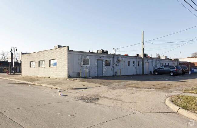
Property Detail
Highview
Detroit-Warren-Dearborn, MI
05E780 LOT 780 DEARBORN WARREN SUB NO. 1 T2S R10E L52 P73 WCR
33-005-01-0780-000
WAYNE
Commercialacreage
Michigan
C-1
780
B and X Area of moderate flood hazard, usually the area between the limits of the 100-year and 500-year floods.
0.12 AC
2025
Dearborn
2025
Detroit
572100
NEARBY LISTINGS FOR SALE OR LEASE
DEMOGRAPHICS near Highview
1 mile
3 mile
5 mile
2025 Total Population
15,706
125,387
320,221
2030 Population
15,348
123,032
316,041
Pop Growth 2025-2030
(2.28%)
(1.88%)
(1.31%)
Average Age
39
39
39
2025 Total Households
5,560
46,818
123,636
HH Growth 2025-2030
(2.30%)
(1.93%)
(1.37%)
Median Household Inc
$70,136
$66,473
$60,504
Avg Household Size
2.80
2.60
2.50
2025 Avg HH Vehicles
2.00
2.00
2.00
Median Home Value
$224,064
$188,722
$171,393
Median Year Built
1958
1955
1955
Nearby Places
Map Layers
Map Styles
 Street
 Aerial
Layers
 Traffic
 Biking
Places
Listings with unknown addresses are not visible on the map
- Restaurants
- Banks
- Shops
- Fitness
- Groceries
PUBLIC TRANSPORTATION
COMMUTER RAIL
Dearborn (Wolverine - Amtrak)
Drive
Walk
Distance
Dearborn (Wolverine - Amtrak)
12 min
5.7 mi
AIRPORT
Detroit Metro Wayne County
Drive
Walk
Distance
Detroit Metro Wayne County
26 min
14.0 mi
Windsor International
Drive
Walk
Distance
Windsor International
45 min
27.8 mi
Freight Ports
Port of Toledo
Drive
Walk
Distance
Port of Toledo
78 min
57.3 mi
Nearby Properties
Address
Land Use
TOTAL SIZE
Lot Size
Zoning
Address
Land Use
TOTAL SIZE
Lot Size
Zoning
335,133 SF
22.08 AC
Address
Land Use
TOTAL SIZE
Lot Size
Zoning
1,156,275 SF
75.88 AC
M-2
Address
Land Use
TOTAL SIZE
Lot Size
Zoning
85.45 AC
Address
Land Use
TOTAL SIZE
Lot Size
Zoning
399,770 SF
34.90 AC
M-2
Address
Land Use
TOTAL SIZE
Lot Size
Zoning
463,642 SF
22.82 AC
Address
Land Use
TOTAL SIZE
Lot Size
Zoning
835,383 SF
36.85 AC
Address
Land Use
TOTAL SIZE
Lot Size
Zoning
158,354 SF
43.70 AC
M4
Address
Land Use
TOTAL SIZE
Lot Size
Zoning
286,524 SF
16.58 AC
Address
Land Use
TOTAL SIZE
Lot Size
Zoning
179,412 SF
2.17 AC
Address
Land Use
TOTAL SIZE
Lot Size
Zoning
149,735 SF
6.64 AC
Address
Land Use
TOTAL SIZE
Lot Size
Zoning
141,206 SF
14.01 AC
M-1
Address
Land Use
TOTAL SIZE
Lot Size
Zoning
152,424 SF
5.02 AC
Address
Land Use
TOTAL SIZE
Lot Size
Zoning
127,017 SF
6.91 AC
Address
Land Use
TOTAL SIZE
Lot Size
Zoning
94,353 SF
8.70 AC
BC
Address
Land Use
TOTAL SIZE
Lot Size
Zoning
176,883 SF
10.83 AC
Address
Land Use
TOTAL SIZE
Lot Size
Zoning
171,414 SF
23.57 AC
Address
Land Use
TOTAL SIZE
Lot Size
Zoning
97,114 SF
2.10 AC
R1
Address
Land Use
TOTAL SIZE
Lot Size
Zoning
207,088 SF
14.25 AC
R-1
Address
Land Use
TOTAL SIZE
Lot Size
Zoning
42,928 SF
4.88 AC
Address
Land Use
TOTAL SIZE
Lot Size
Zoning
111,699 SF
10.08 AC
Address
Land Use
TOTAL SIZE
Lot Size
Zoning
97,376 SF
7.69 AC
Address
Land Use
TOTAL SIZE
Lot Size
Zoning
99,831 SF
8.54 AC
Address
Land Use
TOTAL SIZE
Lot Size
Zoning
59,199 SF
7.44 AC
RMA
Address
Land Use
TOTAL SIZE
Lot Size
Zoning
78,499 SF
4.47 AC
FP
Address
Land Use
TOTAL SIZE
Lot Size
Zoning
111,720 SF
R-1
Address
Land Use
TOTAL SIZE
Lot Size
Zoning
81,197 SF
7.16 AC
RM
Address
Land Use
TOTAL SIZE
Lot Size
Zoning
102,720 SF
5.49 AC
Address
Land Use
TOTAL SIZE
Lot Size
Zoning
79,248 SF
4.67 AC
Address
Land Use
TOTAL SIZE
Lot Size
Zoning
74,770 SF
3.99 AC
Address
Land Use
TOTAL SIZE
Lot Size
Zoning
60,110 SF
5.79 AC
RMA
The World's #1 Commercial Real Estate Marketplace
Connect with us
© 2026 CoStar Group
The information above has been obtained from sources believed reliable. While we do not doubt its accuracy we have not verified it and make no guarantee, warranty or representation about it. It is your responsibility to independently confirm its accuracy and completeness. Any projections, opinions, assumptions, or estimates used are for example only and do not represent the current or future performance of the property. The value of this transaction to you depends on tax and other factors which should be evaluated by your tax, financial, and legal advisors. You and your advisors should conduct a careful, independent investigation of the property to determine to your satisfaction the suitability of the property for your needs.