Property Record
Highway 11, , GA

Property Detail
Highway 11
C140000000090J00
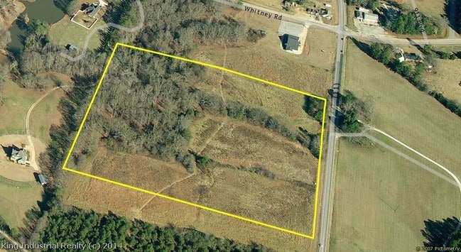
20.12AC
Commercialacreage
WALTON
B3 WP2
Georgia
B and X Area of moderate flood hazard, usually the area between the limits of the 100-year and 500-year floods.
20.12 AC
2025
Walton County
2025
Atlanta
110801
Atlanta-Sandy Springs-Roswell, GA
NEARBY LISTINGS FOR SALE OR LEASE
DEMOGRAPHICS near Highway 11
1 mile
3 mile
5 mile
2025 Total Population
557
2,887
16,752
2030 Population
633
3,272
18,891
Pop Growth 2025-2030
+ 13.64%
+ 13.34%
+ 12.77%
Average Age
42
42
41
2025 Total Households
192
1,021
6,015
HH Growth 2025-2030
+ 13.54%
+ 13.42%
+ 12.87%
Median Household Inc
$104,101
$86,910
$72,043
Avg Household Size
2.80
2.70
2.70
2025 Avg HH Vehicles
3.00
2.00
2.00
Median Home Value
$275,362
$286,606
$315,563
Median Year Built
1996
1997
1996
Nearby Places
Map Layers
Map Styles
 Street
 Aerial
Layers
 Traffic
 Biking
Places
Listings with unknown addresses are not visible on the map
- Restaurants
- Banks
- Shops
- Fitness
- Groceries
SALE & LEASE HISTORY
LISTING DATE
SALE/LEASE

Sep 24, 2016
For Sale
Nearby Properties
Address
Land Use
TOTAL SIZE
Lot Size
Zoning
Address
Land Use
TOTAL SIZE
Lot Size
Zoning
800 SF
35.79 AC
LI WP2
Address
Land Use
TOTAL SIZE
Lot Size
Zoning
Address
Land Use
TOTAL SIZE
Lot Size
Zoning
103,180 SF
22.86 AC
LI WP2
Address
Land Use
TOTAL SIZE
Lot Size
Zoning
428.84 AC
A1 CITY
Address
Land Use
TOTAL SIZE
Lot Size
Zoning
81,250 SF
17 AC
LI WP2
Address
Land Use
TOTAL SIZE
Lot Size
Zoning
33,012 SF
9.89 AC
GC
Address
Land Use
TOTAL SIZE
Lot Size
Zoning
216.02 AC
A WP2
Address
Land Use
TOTAL SIZE
Lot Size
Zoning
205.47 AC
A1 WP2
Address
Land Use
TOTAL SIZE
Lot Size
Zoning
205 AC
A1
Address
Land Use
TOTAL SIZE
Lot Size
Zoning
16,247 SF
1.57 AC
GC
Address
Land Use
TOTAL SIZE
Lot Size
Zoning
127.62 AC
A1
Address
Land Use
TOTAL SIZE
Lot Size
Zoning
152.95 AC
A1
Address
Land Use
TOTAL SIZE
Lot Size
Zoning
1,592 SF
92.39 AC
A1
Address
Land Use
TOTAL SIZE
Lot Size
Zoning
12,650 SF
1.54 AC
GC
Address
Land Use
TOTAL SIZE
Lot Size
Zoning
146.80 AC
A1 WP2
Address
Land Use
TOTAL SIZE
Lot Size
Zoning
146.46 AC
A1
Address
Land Use
TOTAL SIZE
Lot Size
Zoning
15,462 SF
2.73 AC
A1 WP2
Address
Land Use
TOTAL SIZE
Lot Size
Zoning
8,984 SF
6.16 AC
A1 WP2
Address
Land Use
TOTAL SIZE
Lot Size
Zoning
7,203 SF
1.38 AC
GC
Address
Land Use
TOTAL SIZE
Lot Size
Zoning
94.90 AC
LI WP2
Address
Land Use
TOTAL SIZE
Lot Size
Zoning
15,982 SF
2.35 AC
GC
Address
Land Use
TOTAL SIZE
Lot Size
Zoning
120.13 AC
A1 WP2
Address
Land Use
TOTAL SIZE
Lot Size
Zoning
1,242 SF
82.51 AC
A1
Address
Land Use
TOTAL SIZE
Lot Size
Zoning
11,362 SF
1.99 AC
GC
Address
Land Use
TOTAL SIZE
Lot Size
Zoning
4,672 SF
6.49 AC
A1 WP2
Address
Land Use
TOTAL SIZE
Lot Size
Zoning
2,899 SF
26.86 AC
A1 WP2
Address
Land Use
TOTAL SIZE
Lot Size
Zoning
137.72 AC
A1
Address
Land Use
TOTAL SIZE
Lot Size
Zoning
4,259 SF
1.26 AC
GC
Address
Land Use
TOTAL SIZE
Lot Size
Zoning
100 AC
LI WP2
Address
Land Use
TOTAL SIZE
Lot Size
Zoning
3,934 SF
1.07 AC
GC
The World's #1 Commercial Real Estate Marketplace
Connect with us
© 2026 CoStar Group
The information above has been obtained from sources believed reliable. While we do not doubt its accuracy we have not verified it and make no guarantee, warranty or representation about it. It is your responsibility to independently confirm its accuracy and completeness. Any projections, opinions, assumptions, or estimates used are for example only and do not represent the current or future performance of the property. The value of this transaction to you depends on tax and other factors which should be evaluated by your tax, financial, and legal advisors. You and your advisors should conduct a careful, independent investigation of the property to determine to your satisfaction the suitability of the property for your needs.