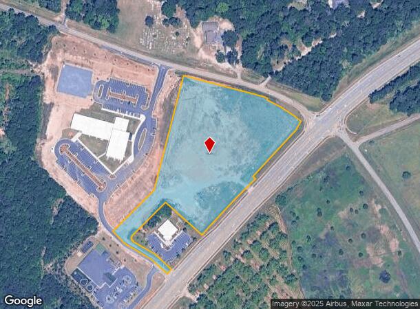
Property Record
Highway 127, Perry, GA 31069

NEARBY LISTINGS FOR SALE OR LEASE
Property Detail
Highway 127
Warner Robins, GA
Hwy 127 25
0P0610008000
TRACT B 7.65 ACRES LL 140&149 10TH LD
Commercialacreage
Houston
X
Georgia
13153C0160E
7.65 AC
2024
Perry/Warner Robins
2024
Other Market Areas
021206
DEMOGRAPHICS near Highway 127
1 Mile
3 Mile
5 Mile
2024 Total Population
1,510
22,338
53,745
2029 Population
1,674
24,697
59,256
Pop Growth 2024-2029
+ 10.86%
+ 10.56%
+ 10.25%
Average Age
37
37
37
2024 Total Households
551
7,892
19,361
HH Growth 2024-2029
+ 10.53%
+ 10.34%
+ 10.01%
Median Household Inc
$87,196
$87,998
$86,261
Avg Household Size
2.70
2.80
2.70
2024 Avg HH Vehicles
2.00
2.00
2.00
Median Home Value
$208,192
$194,616
$195,320
Median Year Built
2004
2005
2001
Nearby Places
Map Layers
Map Styles
 Street
 Aerial
- Restaurants
- Banks
- Shops
- Fitness
- Groceries
SALE & LEASE HISTORY
LISTING DATE
SALE/LEASE

May 09, 2023
For Sale
May 09, 2023
For Sale
Jun 10, 2021
For Sale
Nearby Properties
Address
Land Use
TOTAL SIZE
Lot Size
Zoning
Address
Land Use
TOTAL SIZE
Lot Size
Zoning
147,496 SF
66.05 AC
GU
Address
Land Use
TOTAL SIZE
Lot Size
Zoning
27,696 SF
25.75 AC
C2
Address
Land Use
TOTAL SIZE
Lot Size
Zoning
158,300 SF
43.81 AC
GU
Address
Land Use
TOTAL SIZE
Lot Size
Zoning
158,300 SF
30 AC
GU
Address
Land Use
TOTAL SIZE
Lot Size
Zoning
78,010 SF
20 AC
C2
Address
Land Use
TOTAL SIZE
Lot Size
Zoning
6,382 SF
24.71 AC
RM-2
Address
Land Use
TOTAL SIZE
Lot Size
Zoning
5,736 SF
16.65 AC
RM-2
Address
Land Use
TOTAL SIZE
Lot Size
Zoning
91,249 SF
15.85 AC
GU
Address
Land Use
TOTAL SIZE
Lot Size
Zoning
70,500 SF
19.94 AC
GU
Address
Land Use
TOTAL SIZE
Lot Size
Zoning
106,055 SF
22.72 AC
GU
Address
Land Use
TOTAL SIZE
Lot Size
Zoning
46,200 SF
12.29 AC
C2
Address
Land Use
TOTAL SIZE
Lot Size
Zoning
19,810 SF
79.64 AC
GU
Address
Land Use
TOTAL SIZE
Lot Size
Zoning
31,248 SF
10.30 AC
RM-2
Address
Land Use
TOTAL SIZE
Lot Size
Zoning
12,000 SF
7.27 AC
RM-2
Address
Land Use
TOTAL SIZE
Lot Size
Zoning
30,050 SF
47.52 AC
GU
Address
Land Use
TOTAL SIZE
Lot Size
Zoning
38,066 SF
11.73 AC
GU
Address
Land Use
TOTAL SIZE
Lot Size
Zoning
25,600 SF
10 AC
GU
Address
Land Use
TOTAL SIZE
Lot Size
Zoning
5,160 SF
1.14 AC
C2
Address
Land Use
TOTAL SIZE
Lot Size
Zoning
30,451 SF
10.19 AC
C2
Address
Land Use
TOTAL SIZE
Lot Size
Zoning
14,500 SF
11.56 AC
C2
Address
Land Use
TOTAL SIZE
Lot Size
Zoning
25,485 SF
2.36 AC
C2
Address
Land Use
TOTAL SIZE
Lot Size
Zoning
309.40 AC
R1
Address
Land Use
TOTAL SIZE
Lot Size
Zoning
13,900 SF
10 AC
GU
Address
Land Use
TOTAL SIZE
Lot Size
Zoning
15,949 SF
11.13 AC
C2
Address
Land Use
TOTAL SIZE
Lot Size
Zoning
153.27 AC
RAG
Address
Land Use
TOTAL SIZE
Lot Size
Zoning
85.88 AC
R2A
Address
Land Use
TOTAL SIZE
Lot Size
Zoning
1,080 SF
80.82 AC
R3
Address
Land Use
TOTAL SIZE
Lot Size
Zoning
24,000 SF
7.35 AC
R3
Address
Land Use
TOTAL SIZE
Lot Size
Zoning
268.06 AC
RAG
Address
Land Use
TOTAL SIZE
Lot Size
Zoning
14,250 SF
4.84 AC
GU
The World's #1 Commercial Real Estate Marketplace
Connect with us
© 2026 CoStar Group
The information above has been obtained from sources believed reliable. While we do not doubt its accuracy we have not verified it and make no guarantee, warranty or representation about it. It is your responsibility to independently confirm its accuracy and completeness. Any projections, opinions, assumptions, or estimates used are for example only and do not represent the current or future performance of the property. The value of this transaction to you depends on tax and other factors which should be evaluated by your tax, financial, and legal advisors. You and your advisors should conduct a careful, independent investigation of the property to determine to your satisfaction the suitability of the property for your needs.