Property Record
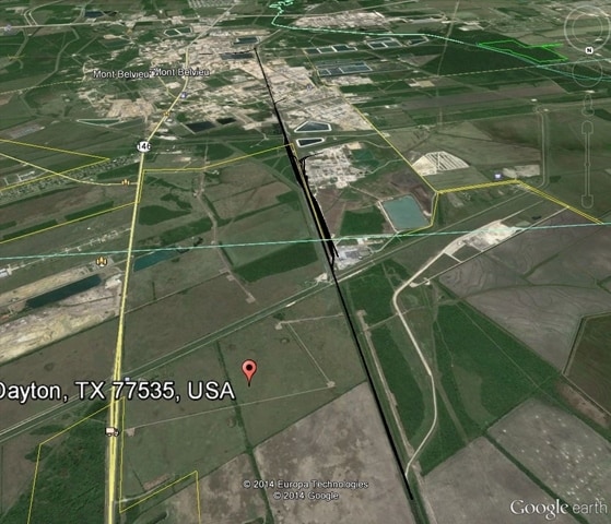
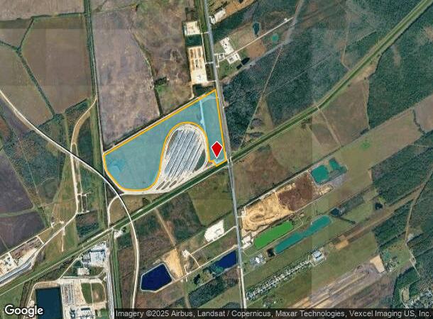
Highway 146, Dayton, TX 77535
NEARBY LISTINGS FOR SALE OR LEASE
Property Detail
Highway 146
Houston-The Woodlands-Sugar Land, TX
Interchange Industrial Park, Sec 1
005975-000001-000
INTERCHANGE INDUSTRIAL PARK, SEC 1, LOT RES A, ACRES 168.52, PARCEL 2 ABATED LAND
Commercialnec
Liberty
X
Texas
48291C0575D
168.52 AC
2024
Liberty County
2025
Houston
701000
DEMOGRAPHICS near Highway 146
1 Mile
3 Mile
5 Mile
2024 Total Population
10
2,092
12,030
2029 Population
13
2,613
15,387
Pop Growth 2024-2029
+ 30.00%
+ 24.90%
+ 27.91%
Average Age
32
39
37
2024 Total Households
3
703
3,992
HH Growth 2024-2029
+ 33.33%
+ 24.89%
+ 27.61%
Median Household Inc
$67,500
$109,166
$78,261
Avg Household Size
2.00
3.00
3.00
2024 Avg HH Vehicles
2.00
2.00
2.00
Median Home Value
$99,999
$296,681
$260,892
Median Year Built
2005
2000
2002
Nearby Places
Map Layers
Map Styles
 Street
 Aerial
- Restaurants
- Banks
- Shops
- Fitness
- Groceries
PUBLIC TRANSPORTATION
AIRPORT
William P Hobby
DRIVE
WALK
Distance
William P Hobby
58 min
39.9 mi
George Bush Intcntl/Houston
DRIVE
WALK
Distance
George Bush Intcntl/Houston
55 min
44.0 mi
Freight Ports
Port of Houston
DRIVE
WALK
Distance
Port of Houston
45 min
31.9 mi
Nearby Properties
Address
Land Use
TOTAL SIZE
Lot Size
Zoning
Address
Land Use
TOTAL SIZE
Lot Size
Zoning
5,700 SF
227.37 AC
Address
Land Use
TOTAL SIZE
Lot Size
Zoning
42.79 AC
Address
Land Use
TOTAL SIZE
Lot Size
Zoning
68.73 AC
Address
Land Use
TOTAL SIZE
Lot Size
Zoning
34.88 AC
Address
Land Use
TOTAL SIZE
Lot Size
Zoning
221.84 AC
Address
Land Use
TOTAL SIZE
Lot Size
Zoning
241.47 AC
Address
Land Use
TOTAL SIZE
Lot Size
Zoning
186.15 AC
Address
Land Use
TOTAL SIZE
Lot Size
Zoning
11,780 SF
15.03 AC
Address
Land Use
TOTAL SIZE
Lot Size
Zoning
231.59 AC
Address
Land Use
TOTAL SIZE
Lot Size
Zoning
1,729.32 AC
Address
Land Use
TOTAL SIZE
Lot Size
Zoning
4,200 SF
22.71 AC
Address
Land Use
TOTAL SIZE
Lot Size
Zoning
113.24 AC
Address
Land Use
TOTAL SIZE
Lot Size
Zoning
13,770 SF
8.20 AC
Address
Land Use
TOTAL SIZE
Lot Size
Zoning
5,919 SF
110.44 AC
Address
Land Use
TOTAL SIZE
Lot Size
Zoning
86.28 AC
Address
Land Use
TOTAL SIZE
Lot Size
Zoning
21,807 SF
20.01 AC
Address
Land Use
TOTAL SIZE
Lot Size
Zoning
125.28 AC
Address
Land Use
TOTAL SIZE
Lot Size
Zoning
75.74 AC
Address
Land Use
TOTAL SIZE
Lot Size
Zoning
16,820 SF
54.52 AC
Address
Land Use
TOTAL SIZE
Lot Size
Zoning
64.75 AC
Address
Land Use
TOTAL SIZE
Lot Size
Zoning
14,676 SF
38.01 AC
Address
Land Use
TOTAL SIZE
Lot Size
Zoning
14,548 SF
143.72 AC
Address
Land Use
TOTAL SIZE
Lot Size
Zoning
5,173 SF
2.21 AC
Address
Land Use
TOTAL SIZE
Lot Size
Zoning
9,875 SF
63.47 AC
Address
Land Use
TOTAL SIZE
Lot Size
Zoning
8,834 SF
1.91 AC
Address
Land Use
TOTAL SIZE
Lot Size
Zoning
18.36 AC
Address
Land Use
TOTAL SIZE
Lot Size
Zoning
134.57 AC
Address
Land Use
TOTAL SIZE
Lot Size
Zoning
19.99 AC
The World's #1 Commercial Real Estate Marketplace
Connect with us
© 2026 CoStar Group
The information above has been obtained from sources believed reliable. While we do not doubt its accuracy we have not verified it and make no guarantee, warranty or representation about it. It is your responsibility to independently confirm its accuracy and completeness. Any projections, opinions, assumptions, or estimates used are for example only and do not represent the current or future performance of the property. The value of this transaction to you depends on tax and other factors which should be evaluated by your tax, financial, and legal advisors. You and your advisors should conduct a careful, independent investigation of the property to determine to your satisfaction the suitability of the property for your needs.