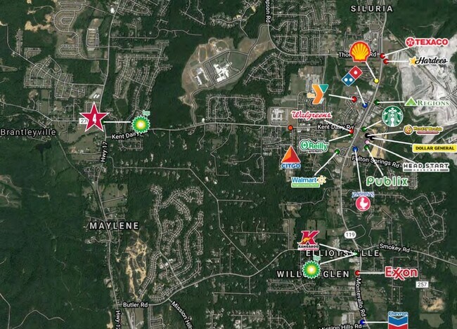
Property Record
9201 Highway 17, Alabaster, AL 35114

Property Detail
9201 Highway 17
Birmingham, AL
BEG AT SLY MOST COR LOT 12 CROSS CREEK SUB MB38 PG3 N311.38 E156.22 TO WLY ROW LN CO RD 17 SELY ALG ROW TO NLY ROW CO RD 270
23-2-09-0-001-024-000
SHELBY
Conveniencestore
Alabama
A Areas with a 1% annual chance of flooding and a 26% chance of flooding over the life of a 30-year mortgage.
12
2025
1.49 AC
2025
I-65 Corr/S Shelby County
030607
Birmingham
5,000 SF
NEARBY LISTINGS FOR SALE OR LEASE
DEMOGRAPHICS near 9201 Highway 17
1 mile
3 mile
5 mile
2025 Total Population
4,080
20,847
52,911
2030 Population
4,244
21,668
54,851
Pop Growth 2025-2030
+ 4.02%
+ 3.94%
+ 3.67%
Average Age
38
39
39
2025 Total Households
1,410
7,281
18,832
HH Growth 2025-2030
+ 4.04%
+ 3.96%
+ 3.70%
Median Household Inc
$80,677
$84,037
$87,273
Avg Household Size
2.90
2.80
2.80
2025 Avg HH Vehicles
2.00
2.00
2.00
Median Home Value
$279,571
$267,481
$263,713
Median Year Built
2001
1995
1995
Nearby Places
Map Layers
Map Styles
 Street
 Aerial
Layers
 Traffic
 Biking
Places
Listings with unknown addresses are not visible on the map
- Restaurants
- Banks
- Shops
- Fitness
- Groceries
PUBLIC TRANSPORTATION
AIRPORT
Birmingham-Shuttlesworth International
Drive
Walk
Distance
Birmingham-Shuttlesworth International
46 min
32.4 mi
SALE & LEASE HISTORY
LISTING DATE
SALE/LEASE

Oct 01, 2020
For Lease
Nearby Properties
Address
Land Use
TOTAL SIZE
Lot Size
Zoning
Address
Land Use
TOTAL SIZE
Lot Size
Zoning
350,630 SF
65.18 AC
Address
Land Use
TOTAL SIZE
Lot Size
Zoning
61,602 SF
145.23 AC
Address
Land Use
TOTAL SIZE
Lot Size
Zoning
226,790 SF
40 AC
Address
Land Use
TOTAL SIZE
Lot Size
Zoning
1,763 SF
21.99 AC
Address
Land Use
TOTAL SIZE
Lot Size
Zoning
161,753 SF
25 AC
Address
Land Use
TOTAL SIZE
Lot Size
Zoning
38,551 SF
17.81 AC
Address
Land Use
TOTAL SIZE
Lot Size
Zoning
120,043 SF
30 AC
Address
Land Use
TOTAL SIZE
Lot Size
Zoning
79,355 SF
3.10 AC
Address
Land Use
TOTAL SIZE
Lot Size
Zoning
77,365 SF
24.97 AC
Address
Land Use
TOTAL SIZE
Lot Size
Zoning
43,903 SF
10.21 AC
Address
Land Use
TOTAL SIZE
Lot Size
Zoning
11,668 SF
18.72 AC
Address
Land Use
TOTAL SIZE
Lot Size
Zoning
32,815 SF
6.09 AC
Address
Land Use
TOTAL SIZE
Lot Size
Zoning
42,097 SF
8.03 AC
Address
Land Use
TOTAL SIZE
Lot Size
Zoning
6,136 SF
18 AC
Address
Land Use
TOTAL SIZE
Lot Size
Zoning
21,160 SF
20.19 AC
Address
Land Use
TOTAL SIZE
Lot Size
Zoning
92.25 AC
Address
Land Use
TOTAL SIZE
Lot Size
Zoning
9,642 SF
11 AC
Address
Land Use
TOTAL SIZE
Lot Size
Zoning
47,835 SF
4.73 AC
Address
Land Use
TOTAL SIZE
Lot Size
Zoning
Address
Land Use
TOTAL SIZE
Lot Size
Zoning
Address
Land Use
TOTAL SIZE
Lot Size
Zoning
14,412 SF
2.19 AC
Address
Land Use
TOTAL SIZE
Lot Size
Zoning
900 SF
5.18 AC
Address
Land Use
TOTAL SIZE
Lot Size
Zoning
14,240 SF
3.50 AC
Address
Land Use
TOTAL SIZE
Lot Size
Zoning
800 SF
5.09 AC
Address
Land Use
TOTAL SIZE
Lot Size
Zoning
33,730 SF
43.12 AC
Address
Land Use
TOTAL SIZE
Lot Size
Zoning
7,320 SF
4.47 AC
Address
Land Use
TOTAL SIZE
Lot Size
Zoning
4,500 SF
41 AC
Address
Land Use
TOTAL SIZE
Lot Size
Zoning
15,000 SF
136 AC
Address
Land Use
TOTAL SIZE
Lot Size
Zoning
1.38 AC
Address
Land Use
TOTAL SIZE
Lot Size
Zoning
3,696 SF
5.61 AC
The World's #1 Commercial Real Estate Marketplace
Connect with us
© 2026 CoStar Group
The information above has been obtained from sources believed reliable. While we do not doubt its accuracy we have not verified it and make no guarantee, warranty or representation about it. It is your responsibility to independently confirm its accuracy and completeness. Any projections, opinions, assumptions, or estimates used are for example only and do not represent the current or future performance of the property. The value of this transaction to you depends on tax and other factors which should be evaluated by your tax, financial, and legal advisors. You and your advisors should conduct a careful, independent investigation of the property to determine to your satisfaction the suitability of the property for your needs.