Property Record
N Highway 17, Myrtle Beach, SC 29575


NEARBY LISTINGS FOR SALE OR LEASE
Property Detail
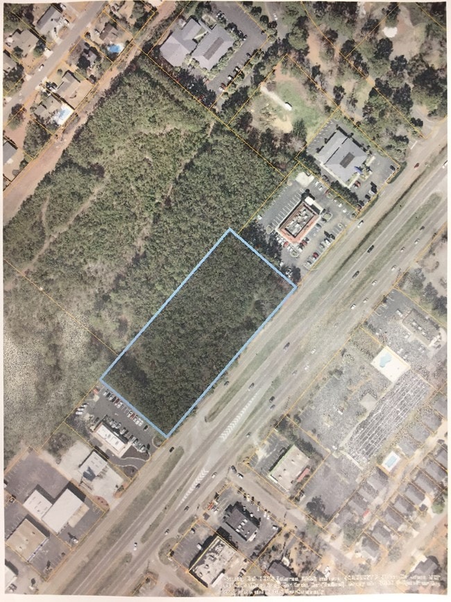
N Highway 17
Myrtle Beach-Conway-North Myrtle Beach, SC-NC
Deerfield Pltn
45915010046
N/W SIDE HWY 17 BUS
Commercialnec
Horry
X
South Carolina
45051C0801K
2.60 AC
2025
Outlying Horry County
2024
Myrtle Beach/Conway
051404
DEMOGRAPHICS near N Highway 17
1 Mile
3 Mile
5 Mile
2024 Total Population
9,376
35,634
86,441
2029 Population
11,717
44,169
105,504
Pop Growth 2024-2029
+ 24.97%
+ 23.95%
+ 22.05%
Average Age
50
51
49
2024 Total Households
4,488
16,814
39,159
HH Growth 2024-2029
+ 23.75%
+ 22.86%
+ 20.92%
Median Household Inc
$58,124
$60,136
$56,196
Avg Household Size
2.00
2.10
2.10
2024 Avg HH Vehicles
2.00
2.00
2.00
Median Home Value
$250,517
$245,840
$237,790
Median Year Built
1987
1991
1995
Nearby Places
Map Layers
Map Styles
 Street
 Aerial
- Restaurants
- Banks
- Shops
- Fitness
- Groceries
PUBLIC TRANSPORTATION
AIRPORT
Myrtle Beach International
DRIVE
WALK
Distance
Myrtle Beach International
13 min
6.4 mi
SALE & LEASE HISTORY
LISTING DATE
SALE/LEASE

Sep 24, 2016
For Sale
Oct 23, 2020
For Sale
May 26, 2017
For Sale
Jun 14, 2022
For Sale
Feb 19, 2021
For Lease
Feb 18, 2022
For Sale
Aug 29, 2017
For Sale
Aug 11, 2017
For Sale
Nearby Properties
Address
Land Use
TOTAL SIZE
Lot Size
Zoning
Address
Land Use
TOTAL SIZE
Lot Size
Zoning
17,640 SF
240.91 AC
Address
Land Use
TOTAL SIZE
Lot Size
Zoning
9,190 SF
85.15 AC
Address
Land Use
TOTAL SIZE
Lot Size
Zoning
9,772 SF
130.49 AC
Address
Land Use
TOTAL SIZE
Lot Size
Zoning
28,959 SF
31.56 AC
Address
Land Use
TOTAL SIZE
Lot Size
Zoning
496.81 AC
Address
Land Use
TOTAL SIZE
Lot Size
Zoning
8,540 SF
41.73 AC
Address
Land Use
TOTAL SIZE
Lot Size
Zoning
636.82 AC
Address
Land Use
TOTAL SIZE
Lot Size
Zoning
39,275 SF
14.37 AC
Address
Land Use
TOTAL SIZE
Lot Size
Zoning
194,035 SF
26.79 AC
Address
Land Use
TOTAL SIZE
Lot Size
Zoning
25,722 SF
13.73 AC
Address
Land Use
TOTAL SIZE
Lot Size
Zoning
92,277 SF
8.84 AC
Address
Land Use
TOTAL SIZE
Lot Size
Zoning
46.79 AC
Address
Land Use
TOTAL SIZE
Lot Size
Zoning
57,216 SF
2.36 AC
Address
Land Use
TOTAL SIZE
Lot Size
Zoning
132,091 SF
14.03 AC
Address
Land Use
TOTAL SIZE
Lot Size
Zoning
18,816 SF
10.17 AC
Address
Land Use
TOTAL SIZE
Lot Size
Zoning
33,862 SF
9.98 AC
Address
Land Use
TOTAL SIZE
Lot Size
Zoning
28,278 SF
50.53 AC
Address
Land Use
TOTAL SIZE
Lot Size
Zoning
42,768 SF
10.40 AC
Address
Land Use
TOTAL SIZE
Lot Size
Zoning
8,012 SF
7.40 AC
Address
Land Use
TOTAL SIZE
Lot Size
Zoning
74,389 SF
1.90 AC
Address
Land Use
TOTAL SIZE
Lot Size
Zoning
44.71 AC
Address
Land Use
TOTAL SIZE
Lot Size
Zoning
49.53 AC
Address
Land Use
TOTAL SIZE
Lot Size
Zoning
6,728 SF
35.71 AC
Address
Land Use
TOTAL SIZE
Lot Size
Zoning
51,376 SF
8.02 AC
The World's #1 Commercial Real Estate Marketplace
Connect with us
© 2026 CoStar Group
The information above has been obtained from sources believed reliable. While we do not doubt its accuracy we have not verified it and make no guarantee, warranty or representation about it. It is your responsibility to independently confirm its accuracy and completeness. Any projections, opinions, assumptions, or estimates used are for example only and do not represent the current or future performance of the property. The value of this transaction to you depends on tax and other factors which should be evaluated by your tax, financial, and legal advisors. You and your advisors should conduct a careful, independent investigation of the property to determine to your satisfaction the suitability of the property for your needs.