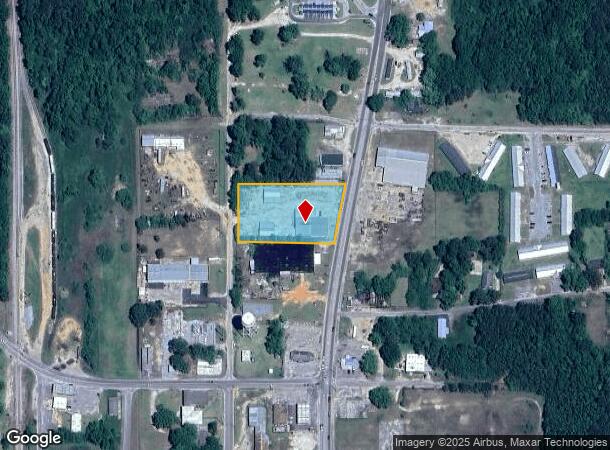
Property Record
Highway 21, Atmore, AL 36502

NEARBY LISTINGS FOR SALE OR LEASE
Property Detail
Highway 21
Atmore, AL
Thirteenth Subdivision
26-04-20-3-005-010.000
LOTS 8 & 21 S 33.06 OF LOTS 7 & 22 & N 66.94 OF LOTS 9 & 20 BLK 2 13TH SUB ATMORE (200 X 364 X 200 X 325 ) W S OF MAIN ST N OF HOWARD ST PB 3-4
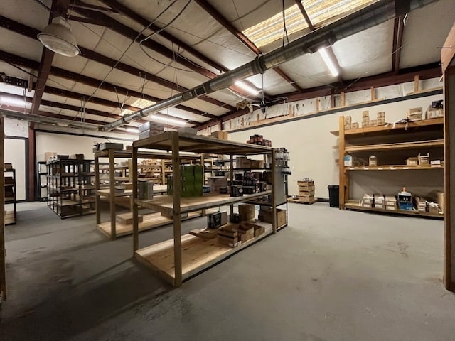
Storebuilding
Escambia
X
Alabama
01053C0415F
7&22
2025
1.58 AC
2024
Alabama South Area
970500
Other Market Areas
8,100 SF
DEMOGRAPHICS near Highway 21
1 Mile
3 Mile
5 Mile
2024 Total Population
3,683
9,088
11,671
2029 Population
3,665
9,032
11,645
Pop Growth 2024-2029
(0.49%)
(0.62%)
(0.22%)
Average Age
40
40
41
2024 Total Households
1,606
3,809
4,864
HH Growth 2024-2029
(0.62%)
(0.66%)
(0.25%)
Median Household Inc
$24,843
$38,378
$39,512
Avg Household Size
2.20
2.30
2.30
2024 Avg HH Vehicles
1.00
2.00
2.00
Median Home Value
$119,876
$133,993
$137,888
Median Year Built
1984
1984
1985
Nearby Places
Map Layers
Map Styles
 Street
 Aerial
- Restaurants
- Banks
- Shops
- Fitness
- Groceries
Nearby Properties
Address
Land Use
TOTAL SIZE
Lot Size
Zoning
Address
Land Use
TOTAL SIZE
Lot Size
Zoning
75,361 SF
55 AC
Address
Land Use
TOTAL SIZE
Lot Size
Zoning
86,400 SF
4 AC
Address
Land Use
TOTAL SIZE
Lot Size
Zoning
44,142 SF
15.75 AC
RMU
Address
Land Use
TOTAL SIZE
Lot Size
Zoning
157,440 SF
5 AC
Address
Land Use
TOTAL SIZE
Lot Size
Zoning
68,788 SF
14 AC
Address
Land Use
TOTAL SIZE
Lot Size
Zoning
13,652 SF
6 AC
Address
Land Use
TOTAL SIZE
Lot Size
Zoning
102,000 SF
15 AC
Address
Land Use
TOTAL SIZE
Lot Size
Zoning
13,555 SF
4.90 AC
RMU
Address
Land Use
TOTAL SIZE
Lot Size
Zoning
101,840 SF
5 AC
Address
Land Use
TOTAL SIZE
Lot Size
Zoning
63,750 SF
25 AC
Address
Land Use
TOTAL SIZE
Lot Size
Zoning
31,267 SF
6.17 AC
Address
Land Use
TOTAL SIZE
Lot Size
Zoning
12,696 SF
2.56 AC
Address
Land Use
TOTAL SIZE
Lot Size
Zoning
110,046 SF
4 AC
Address
Land Use
TOTAL SIZE
Lot Size
Zoning
11,086 SF
5 AC
AGR,RMU
Address
Land Use
TOTAL SIZE
Lot Size
Zoning
84,000 SF
2 AC
Address
Land Use
TOTAL SIZE
Lot Size
Zoning
40,256 SF
4 AC
Address
Land Use
TOTAL SIZE
Lot Size
Zoning
93,780 SF
10 AC
Address
Land Use
TOTAL SIZE
Lot Size
Zoning
3,513 SF
45 AC
Address
Land Use
TOTAL SIZE
Lot Size
Zoning
8,826 SF
7.61 AC
Address
Land Use
TOTAL SIZE
Lot Size
Zoning
17,230 SF
38 AC
Address
Land Use
TOTAL SIZE
Lot Size
Zoning
36,788 SF
15 AC
Address
Land Use
TOTAL SIZE
Lot Size
Zoning
22,260 SF
5 AC
Address
Land Use
TOTAL SIZE
Lot Size
Zoning
15,526 SF
11 AC
Address
Land Use
TOTAL SIZE
Lot Size
Zoning
27,378 SF
3.64 AC
Address
Land Use
TOTAL SIZE
Lot Size
Zoning
13,846 SF
0.52 AC
Address
Land Use
TOTAL SIZE
Lot Size
Zoning
85,443 SF
15 AC
Address
Land Use
TOTAL SIZE
Lot Size
Zoning
91,868 SF
8.43 AC
Address
Land Use
TOTAL SIZE
Lot Size
Zoning
16,138 SF
2.01 AC
Address
Land Use
TOTAL SIZE
Lot Size
Zoning
22,400 SF
19 AC
Address
Land Use
TOTAL SIZE
Lot Size
Zoning
74,015 SF
9 AC
The World's #1 Commercial Real Estate Marketplace
Connect with us
© 2025 CoStar Group
The information above has been obtained from sources believed reliable. While we do not doubt its accuracy we have not verified it and make no guarantee, warranty or representation about it. It is your responsibility to independently confirm its accuracy and completeness. Any projections, opinions, assumptions, or estimates used are for example only and do not represent the current or future performance of the property. The value of this transaction to you depends on tax and other factors which should be evaluated by your tax, financial, and legal advisors. You and your advisors should conduct a careful, independent investigation of the property to determine to your satisfaction the suitability of the property for your needs.