Property Record
Highway 2147, Horseshoe Bay, TX 78657


Save to a Folder
{{folder.Name}}
{{folder.ListingIds.length}} Properties
{{folder.ListingIds.length}} Property
Create a New Folder
Property Detail
Highway 2147
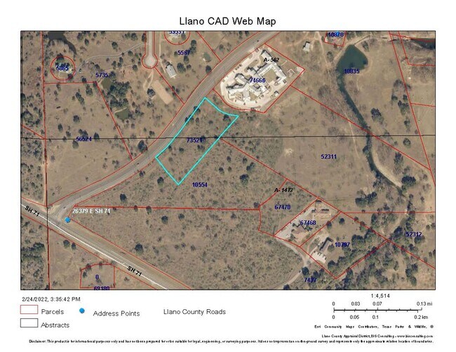
73521
E MERCER ABST #562 4.554 AC
Agriculturalland
LLANO
B and X Area of moderate flood hazard, usually the area between the limits of the 100-year and 500-year floods.
Texas
2025
4.55 AC
2025
Horseshoe Bay
970402
Other Market Areas
NEARBY LISTINGS FOR SALE OR LEASE
DEMOGRAPHICS near Highway 2147
1 mile
3 mile
5 mile
2025 Total Population
497
4,413
11,621
2030 Population
542
4,803
12,889
Pop Growth 2025-2030
+ 9.05%
+ 8.84%
+ 10.91%
Average Age
62
61
51
2025 Total Households
251
2,256
5,200
HH Growth 2025-2030
+ 8.76%
+ 8.69%
+ 10.67%
Median Household Inc
$115,064
$109,332
$86,342
Avg Household Size
2.00
2.00
2.20
2025 Avg HH Vehicles
2.00
2.00
2.00
Median Home Value
$725,543
$664,169
$486,528
Median Year Built
1997
1995
1995
Nearby Places
Map Layers
Map Styles
 Street
 Aerial
Layers
 Traffic
 Biking
Places
Listings with unknown addresses are not visible on the map
- Restaurants
- Banks
- Shops
- Fitness
- Groceries
SALE & LEASE HISTORY
LISTING DATE
SALE/LEASE

May 06, 2020
For Sale
Jan 03, 2023
For Sale
Nearby Properties
Address
Land Use
TOTAL SIZE
Lot Size
Zoning
Address
Land Use
TOTAL SIZE
Lot Size
Zoning
5,837 SF
1.46 AC
Address
Land Use
TOTAL SIZE
Lot Size
Zoning
Address
Land Use
TOTAL SIZE
Lot Size
Zoning
6,321 SF
0.44 AC
Address
Land Use
TOTAL SIZE
Lot Size
Zoning
Address
Land Use
TOTAL SIZE
Lot Size
Zoning
46,780 SF
5 AC
Address
Land Use
TOTAL SIZE
Lot Size
Zoning
324.63 AC
Address
Land Use
TOTAL SIZE
Lot Size
Zoning
4,305 SF
0.76 AC
Address
Land Use
TOTAL SIZE
Lot Size
Zoning
18,304 SF
170.06 AC
Address
Land Use
TOTAL SIZE
Lot Size
Zoning
Address
Land Use
TOTAL SIZE
Lot Size
Zoning
6,384 SF
0.28 AC
Address
Land Use
TOTAL SIZE
Lot Size
Zoning
152.88 AC
Address
Land Use
TOTAL SIZE
Lot Size
Zoning
Address
Land Use
TOTAL SIZE
Lot Size
Zoning
12,376 SF
4.51 AC
Address
Land Use
TOTAL SIZE
Lot Size
Zoning
113.96 AC
Address
Land Use
TOTAL SIZE
Lot Size
Zoning
5,198 SF
0.86 AC
Address
Land Use
TOTAL SIZE
Lot Size
Zoning
42,127 SF
4.21 AC
Address
Land Use
TOTAL SIZE
Lot Size
Zoning
14,178 SF
0.73 AC
Address
Land Use
TOTAL SIZE
Lot Size
Zoning
85,550 SF
9.16 AC
Address
Land Use
TOTAL SIZE
Lot Size
Zoning
4,210 SF
0.59 AC
Address
Land Use
TOTAL SIZE
Lot Size
Zoning
4,296 SF
0.28 AC
Address
Land Use
TOTAL SIZE
Lot Size
Zoning
4,111 SF
1.39 AC
Address
Land Use
TOTAL SIZE
Lot Size
Zoning
3,610 SF
143.65 AC
Address
Land Use
TOTAL SIZE
Lot Size
Zoning
49,220 SF
1.69 AC
Address
Land Use
TOTAL SIZE
Lot Size
Zoning
0.36 AC
Address
Land Use
TOTAL SIZE
Lot Size
Zoning
17,004 SF
2.11 AC
Address
Land Use
TOTAL SIZE
Lot Size
Zoning
4,981 SF
0.38 AC
Address
Land Use
TOTAL SIZE
Lot Size
Zoning
Address
Land Use
TOTAL SIZE
Lot Size
Zoning
17.85 AC
Address
Land Use
TOTAL SIZE
Lot Size
Zoning
8,436 SF
2.05 AC
Address
Land Use
TOTAL SIZE
Lot Size
Zoning
4,408 SF
1.23 AC
The World's #1 Commercial Real Estate Marketplace
Connect with us
© 2026 CoStar Group
The information above has been obtained from sources believed reliable. While we do not doubt its accuracy we have not verified it and make no guarantee, warranty or representation about it. It is your responsibility to independently confirm its accuracy and completeness. Any projections, opinions, assumptions, or estimates used are for example only and do not represent the current or future performance of the property. The value of this transaction to you depends on tax and other factors which should be evaluated by your tax, financial, and legal advisors. You and your advisors should conduct a careful, independent investigation of the property to determine to your satisfaction the suitability of the property for your needs.