Property Record
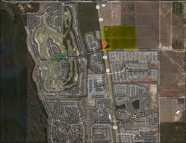
Highway 27, Davenport, FL 33897


NEARBY LISTINGS FOR SALE OR LEASE
Property Detail
Highway 27
Tampa/St Petersburg
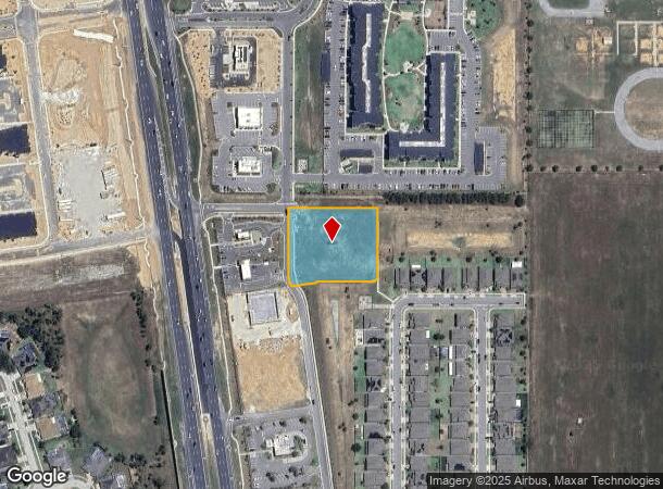
Trinity Ridge Commercial Parcel F Replat
Lakeland-Winter Haven, FL
TRINITY RIDGE COMMERCIAL PARCEL F-REPLAT PB 196 PGS 43-44 PARCEL G
26-25-13-998017-000020
Polk
Commercialacreage
Florida
2024
1.53 AC
2025
Polk County
012413
DEMOGRAPHICS near Highway 27
1 Mile
3 Mile
5 Mile
2024 Total Population
10,678
47,607
103,429
2029 Population
13,250
59,889
130,177
Pop Growth 2024-2029
+ 24.09%
+ 25.80%
+ 25.86%
Average Age
37
39
38
2024 Total Households
3,543
17,452
38,597
HH Growth 2024-2029
+ 24.27%
+ 25.89%
+ 25.71%
Median Household Inc
$66,528
$64,937
$64,061
Avg Household Size
2.90
2.70
2.60
2024 Avg HH Vehicles
2.00
2.00
2.00
Median Home Value
$246,856
$252,572
$266,864
Median Year Built
2004
2005
2006
Nearby Places
Map Layers
Map Styles
 Street
 Aerial
- Restaurants
- Banks
- Shops
- Fitness
- Groceries
PUBLIC TRANSPORTATION
AIRPORT
Orlando International
DRIVE
WALK
Distance
Orlando International
45 min
30.6 mi
Freight Ports
Port of Tampa Bay
DRIVE
WALK
Distance
Port of Tampa Bay
75 min
61.7 mi
SALE & LEASE HISTORY
LISTING DATE
SALE/LEASE

Jan 08, 2019
For Lease
Jan 08, 2019
For Sale
Nearby Properties
Address
Land Use
TOTAL SIZE
Lot Size
Zoning
Address
Land Use
TOTAL SIZE
Lot Size
Zoning
489,411 SF
19.04 AC
Address
Land Use
TOTAL SIZE
Lot Size
Zoning
380,530 SF
18.92 AC
RC
Address
Land Use
TOTAL SIZE
Lot Size
Zoning
364,023 SF
18.77 AC
OPD
Address
Land Use
TOTAL SIZE
Lot Size
Zoning
381,117 SF
10.72 AC
Address
Land Use
TOTAL SIZE
Lot Size
Zoning
321,417 SF
23.19 AC
Address
Land Use
TOTAL SIZE
Lot Size
Zoning
479,776 SF
20.90 AC
Address
Land Use
TOTAL SIZE
Lot Size
Zoning
360,270 SF
16.97 AC
OPD
Address
Land Use
TOTAL SIZE
Lot Size
Zoning
353,423 SF
16.51 AC
PUD
Address
Land Use
TOTAL SIZE
Lot Size
Zoning
442,457 SF
28.76 AC
RC
Address
Land Use
TOTAL SIZE
Lot Size
Zoning
277,616 SF
19.03 AC
Address
Land Use
TOTAL SIZE
Lot Size
Zoning
154,933 SF
20.94 AC
OPD
Address
Land Use
TOTAL SIZE
Lot Size
Zoning
60,000 SF
10.79 AC
RC
Address
Land Use
TOTAL SIZE
Lot Size
Zoning
97,850 SF
3.02 AC
Address
Land Use
TOTAL SIZE
Lot Size
Zoning
77,030 SF
11.78 AC
PUD
Address
Land Use
TOTAL SIZE
Lot Size
Zoning
95,708 SF
3.72 AC
PUD
Address
Land Use
TOTAL SIZE
Lot Size
Zoning
92,829 SF
16.20 AC
Address
Land Use
TOTAL SIZE
Lot Size
Zoning
88,789 SF
20.21 AC
OIN
Address
Land Use
TOTAL SIZE
Lot Size
Zoning
98,672 SF
1.93 AC
Address
Land Use
TOTAL SIZE
Lot Size
Zoning
130,330 SF
6.84 AC
Address
Land Use
TOTAL SIZE
Lot Size
Zoning
82,060 SF
7.11 AC
Address
Land Use
TOTAL SIZE
Lot Size
Zoning
61,995 SF
7.10 AC
Address
Land Use
TOTAL SIZE
Lot Size
Zoning
Address
Land Use
TOTAL SIZE
Lot Size
Zoning
11,911 SF
78.83 AC
RC
Address
Land Use
TOTAL SIZE
Lot Size
Zoning
50,224 SF
4.36 AC
PUD
Address
Land Use
TOTAL SIZE
Lot Size
Zoning
35,192 SF
647.38 AC
RC
Address
Land Use
TOTAL SIZE
Lot Size
Zoning
19.94 AC
RC
Address
Land Use
TOTAL SIZE
Lot Size
Zoning
73.39 AC
OAC
Address
Land Use
TOTAL SIZE
Lot Size
Zoning
62,088 SF
7.88 AC
Address
Land Use
TOTAL SIZE
Lot Size
Zoning
47,324 SF
1.71 AC
Address
Land Use
TOTAL SIZE
Lot Size
Zoning
4,485 SF
1.63 AC
The World's #1 Commercial Real Estate Marketplace
Connect with us
© 2025 CoStar Group
The information above has been obtained from sources believed reliable. While we do not doubt its accuracy we have not verified it and make no guarantee, warranty or representation about it. It is your responsibility to independently confirm its accuracy and completeness. Any projections, opinions, assumptions, or estimates used are for example only and do not represent the current or future performance of the property. The value of this transaction to you depends on tax and other factors which should be evaluated by your tax, financial, and legal advisors. You and your advisors should conduct a careful, independent investigation of the property to determine to your satisfaction the suitability of the property for your needs.