Property Record
10253 Commerce St, Summerville, GA 30747
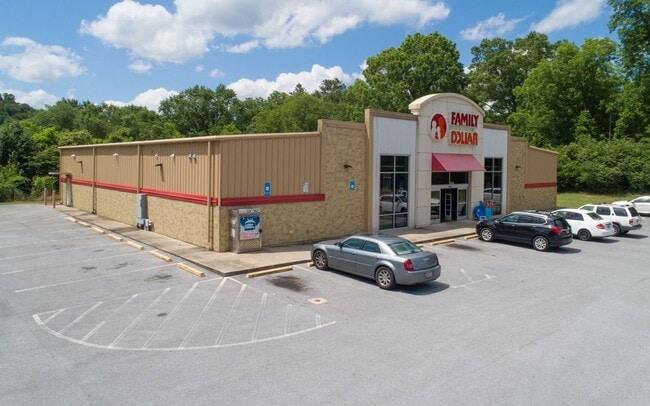

Property Detail
10253 Commerce St
Summerville, GA
LTS 19-33 BLK K BITTING S
00S26-00000-084-000
CHATTOOGA
Wholesaleoutletdiscountstore
Georgia
B and X Area of moderate flood hazard, usually the area between the limits of the 100-year and 500-year floods.
19-33
2025
1.67 AC
2025
Georgia Northwest
010402
Other Market Areas
9,270 SF
NEARBY LISTINGS FOR SALE OR LEASE
DEMOGRAPHICS near 10253 Commerce St
1 mile
3 mile
5 mile
2025 Total Population
3,832
10,599
15,556
2030 Population
3,878
10,753
15,777
Pop Growth 2025-2030
+ 1.20%
+ 1.45%
+ 1.42%
Average Age
42
41
40
2025 Total Households
1,568
3,837
5,710
HH Growth 2025-2030
+ 1.15%
+ 1.41%
+ 1.40%
Median Household Inc
$33,935
$43,218
$45,523
Avg Household Size
2.30
2.40
2.50
2025 Avg HH Vehicles
2.00
2.00
2.00
Median Home Value
$96,666
$112,544
$108,005
Median Year Built
1969
1974
1972
Nearby Places
Map Layers
Map Styles
 Street
 Aerial
Layers
 Traffic
 Biking
Places
Listings with unknown addresses are not visible on the map
- Restaurants
- Banks
- Shops
- Fitness
- Groceries
SALE & LEASE HISTORY
LISTING DATE
SALE/LEASE

Jul 05, 2022
For Sale
Nearby Properties
Address
Land Use
TOTAL SIZE
Lot Size
Zoning
Address
Land Use
TOTAL SIZE
Lot Size
Zoning
71,679 SF
39.24 AC
Address
Land Use
TOTAL SIZE
Lot Size
Zoning
110,296 SF
26 AC
Address
Land Use
TOTAL SIZE
Lot Size
Zoning
62,537 SF
5.28 AC
Address
Land Use
TOTAL SIZE
Lot Size
Zoning
76,321 SF
14.82 AC
Address
Land Use
TOTAL SIZE
Lot Size
Zoning
67,607 SF
8.06 AC
Address
Land Use
TOTAL SIZE
Lot Size
Zoning
2,400 SF
7 AC
Address
Land Use
TOTAL SIZE
Lot Size
Zoning
111,596 SF
51.85 AC
Address
Land Use
TOTAL SIZE
Lot Size
Zoning
55,000 SF
33.62 AC
Address
Land Use
TOTAL SIZE
Lot Size
Zoning
10,860 SF
5.85 AC
Address
Land Use
TOTAL SIZE
Lot Size
Zoning
28,500 SF
12.92 AC
Address
Land Use
TOTAL SIZE
Lot Size
Zoning
142,500 SF
10.48 AC
Address
Land Use
TOTAL SIZE
Lot Size
Zoning
24,552 SF
1.49 AC
Address
Land Use
TOTAL SIZE
Lot Size
Zoning
183,600 SF
8.65 AC
Address
Land Use
TOTAL SIZE
Lot Size
Zoning
10,782 SF
1.33 AC
Address
Land Use
TOTAL SIZE
Lot Size
Zoning
18,960 SF
4.83 AC
Address
Land Use
TOTAL SIZE
Lot Size
Zoning
Address
Land Use
TOTAL SIZE
Lot Size
Zoning
52,107 SF
7.29 AC
Address
Land Use
TOTAL SIZE
Lot Size
Zoning
12,036 SF
1.83 AC
Address
Land Use
TOTAL SIZE
Lot Size
Zoning
24,754 SF
1.21 AC
Address
Land Use
TOTAL SIZE
Lot Size
Zoning
2,230 SF
7 AC
Address
Land Use
TOTAL SIZE
Lot Size
Zoning
12,482 SF
0.92 AC
Address
Land Use
TOTAL SIZE
Lot Size
Zoning
36,500 SF
4.22 AC
Address
Land Use
TOTAL SIZE
Lot Size
Zoning
7,800 SF
0.86 AC
Address
Land Use
TOTAL SIZE
Lot Size
Zoning
Address
Land Use
TOTAL SIZE
Lot Size
Zoning
5,890 SF
3.24 AC
Address
Land Use
TOTAL SIZE
Lot Size
Zoning
11,368 SF
2 AC
Address
Land Use
TOTAL SIZE
Lot Size
Zoning
6,900 SF
1.23 AC
Address
Land Use
TOTAL SIZE
Lot Size
Zoning
71,568 SF
6.80 AC
Address
Land Use
TOTAL SIZE
Lot Size
Zoning
2,992 SF
2.60 AC
Address
Land Use
TOTAL SIZE
Lot Size
Zoning
4.62 AC
The World's #1 Commercial Real Estate Marketplace
Connect with us
© 2026 CoStar Group
The information above has been obtained from sources believed reliable. While we do not doubt its accuracy we have not verified it and make no guarantee, warranty or representation about it. It is your responsibility to independently confirm its accuracy and completeness. Any projections, opinions, assumptions, or estimates used are for example only and do not represent the current or future performance of the property. The value of this transaction to you depends on tax and other factors which should be evaluated by your tax, financial, and legal advisors. You and your advisors should conduct a careful, independent investigation of the property to determine to your satisfaction the suitability of the property for your needs.