Property Record
Highway 276, Rockwall, TX 75032
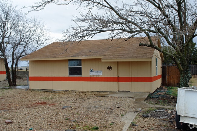


Property Detail
Highway 276
Dallas-Fort Worth-Arlington, TX
A0132 S KELLY, TRACT 10-02, ACRES 10.82, (PT OF 11.82 AC TR)
11361
ROCKWALL
Agriculturalland
Texas
A Areas with a 1% annual chance of flooding and a 26% chance of flooding over the life of a 30-year mortgage.
10.82 AC
2024
Rockwall
2025
Dallas/Ft Worth
040503
NEARBY LISTINGS FOR SALE OR LEASE
DEMOGRAPHICS near Highway 276
1 mile
3 mile
5 mile
2025 Total Population
1,256
31,730
81,079
2030 Population
1,552
38,258
97,644
Pop Growth 2025-2030
+ 23.57%
+ 20.57%
+ 20.43%
Average Age
34
36
36
2025 Total Households
394
10,242
26,662
HH Growth 2025-2030
+ 23.35%
+ 20.49%
+ 20.29%
Median Household Inc
$103,629
$118,012
$105,633
Avg Household Size
3.20
3.00
3.00
2025 Avg HH Vehicles
2.00
2.00
2.00
Median Home Value
$358,132
$390,865
$384,242
Median Year Built
2011
2010
2009
Nearby Places
Map Layers
Map Styles
 Street
 Aerial
Transit
 Traffic
 Biking
Places
Listings with unknown addresses are not visible on the map
- Restaurants
- Banks
- Shops
- Fitness
- Groceries
PUBLIC TRANSPORTATION
AIRPORT
Dallas Love Field
Drive
Walk
Distance
Dallas Love Field
48 min
32.3 mi
Freight Ports
Port of Shreveport
Drive
Walk
Distance
Port of Shreveport
207 min
184.9 mi
Nearby Properties
Address
Land Use
TOTAL SIZE
Lot Size
Zoning
Address
Land Use
TOTAL SIZE
Lot Size
Zoning
193,393 SF
80 AC
Address
Land Use
TOTAL SIZE
Lot Size
Zoning
408,932 SF
12.93 AC
Address
Land Use
TOTAL SIZE
Lot Size
Zoning
44,191 SF
32.66 AC
Address
Land Use
TOTAL SIZE
Lot Size
Zoning
326,842 SF
21.28 AC
Address
Land Use
TOTAL SIZE
Lot Size
Zoning
378,763 SF
12.92 AC
Address
Land Use
TOTAL SIZE
Lot Size
Zoning
311,294 SF
21.28 AC
Address
Land Use
TOTAL SIZE
Lot Size
Zoning
656,340 SF
34.23 AC
Address
Land Use
TOTAL SIZE
Lot Size
Zoning
250,627 SF
18.17 AC
Address
Land Use
TOTAL SIZE
Lot Size
Zoning
153,541 SF
27.44 AC
Address
Land Use
TOTAL SIZE
Lot Size
Zoning
391,599 SF
30.04 AC
Address
Land Use
TOTAL SIZE
Lot Size
Zoning
288,266 SF
38.93 AC
Address
Land Use
TOTAL SIZE
Lot Size
Zoning
83,268 SF
8.67 AC
Address
Land Use
TOTAL SIZE
Lot Size
Zoning
190,558 SF
49.75 AC
Address
Land Use
TOTAL SIZE
Lot Size
Zoning
227,610 SF
11.15 AC
Address
Land Use
TOTAL SIZE
Lot Size
Zoning
91,612 SF
14.20 AC
Address
Land Use
TOTAL SIZE
Lot Size
Zoning
91,039 SF
13.35 AC
Address
Land Use
TOTAL SIZE
Lot Size
Zoning
83,710 SF
6.38 AC
Address
Land Use
TOTAL SIZE
Lot Size
Zoning
93,932 SF
10 AC
Address
Land Use
TOTAL SIZE
Lot Size
Zoning
74,900 SF
15.43 AC
Address
Land Use
TOTAL SIZE
Lot Size
Zoning
79,228 SF
14.75 AC
Address
Land Use
TOTAL SIZE
Lot Size
Zoning
66,333 SF
7.46 AC
Address
Land Use
TOTAL SIZE
Lot Size
Zoning
153,805 SF
13 AC
Address
Land Use
TOTAL SIZE
Lot Size
Zoning
52,582 SF
15.16 AC
Address
Land Use
TOTAL SIZE
Lot Size
Zoning
49,920 SF
5.13 AC
Address
Land Use
TOTAL SIZE
Lot Size
Zoning
114,708 SF
13.83 AC
Address
Land Use
TOTAL SIZE
Lot Size
Zoning
145,375 SF
12 AC
Address
Land Use
TOTAL SIZE
Lot Size
Zoning
57,650 SF
6.71 AC
Address
Land Use
TOTAL SIZE
Lot Size
Zoning
105,750 SF
6.84 AC
Address
Land Use
TOTAL SIZE
Lot Size
Zoning
134,076 SF
10.23 AC
Address
Land Use
TOTAL SIZE
Lot Size
Zoning
4,343 SF
14.06 AC
The World's #1 Commercial Real Estate Marketplace
Connect with us
© 2026 CoStar Group
The information above has been obtained from sources believed reliable. While we do not doubt its accuracy we have not verified it and make no guarantee, warranty or representation about it. It is your responsibility to independently confirm its accuracy and completeness. Any projections, opinions, assumptions, or estimates used are for example only and do not represent the current or future performance of the property. The value of this transaction to you depends on tax and other factors which should be evaluated by your tax, financial, and legal advisors. You and your advisors should conduct a careful, independent investigation of the property to determine to your satisfaction the suitability of the property for your needs.