Property Record
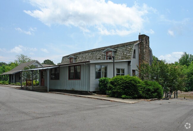
Highway 278 E, Cullman, AL 35055

Property Detail
Highway 278 E
Cullman, AL
LOT 1 BLOCK 1 BACHMUTH SUB D IN NE1/4 OF SW1/4
17-01-12-0-001-095.000
CULLMAN
Vacantlandnec
Alabama
B and X Area of moderate flood hazard, usually the area between the limits of the 100-year and 500-year floods.
1
2025
1.42 AC
2025
Other Market Areas
964901
NEARBY LISTINGS FOR SALE OR LEASE
-
-
View all Cullman listings for sale on LoopNet.com
DEMOGRAPHICS near Highway 278 E
1 mile
3 mile
5 mile
2025 Total Population
860
13,989
28,443
2030 Population
887
14,358
29,273
Pop Growth 2025-2030
+ 3.14%
+ 2.64%
+ 2.92%
Average Age
42
40
40
2025 Total Households
316
5,541
11,367
HH Growth 2025-2030
+ 3.16%
+ 2.54%
+ 2.81%
Median Household Inc
$74,999
$56,276
$58,455
Avg Household Size
2.60
2.40
2.40
2025 Avg HH Vehicles
2.00
2.00
2.00
Median Home Value
$274,999
$221,736
$231,823
Median Year Built
1989
1976
1978
Nearby Places
Map Layers
Map Styles
 Street
 Aerial
Transit
 Traffic
 Biking
Places
Listings with unknown addresses are not visible on the map
- Restaurants
- Banks
- Shops
- Fitness
- Groceries
PUBLIC TRANSPORTATION
AIRPORT
Huntsville International-Carl T Jones Field
Drive
Walk
Distance
Huntsville International-Carl T Jones Field
59 min
47.2 mi
Nearby Properties
Address
Land Use
TOTAL SIZE
Lot Size
Zoning
Address
Land Use
TOTAL SIZE
Lot Size
Zoning
10,938 SF
25 AC
Address
Land Use
TOTAL SIZE
Lot Size
Zoning
10,104 SF
112 AC
Address
Land Use
TOTAL SIZE
Lot Size
Zoning
Address
Land Use
TOTAL SIZE
Lot Size
Zoning
28,800 SF
22 AC
Address
Land Use
TOTAL SIZE
Lot Size
Zoning
3,522 SF
100 AC
Address
Land Use
TOTAL SIZE
Lot Size
Zoning
12,260 SF
15.42 AC
Address
Land Use
TOTAL SIZE
Lot Size
Zoning
7,344 SF
397 AC
Address
Land Use
TOTAL SIZE
Lot Size
Zoning
22 AC
Address
Land Use
TOTAL SIZE
Lot Size
Zoning
5,892 SF
26.30 AC
Address
Land Use
TOTAL SIZE
Lot Size
Zoning
11,280 SF
28.27 AC
Address
Land Use
TOTAL SIZE
Lot Size
Zoning
3,895 SF
17.50 AC
Address
Land Use
TOTAL SIZE
Lot Size
Zoning
Address
Land Use
TOTAL SIZE
Lot Size
Zoning
29,653 SF
Address
Land Use
TOTAL SIZE
Lot Size
Zoning
103,446 SF
18.49 AC
Address
Land Use
TOTAL SIZE
Lot Size
Zoning
7,516 SF
1.09 AC
Address
Land Use
TOTAL SIZE
Lot Size
Zoning
0.60 AC
Address
Land Use
TOTAL SIZE
Lot Size
Zoning
7,735 SF
3.94 AC
Address
Land Use
TOTAL SIZE
Lot Size
Zoning
9,764 SF
0.98 AC
Address
Land Use
TOTAL SIZE
Lot Size
Zoning
364 SF
0.69 AC
Address
Land Use
TOTAL SIZE
Lot Size
Zoning
Address
Land Use
TOTAL SIZE
Lot Size
Zoning
46,031 SF
4.97 AC
Address
Land Use
TOTAL SIZE
Lot Size
Zoning
9,492 SF
1.82 AC
Address
Land Use
TOTAL SIZE
Lot Size
Zoning
2,580 SF
0.39 AC
Address
Land Use
TOTAL SIZE
Lot Size
Zoning
31,146 SF
2.76 AC
Address
Land Use
TOTAL SIZE
Lot Size
Zoning
Address
Land Use
TOTAL SIZE
Lot Size
Zoning
15,912 SF
1.50 AC
Address
Land Use
TOTAL SIZE
Lot Size
Zoning
67,608 SF
8.32 AC
Address
Land Use
TOTAL SIZE
Lot Size
Zoning
9,294 SF
0.50 AC
Address
Land Use
TOTAL SIZE
Lot Size
Zoning
7,212 SF
20 AC
Address
Land Use
TOTAL SIZE
Lot Size
Zoning
99,984 SF
6.68 AC
The World's #1 Commercial Real Estate Marketplace
Connect with us
© 2026 CoStar Group
The information above has been obtained from sources believed reliable. While we do not doubt its accuracy we have not verified it and make no guarantee, warranty or representation about it. It is your responsibility to independently confirm its accuracy and completeness. Any projections, opinions, assumptions, or estimates used are for example only and do not represent the current or future performance of the property. The value of this transaction to you depends on tax and other factors which should be evaluated by your tax, financial, and legal advisors. You and your advisors should conduct a careful, independent investigation of the property to determine to your satisfaction the suitability of the property for your needs.