Property Record
Highway 279, , AL

Property Detail
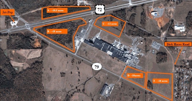
Highway 279
34-02-10-0-000-010.000
S10 T5 R5 PT SE1/4 PT S1/2 OF NW1/4 PT S1/2 OF NE1/4 PT N1/2OF SW1/4 BEG WHERE W LINE SEC 10 INT S ROW HWY 72 TH NE 2600 SELY
Warehouse
JACKSON
B and X Area of moderate flood hazard, usually the area between the limits of the 100-year and 500-year floods.
Alabama
2025
63 AC
2025
Alabama North Area
950600
Other Market Areas
28,100 SF
Scottsboro, AL
NEARBY LISTINGS FOR SALE OR LEASE
-
-
View all listings for sale on LoopNet.com
DEMOGRAPHICS near Highway 279
1 mile
3 mile
5 mile
2025 Total Population
88
3,913
11,179
2030 Population
89
3,945
11,304
Pop Growth 2025-2030
+ 1.14%
+ 0.82%
+ 1.12%
Average Age
42
43
44
2025 Total Households
39
1,733
4,692
HH Growth 2025-2030
0.00%
+ 0.81%
+ 1.07%
Median Household Inc
$43,999
$49,671
$58,608
Avg Household Size
2.20
2.20
2.30
2025 Avg HH Vehicles
2.00
2.00
2.00
Median Home Value
$174,999
$193,266
$187,660
Median Year Built
1985
1981
1977
Nearby Places
Map Layers
Map Styles
 Street
 Aerial
Transit
 Traffic
 Biking
Places
Listings with unknown addresses are not visible on the map
- Restaurants
- Banks
- Shops
- Fitness
- Groceries
Nearby Properties
Address
Land Use
TOTAL SIZE
Lot Size
Zoning
Address
Land Use
TOTAL SIZE
Lot Size
Zoning
299,490 SF
29 AC
Address
Land Use
TOTAL SIZE
Lot Size
Zoning
220,793 SF
4.62 AC
Address
Land Use
TOTAL SIZE
Lot Size
Zoning
279,720 SF
11.50 AC
Address
Land Use
TOTAL SIZE
Lot Size
Zoning
199,275 SF
7 AC
Address
Land Use
TOTAL SIZE
Lot Size
Zoning
28,113 SF
26.98 AC
Address
Land Use
TOTAL SIZE
Lot Size
Zoning
3,520 SF
8.10 AC
Address
Land Use
TOTAL SIZE
Lot Size
Zoning
78,420 SF
44.90 AC
Address
Land Use
TOTAL SIZE
Lot Size
Zoning
58,385 SF
4.98 AC
Address
Land Use
TOTAL SIZE
Lot Size
Zoning
122,100 SF
19.72 AC
Address
Land Use
TOTAL SIZE
Lot Size
Zoning
3,843 SF
4.47 AC
Address
Land Use
TOTAL SIZE
Lot Size
Zoning
1,904 SF
10 AC
Address
Land Use
TOTAL SIZE
Lot Size
Zoning
1,945 SF
5.20 AC
Address
Land Use
TOTAL SIZE
Lot Size
Zoning
4,464 SF
3.30 AC
Address
Land Use
TOTAL SIZE
Lot Size
Zoning
78,960 SF
3.20 AC
Address
Land Use
TOTAL SIZE
Lot Size
Zoning
3,328 SF
5 AC
Address
Land Use
TOTAL SIZE
Lot Size
Zoning
3,843 SF
2.22 AC
Address
Land Use
TOTAL SIZE
Lot Size
Zoning
43,350 SF
5 AC
Address
Land Use
TOTAL SIZE
Lot Size
Zoning
19,182 SF
7.95 AC
Address
Land Use
TOTAL SIZE
Lot Size
Zoning
25,136 SF
Address
Land Use
TOTAL SIZE
Lot Size
Zoning
2,349 SF
7.46 AC
Address
Land Use
TOTAL SIZE
Lot Size
Zoning
104,002 SF
20 AC
Address
Land Use
TOTAL SIZE
Lot Size
Zoning
20,000 SF
6.42 AC
Address
Land Use
TOTAL SIZE
Lot Size
Zoning
27,840 SF
5.19 AC
Address
Land Use
TOTAL SIZE
Lot Size
Zoning
27,840 SF
5.19 AC
Address
Land Use
TOTAL SIZE
Lot Size
Zoning
53,000 SF
5.10 AC
Address
Land Use
TOTAL SIZE
Lot Size
Zoning
12,289 SF
5.20 AC
Address
Land Use
TOTAL SIZE
Lot Size
Zoning
9,834 SF
1.10 AC
Address
Land Use
TOTAL SIZE
Lot Size
Zoning
1,361 SF
4.30 AC
Address
Land Use
TOTAL SIZE
Lot Size
Zoning
24,250 SF
11 AC
The World's #1 Commercial Real Estate Marketplace
Connect with us
© 2026 CoStar Group
The information above has been obtained from sources believed reliable. While we do not doubt its accuracy we have not verified it and make no guarantee, warranty or representation about it. It is your responsibility to independently confirm its accuracy and completeness. Any projections, opinions, assumptions, or estimates used are for example only and do not represent the current or future performance of the property. The value of this transaction to you depends on tax and other factors which should be evaluated by your tax, financial, and legal advisors. You and your advisors should conduct a careful, independent investigation of the property to determine to your satisfaction the suitability of the property for your needs.