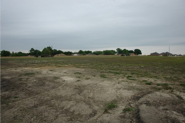
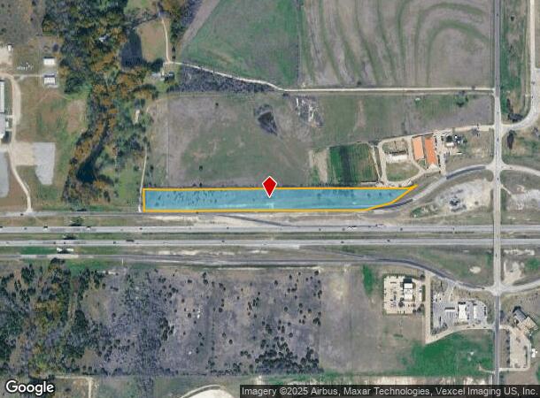
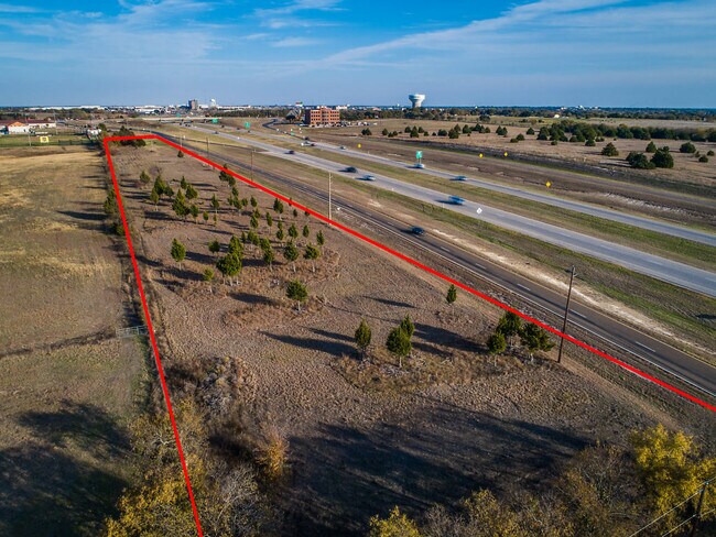
Property Record
Highway 287, Waxahachie, TX 75165
NEARBY LISTINGS FOR SALE OR LEASE
Property Detail
Highway 287
Dallas-Fort Worth-Arlington, TX
Wm Irwin
185892
545 WM IRWIN 4.56 ACRES
Commercialacreage
Ellis
X
Texas
48139C0170G
4.56 AC
2024
Ellis County
2025
Dallas/Ft Worth
060300
DEMOGRAPHICS near Highway 287
1 Mile
3 Mile
5 Mile
2024 Total Population
11,077
42,692
59,626
2029 Population
14,118
54,250
75,572
Pop Growth 2024-2029
+ 27.45%
+ 27.07%
+ 26.74%
Average Age
37
36
37
2024 Total Households
3,784
15,018
20,792
HH Growth 2024-2029
+ 27.70%
+ 27.19%
+ 26.94%
Median Household Inc
$95,293
$77,772
$82,527
Avg Household Size
2.90
2.70
2.80
2024 Avg HH Vehicles
2.00
2.00
2.00
Median Home Value
$251,392
$253,266
$264,181
Median Year Built
2003
2000
2000
Nearby Places
Map Layers
Map Styles
 Street
 Aerial
- Restaurants
- Banks
- Shops
- Fitness
- Groceries
PUBLIC TRANSPORTATION
AIRPORT
Dallas Love Field
DRIVE
WALK
Distance
Dallas Love Field
48 min
33.4 mi
Freight Ports
Port of Shreveport
DRIVE
WALK
Distance
Port of Shreveport
235 min
214.6 mi
SALE & LEASE HISTORY
LISTING DATE
SALE/LEASE

Jan 09, 2020
For Sale
Nearby Properties
Address
Land Use
TOTAL SIZE
Lot Size
Zoning
Address
Land Use
TOTAL SIZE
Lot Size
Zoning
488,705 SF
43.76 AC
Address
Land Use
TOTAL SIZE
Lot Size
Zoning
413,618 SF
94.72 AC
Address
Land Use
TOTAL SIZE
Lot Size
Zoning
630,460 SF
71.82 AC
Address
Land Use
TOTAL SIZE
Lot Size
Zoning
643,064 SF
42.15 AC
Address
Land Use
TOTAL SIZE
Lot Size
Zoning
259,166 SF
11.07 AC
Address
Land Use
TOTAL SIZE
Lot Size
Zoning
675,375 SF
59.26 AC
Address
Land Use
TOTAL SIZE
Lot Size
Zoning
193,837 SF
10.41 AC
Address
Land Use
TOTAL SIZE
Lot Size
Zoning
99,354 SF
62.87 AC
Address
Land Use
TOTAL SIZE
Lot Size
Zoning
258,147 SF
12.40 AC
Address
Land Use
TOTAL SIZE
Lot Size
Zoning
177,000 SF
20.25 AC
Address
Land Use
TOTAL SIZE
Lot Size
Zoning
708,800 SF
149.18 AC
Address
Land Use
TOTAL SIZE
Lot Size
Zoning
198,180 SF
11.48 AC
Address
Land Use
TOTAL SIZE
Lot Size
Zoning
1,123,347 SF
74.97 AC
Address
Land Use
TOTAL SIZE
Lot Size
Zoning
413,050 SF
54.30 AC
Address
Land Use
TOTAL SIZE
Lot Size
Zoning
134,530 SF
12.11 AC
Address
Land Use
TOTAL SIZE
Lot Size
Zoning
178,880 SF
5.51 AC
Address
Land Use
TOTAL SIZE
Lot Size
Zoning
85,823 SF
56.24 AC
Address
Land Use
TOTAL SIZE
Lot Size
Zoning
118,782 SF
5.11 AC
Address
Land Use
TOTAL SIZE
Lot Size
Zoning
326,740 SF
23.01 AC
Address
Land Use
TOTAL SIZE
Lot Size
Zoning
352,350 SF
18.78 AC
Address
Land Use
TOTAL SIZE
Lot Size
Zoning
568,234 SF
65.79 AC
Address
Land Use
TOTAL SIZE
Lot Size
Zoning
886,858 SF
8.60 AC
Address
Land Use
TOTAL SIZE
Lot Size
Zoning
109,978 SF
28.14 AC
Address
Land Use
TOTAL SIZE
Lot Size
Zoning
278,000 SF
22.82 AC
Address
Land Use
TOTAL SIZE
Lot Size
Zoning
92,475 SF
12.38 AC
Address
Land Use
TOTAL SIZE
Lot Size
Zoning
326,130 SF
18.48 AC
Address
Land Use
TOTAL SIZE
Lot Size
Zoning
115,544 SF
6.70 AC
Address
Land Use
TOTAL SIZE
Lot Size
Zoning
120,587 SF
23.95 AC
Address
Land Use
TOTAL SIZE
Lot Size
Zoning
92,860 SF
26.02 AC
Address
Land Use
TOTAL SIZE
Lot Size
Zoning
The World's #1 Commercial Real Estate Marketplace
Connect with us
© 2025 CoStar Group
The information above has been obtained from sources believed reliable. While we do not doubt its accuracy we have not verified it and make no guarantee, warranty or representation about it. It is your responsibility to independently confirm its accuracy and completeness. Any projections, opinions, assumptions, or estimates used are for example only and do not represent the current or future performance of the property. The value of this transaction to you depends on tax and other factors which should be evaluated by your tax, financial, and legal advisors. You and your advisors should conduct a careful, independent investigation of the property to determine to your satisfaction the suitability of the property for your needs.