Property Record
Highway 29 Rd S, Hull, GA 30646
NEARBY LISTINGS FOR SALE OR LEASE
-
-
View all Hull listings for sale on LoopNet.com
Property Detail
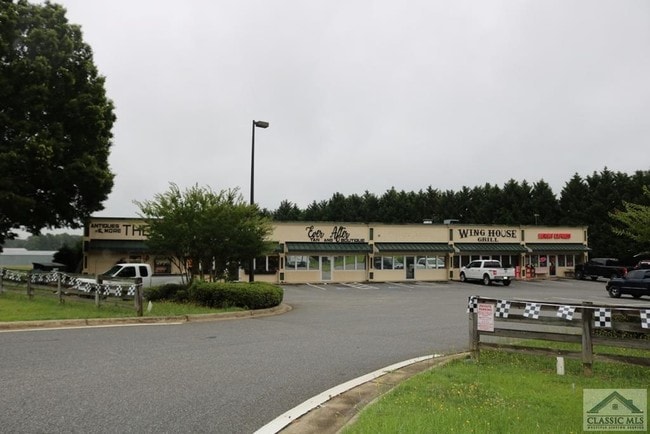
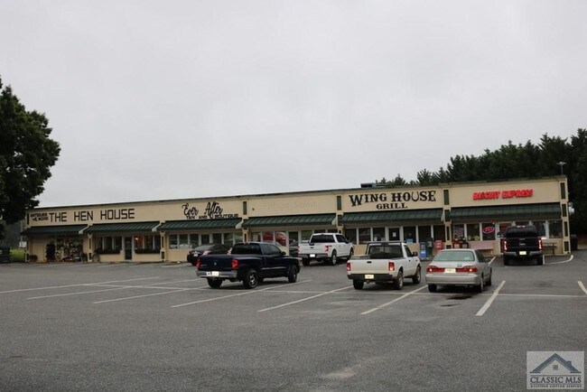
Highway 29 Rd S
Athens-Clarke County, GA
Comm 30000 Acr
0032A-001
LAND
Commercialacreage
Madison
X
Georgia
13059C0003E
1.26 AC
2024
Athens/Gainesville
2024
Other Market Areas
020502
DEMOGRAPHICS near Highway 29 Rd S
1 Mile
3 Mile
5 Mile
2024 Total Population
2,702
11,150
24,039
2029 Population
3,017
11,992
25,506
Pop Growth 2024-2029
+ 11.66%
+ 7.55%
+ 6.10%
Average Age
38
38
39
2024 Total Households
965
4,043
9,038
HH Growth 2024-2029
+ 11.19%
+ 7.42%
+ 5.75%
Median Household Inc
$48,090
$53,204
$53,153
Avg Household Size
2.80
2.70
2.60
2024 Avg HH Vehicles
2.00
2.00
2.00
Median Home Value
$188,565
$160,151
$164,186
Median Year Built
1990
1990
1990
Nearby Places
- Restaurants
- Banks
- Shops
- Fitness
- Groceries
SALE & LEASE HISTORY
LISTING DATE
SALE/LEASE

Jul 20, 2018
For Sale
Nearby Properties
Address
Land Use
TOTAL SIZE
Lot Size
Zoning
Address
Land Use
TOTAL SIZE
Lot Size
Zoning
17,234 SF
56.08 AC
Address
Land Use
TOTAL SIZE
Lot Size
Zoning
1,403 SF
21.64 AC
C-G
Address
Land Use
TOTAL SIZE
Lot Size
Zoning
2,880 SF
36.84 AC
RM-1
Address
Land Use
TOTAL SIZE
Lot Size
Zoning
4,392 SF
11.79 AC
C-G
Address
Land Use
TOTAL SIZE
Lot Size
Zoning
26,100 SF
18.59 AC
C-G
Address
Land Use
TOTAL SIZE
Lot Size
Zoning
124,136 SF
19.82 AC
C-G (PD)
Address
Land Use
TOTAL SIZE
Lot Size
Zoning
18.38 AC
G
Address
Land Use
TOTAL SIZE
Lot Size
Zoning
222,180 SF
17.08 AC
E-I
Address
Land Use
TOTAL SIZE
Lot Size
Zoning
13,320 SF
60.89 AC
C-G
Address
Land Use
TOTAL SIZE
Lot Size
Zoning
120,000 SF
8.92 AC
E-I
Address
Land Use
TOTAL SIZE
Lot Size
Zoning
130,048 SF
17.19 AC
E-I
Address
Land Use
TOTAL SIZE
Lot Size
Zoning
278.29 AC
E-I
Address
Land Use
TOTAL SIZE
Lot Size
Zoning
42,254 SF
19.23 AC
B
Address
Land Use
TOTAL SIZE
Lot Size
Zoning
60,480 SF
13.87 AC
A1
Address
Land Use
TOTAL SIZE
Lot Size
Zoning
5,005 SF
12.67 AC
C-G
Address
Land Use
TOTAL SIZE
Lot Size
Zoning
1 SF
17.11 AC
C-R
Address
Land Use
TOTAL SIZE
Lot Size
Zoning
11,508 SF
1.96 AC
C-G
Address
Land Use
TOTAL SIZE
Lot Size
Zoning
14,317 SF
1.60 AC
C-G
Address
Land Use
TOTAL SIZE
Lot Size
Zoning
4,284 SF
2.48 AC
C-G (PD)
Address
Land Use
TOTAL SIZE
Lot Size
Zoning
591.91 AC
A1
Address
Land Use
TOTAL SIZE
Lot Size
Zoning
17.85 AC
C-G
Address
Land Use
TOTAL SIZE
Lot Size
Zoning
840 SF
73.31 AC
AR
Address
Land Use
TOTAL SIZE
Lot Size
Zoning
25,000 SF
18.39 AC
C-R
Address
Land Use
TOTAL SIZE
Lot Size
Zoning
6,552 SF
1.43 AC
C-G
Address
Land Use
TOTAL SIZE
Lot Size
Zoning
372.42 AC
A2
Address
Land Use
TOTAL SIZE
Lot Size
Zoning
6,972 SF
0.89 AC
C-G
Address
Land Use
TOTAL SIZE
Lot Size
Zoning
2,058 SF
23.14 AC
RM-2
Address
Land Use
TOTAL SIZE
Lot Size
Zoning
2,701 SF
1.17 AC
C-G
Address
Land Use
TOTAL SIZE
Lot Size
Zoning
27,875 SF
6.02 AC
C-R
Address
Land Use
TOTAL SIZE
Lot Size
Zoning
2,430 SF
1.41 AC
C-G
The World's #1 Commercial Real Estate Marketplace
Connect with us
© 2025 CoStar Group
The information above has been obtained from sources believed reliable. While we do not doubt its accuracy we have not verified it and make no guarantee, warranty or representation about it. It is your responsibility to independently confirm its accuracy and completeness. Any projections, opinions, assumptions, or estimates used are for example only and do not represent the current or future performance of the property. The value of this transaction to you depends on tax and other factors which should be evaluated by your tax, financial, and legal advisors. You and your advisors should conduct a careful, independent investigation of the property to determine to your satisfaction the suitability of the property for your needs.