Property Record
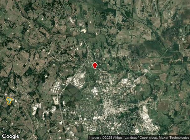
Highway 290 W, Brenham, TX 77833


Property Detail
Highway 290 W
Brenham, TX
Gordon, Elizabeth
0049-000-16700
A0049 GORDON, ELIZABETH, TRACT 167, ACRES 15.295
Commercialnec
Washington
2022
Texas
2023
15.30 AC
170201
Central Texas Area
26,760 SF
Other Market Areas
NEARBY LISTINGS FOR SALE OR LEASE
DEMOGRAPHICS near Highway 290 W
1 mile
3 mile
5 mile
2024 Total Population
432
7,544
22,488
2029 Population
435
7,708
23,024
Pop Growth 2024-2029
+ 0.69%
+ 2.17%
+ 2.38%
Average Age
46
41
41
2024 Total Households
171
2,745
8,541
HH Growth 2024-2029
+ 1.17%
+ 2.30%
+ 2.55%
Median Household Inc
$56,999
$56,931
$58,726
Avg Household Size
2.50
2.50
2.40
2024 Avg HH Vehicles
2.00
2.00
2.00
Median Home Value
$265,853
$226,004
$215,053
Median Year Built
1994
1990
1988
Nearby Places
Map Layers
Map Styles
 Street
 Aerial
Transit
 Traffic
 Biking
Places
Listings with unknown addresses are not visible on the map
- Restaurants
- Banks
- Shops
- Fitness
- Groceries
PUBLIC TRANSPORTATION
AIRPORT
Easterwood Field
Drive
Walk
Distance
Easterwood Field
59 min
40.2 mi
Freight Ports
Port of Houston
Drive
Walk
Distance
Port of Houston
104 min
83.5 mi
SALE & LEASE HISTORY
LISTING DATE
SALE/LEASE

Sep 12, 2023
For Sale
Sep 08, 2022
For Sale
Oct 27, 2017
For Sale
May 03, 2017
For Sale
Apr 10, 2023
For Lease
Nearby Properties
Address
Land Use
TOTAL SIZE
Lot Size
Zoning
Address
Land Use
TOTAL SIZE
Lot Size
Zoning
172,665 SF
12.76 AC
Address
Land Use
TOTAL SIZE
Lot Size
Zoning
91,028 SF
3.94 AC
Address
Land Use
TOTAL SIZE
Lot Size
Zoning
Address
Land Use
TOTAL SIZE
Lot Size
Zoning
118,557 SF
11.53 AC
Address
Land Use
TOTAL SIZE
Lot Size
Zoning
230,486 SF
23.85 AC
Address
Land Use
TOTAL SIZE
Lot Size
Zoning
101,192 SF
3.77 AC
Address
Land Use
TOTAL SIZE
Lot Size
Zoning
92,565 SF
17.45 AC
Address
Land Use
TOTAL SIZE
Lot Size
Zoning
106,211 SF
48.30 AC
Address
Land Use
TOTAL SIZE
Lot Size
Zoning
92,469 SF
8.76 AC
Address
Land Use
TOTAL SIZE
Lot Size
Zoning
76,425 SF
39.31 AC
Address
Land Use
TOTAL SIZE
Lot Size
Zoning
86,974 SF
4.31 AC
Address
Land Use
TOTAL SIZE
Lot Size
Zoning
42,642 SF
6.30 AC
Address
Land Use
TOTAL SIZE
Lot Size
Zoning
68,357 SF
6.70 AC
Address
Land Use
TOTAL SIZE
Lot Size
Zoning
140.66 AC
Address
Land Use
TOTAL SIZE
Lot Size
Zoning
35,655 SF
52.35 AC
Address
Land Use
TOTAL SIZE
Lot Size
Zoning
171,429 SF
7.08 AC
Address
Land Use
TOTAL SIZE
Lot Size
Zoning
97,848 SF
7.66 AC
Address
Land Use
TOTAL SIZE
Lot Size
Zoning
68,117 SF
7.83 AC
Address
Land Use
TOTAL SIZE
Lot Size
Zoning
38,711 SF
6.70 AC
Address
Land Use
TOTAL SIZE
Lot Size
Zoning
45,049 SF
2.33 AC
Address
Land Use
TOTAL SIZE
Lot Size
Zoning
38,711 SF
3.91 AC
Address
Land Use
TOTAL SIZE
Lot Size
Zoning
58,340 SF
3 AC
Address
Land Use
TOTAL SIZE
Lot Size
Zoning
31,041 SF
0.69 AC
Address
Land Use
TOTAL SIZE
Lot Size
Zoning
30,396 SF
6.83 AC
Address
Land Use
TOTAL SIZE
Lot Size
Zoning
10,023 SF
3.70 AC
Address
Land Use
TOTAL SIZE
Lot Size
Zoning
45.73 AC
Address
Land Use
TOTAL SIZE
Lot Size
Zoning
71,250 SF
3.99 AC
Address
Land Use
TOTAL SIZE
Lot Size
Zoning
38,944 SF
4.51 AC
Address
Land Use
TOTAL SIZE
Lot Size
Zoning
33,434 SF
4.86 AC
Address
Land Use
TOTAL SIZE
Lot Size
Zoning
1,577 SF
259.87 AC
The World's #1 Commercial Real Estate Marketplace
Connect with us
© 2026 CoStar Group
The information above has been obtained from sources believed reliable. While we do not doubt its accuracy we have not verified it and make no guarantee, warranty or representation about it. It is your responsibility to independently confirm its accuracy and completeness. Any projections, opinions, assumptions, or estimates used are for example only and do not represent the current or future performance of the property. The value of this transaction to you depends on tax and other factors which should be evaluated by your tax, financial, and legal advisors. You and your advisors should conduct a careful, independent investigation of the property to determine to your satisfaction the suitability of the property for your needs.