Property Record
Highway 30, Carville, LA 70721


Save to a Folder
{{folder.Name}}
{{folder.ListingIds.length}} Properties
{{folder.ListingIds.length}} Property
Create a New Folder
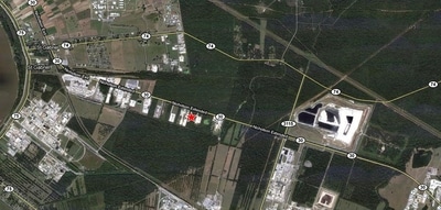
Property Detail
Highway 30
Baton Rouge, LA
ACRES - 16.25 TR C & D EVERGREEN INDUSTRIAL PARK SUB. SEC 31 T9SR1E. 38..46 ACS ///CB 388 E 16
05-10648840
IBERVILLE
Agriculturalland
Louisiana
A Areas with a 1% annual chance of flooding and a 26% chance of flooding over the life of a 30-year mortgage.
d,c
2025
16.25 AC
2025
West Baton Rouge
953200
Baton Rouge
NEARBY LISTINGS FOR SALE OR LEASE
DEMOGRAPHICS near Highway 30
1 mile
3 mile
5 mile
2025 Total Population
205
2,031
13,687
2030 Population
207
2,018
14,077
Pop Growth 2025-2030
+ 0.98%
(0.64%)
+ 2.85%
Average Age
43
38
38
2025 Total Households
50
590
4,297
HH Growth 2025-2030
0.00%
(1.02%)
+ 3.00%
Median Household Inc
$107,500
$39,076
$107,703
Avg Household Size
2.20
2.40
2.80
2025 Avg HH Vehicles
2.00
2.00
2.00
Median Home Value
$299,999
$223,009
$358,581
Median Year Built
2005
1998
2004
Nearby Places
Map Layers
Map Styles
 Street
 Aerial
Layers
 Traffic
 Biking
Places
Listings with unknown addresses are not visible on the map
- Restaurants
- Banks
- Shops
- Fitness
- Groceries
PUBLIC TRANSPORTATION
AIRPORT
Baton Rouge Metro Ryan Field
Drive
Walk
Distance
Baton Rouge Metro Ryan Field
39 min
24.8 mi
Freight Ports
Port of Greater Baton Rouge
Drive
Walk
Distance
Port of Greater Baton Rouge
33 min
19.3 mi
SALE & LEASE HISTORY
LISTING DATE
SALE/LEASE

Sep 24, 2016
For Sale
Nearby Properties
Address
Land Use
TOTAL SIZE
Lot Size
Zoning
Address
Land Use
TOTAL SIZE
Lot Size
Zoning
1,313.56 AC
IND
Address
Land Use
TOTAL SIZE
Lot Size
Zoning
76.72 AC
IND
Address
Land Use
TOTAL SIZE
Lot Size
Zoning
735.49 AC
Address
Land Use
TOTAL SIZE
Lot Size
Zoning
7.91 AC
IND
Address
Land Use
TOTAL SIZE
Lot Size
Zoning
60.66 AC
IND
Address
Land Use
TOTAL SIZE
Lot Size
Zoning
Address
Land Use
TOTAL SIZE
Lot Size
Zoning
81.37 AC
IND
Address
Land Use
TOTAL SIZE
Lot Size
Zoning
8.63 AC
Address
Land Use
TOTAL SIZE
Lot Size
Zoning
124.04 AC
IND
Address
Land Use
TOTAL SIZE
Lot Size
Zoning
61.29 AC
IND
Address
Land Use
TOTAL SIZE
Lot Size
Zoning
Address
Land Use
TOTAL SIZE
Lot Size
Zoning
18.61 AC
BP
Address
Land Use
TOTAL SIZE
Lot Size
Zoning
45.28 AC
IND
Address
Land Use
TOTAL SIZE
Lot Size
Zoning
2.87 AC
Address
Land Use
TOTAL SIZE
Lot Size
Zoning
Address
Land Use
TOTAL SIZE
Lot Size
Zoning
5.07 AC
Address
Land Use
TOTAL SIZE
Lot Size
Zoning
Address
Land Use
TOTAL SIZE
Lot Size
Zoning
Address
Land Use
TOTAL SIZE
Lot Size
Zoning
6.97 AC
IND
Address
Land Use
TOTAL SIZE
Lot Size
Zoning
Address
Land Use
TOTAL SIZE
Lot Size
Zoning
232.67 AC
IND
Address
Land Use
TOTAL SIZE
Lot Size
Zoning
11.48 AC
Address
Land Use
TOTAL SIZE
Lot Size
Zoning
160.90 AC
Address
Land Use
TOTAL SIZE
Lot Size
Zoning
6.87 AC
BP
Address
Land Use
TOTAL SIZE
Lot Size
Zoning
Address
Land Use
TOTAL SIZE
Lot Size
Zoning
227.12 AC
IND
Address
Land Use
TOTAL SIZE
Lot Size
Zoning
2.20 AC
T
Address
Land Use
TOTAL SIZE
Lot Size
Zoning
3.37 AC
BP
Address
Land Use
TOTAL SIZE
Lot Size
Zoning
2.30 AC
IND
Address
Land Use
TOTAL SIZE
Lot Size
Zoning
2.15 AC
IND
The World's #1 Commercial Real Estate Marketplace
Connect with us
© 2026 CoStar Group
The information above has been obtained from sources believed reliable. While we do not doubt its accuracy we have not verified it and make no guarantee, warranty or representation about it. It is your responsibility to independently confirm its accuracy and completeness. Any projections, opinions, assumptions, or estimates used are for example only and do not represent the current or future performance of the property. The value of this transaction to you depends on tax and other factors which should be evaluated by your tax, financial, and legal advisors. You and your advisors should conduct a careful, independent investigation of the property to determine to your satisfaction the suitability of the property for your needs.