Property Record
Highway 301, Smithfield, NC 27577


Property Detail
Highway 301
15J11023
62/275 168210-3
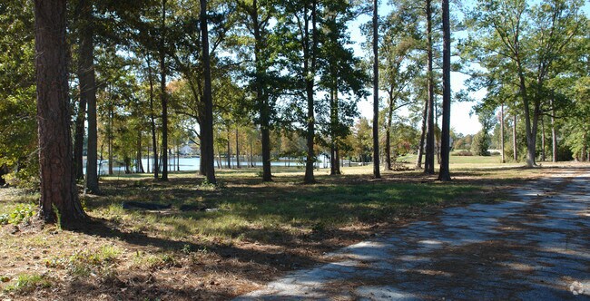
Vacantlandnec
JOHNSTON
RAG
North Carolina
AE The base floodplain where base flood elevations are provided. AE Zones are now used on new format FIRMs instead of A1-A30 Zones.
8.03 AC
2025
Johnston County
2025
Raleigh/Durham
040800
Raleigh-Cary, NC
NEARBY LISTINGS FOR SALE OR LEASE
-
-
View all Smithfield listings for sale on LoopNet.com
DEMOGRAPHICS near Highway 301
1 mile
3 mile
5 mile
2024 Total Population
1,296
8,640
22,300
2029 Population
1,456
9,658
24,991
Pop Growth 2024-2029
+ 12.35%
+ 11.78%
+ 12.07%
Average Age
41
41
41
2024 Total Households
495
3,372
8,728
HH Growth 2024-2029
+ 12.53%
+ 11.89%
+ 12.21%
Median Household Inc
$88,333
$64,950
$58,184
Avg Household Size
2.60
2.50
2.50
2024 Avg HH Vehicles
3.00
2.00
2.00
Median Home Value
$320,349
$280,701
$246,792
Median Year Built
1994
1980
1980
Nearby Places
Map Layers
Map Styles
 Street
 Aerial
Transit
 Traffic
 Biking
Places
Listings with unknown addresses are not visible on the map
- Restaurants
- Banks
- Shops
- Fitness
- Groceries
PUBLIC TRANSPORTATION
COMMUTER RAIL
Selma (Carolinian - Amtrak, Palmetto - Amtrak)
Drive
Walk
Distance
Selma (Carolinian - Amtrak, Palmetto - Amtrak)
14 min
9.3 mi
Freight Ports
Port of Wilmington
Drive
Walk
Distance
Port of Wilmington
126 min
104.2 mi
SALE & LEASE HISTORY
LISTING DATE
SALE/LEASE

Sep 24, 2016
For Sale
Nearby Properties
Address
Land Use
TOTAL SIZE
Lot Size
Zoning
Address
Land Use
TOTAL SIZE
Lot Size
Zoning
264,880 SF
19.07 AC
IND
Address
Land Use
TOTAL SIZE
Lot Size
Zoning
122,012 SF
30.94 AC
IND
Address
Land Use
TOTAL SIZE
Lot Size
Zoning
24,142 SF
37.47 AC
RES
Address
Land Use
TOTAL SIZE
Lot Size
Zoning
249,045 SF
27.03 AC
IND
Address
Land Use
TOTAL SIZE
Lot Size
Zoning
15,500 SF
27.78 AC
OFF
Address
Land Use
TOTAL SIZE
Lot Size
Zoning
17,808 SF
27.29 AC
RES
Address
Land Use
TOTAL SIZE
Lot Size
Zoning
41,545 SF
4.86 AC
OFF
Address
Land Use
TOTAL SIZE
Lot Size
Zoning
2,304 SF
27.39 AC
COM
Address
Land Use
TOTAL SIZE
Lot Size
Zoning
182,406 SF
17.57 AC
IND
Address
Land Use
TOTAL SIZE
Lot Size
Zoning
152,080 SF
6.65 AC
IND
Address
Land Use
TOTAL SIZE
Lot Size
Zoning
11,922 SF
41.19 AC
IND
Address
Land Use
TOTAL SIZE
Lot Size
Zoning
1,423 SF
15.56 AC
MHW
Address
Land Use
TOTAL SIZE
Lot Size
Zoning
141,516 SF
13.26 AC
COM
Address
Land Use
TOTAL SIZE
Lot Size
Zoning
36,882 SF
6.31 AC
COM
Address
Land Use
TOTAL SIZE
Lot Size
Zoning
5,913 SF
8.25 AC
RES
Address
Land Use
TOTAL SIZE
Lot Size
Zoning
3,364 SF
19.82 AC
IND
Address
Land Use
TOTAL SIZE
Lot Size
Zoning
936 SF
655.79 AC
RAG
Address
Land Use
TOTAL SIZE
Lot Size
Zoning
32,366 SF
18.71 AC
IND
Address
Land Use
TOTAL SIZE
Lot Size
Zoning
1,792 SF
6.44 AC
COM
Address
Land Use
TOTAL SIZE
Lot Size
Zoning
4,340 SF
8 AC
IND
Address
Land Use
TOTAL SIZE
Lot Size
Zoning
11,838 SF
27.65 AC
COM
Address
Land Use
TOTAL SIZE
Lot Size
Zoning
18,810 SF
5.20 AC
IND
Address
Land Use
TOTAL SIZE
Lot Size
Zoning
29,520 SF
4.11 AC
COM
Address
Land Use
TOTAL SIZE
Lot Size
Zoning
81,250 SF
12.71 AC
COM
Address
Land Use
TOTAL SIZE
Lot Size
Zoning
90,430 SF
4.19 AC
SUP
Address
Land Use
TOTAL SIZE
Lot Size
Zoning
78,880 SF
5.30 AC
IND
Address
Land Use
TOTAL SIZE
Lot Size
Zoning
9,600 SF
2.10 AC
COM
Address
Land Use
TOTAL SIZE
Lot Size
Zoning
464.68 AC
RAG
Address
Land Use
TOTAL SIZE
Lot Size
Zoning
15,420 SF
2.21 AC
IND
Address
Land Use
TOTAL SIZE
Lot Size
Zoning
4,508 SF
1.16 AC
COM
The World's #1 Commercial Real Estate Marketplace
Connect with us
© 2026 CoStar Group
The information above has been obtained from sources believed reliable. While we do not doubt its accuracy we have not verified it and make no guarantee, warranty or representation about it. It is your responsibility to independently confirm its accuracy and completeness. Any projections, opinions, assumptions, or estimates used are for example only and do not represent the current or future performance of the property. The value of this transaction to you depends on tax and other factors which should be evaluated by your tax, financial, and legal advisors. You and your advisors should conduct a careful, independent investigation of the property to determine to your satisfaction the suitability of the property for your needs.