Property Record
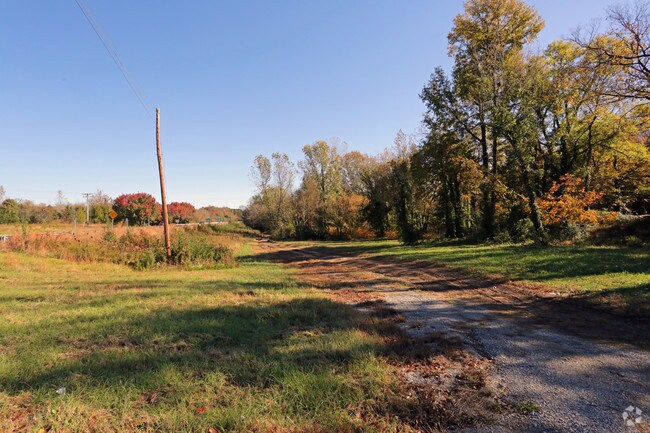
Highway 301, Weldon, NC 27890


Property Detail
Highway 301
12-02311
ADJ 301
Residentialacreage
HALIFAX
WELC1
North Carolina
AE The base floodplain where base flood elevations are provided. AE Zones are now used on new format FIRMs instead of A1-A30 Zones.
2.30 AC
2024
North Carolina Northeast Area
2025
Other Market Areas
930100
Roanoke Rapids, NC
NEARBY LISTINGS FOR SALE OR LEASE
DEMOGRAPHICS near Highway 301
1 mile
3 mile
5 mile
2025 Total Population
1,361
5,544
18,475
2030 Population
1,379
5,376
17,835
Pop Growth 2025-2030
+ 1.32%
(3.03%)
(3.46%)
Average Age
41
44
42
2025 Total Households
532
2,484
7,929
HH Growth 2025-2030
+ 1.50%
(3.30%)
(3.58%)
Median Household Inc
$30,093
$40,550
$48,325
Avg Household Size
2.50
2.20
2.30
2025 Avg HH Vehicles
2.00
2.00
2.00
Median Home Value
$118,041
$168,976
$138,552
Median Year Built
1954
1979
1973
Nearby Places
Map Layers
Map Styles
 Street
 Aerial
Transit
 Traffic
 Biking
Places
Listings with unknown addresses are not visible on the map
- Restaurants
- Banks
- Shops
- Fitness
- Groceries
Nearby Properties
Address
Land Use
TOTAL SIZE
Lot Size
Zoning
Address
Land Use
TOTAL SIZE
Lot Size
Zoning
50,336 SF
113.40 AC
WELI1
Address
Land Use
TOTAL SIZE
Lot Size
Zoning
3,171 SF
228.25 AC
LI
Address
Land Use
TOTAL SIZE
Lot Size
Zoning
74,953 SF
107.43 AC
Address
Land Use
TOTAL SIZE
Lot Size
Zoning
203,628 SF
17.91 AC
RRB4
Address
Land Use
TOTAL SIZE
Lot Size
Zoning
66,609 SF
2.60 AC
RRB4
Address
Land Use
TOTAL SIZE
Lot Size
Zoning
110,678 SF
11.34 AC
RRB4
Address
Land Use
TOTAL SIZE
Lot Size
Zoning
2.05 AC
WELCH
Address
Land Use
TOTAL SIZE
Lot Size
Zoning
13,794 SF
11.34 AC
RRR
Address
Land Use
TOTAL SIZE
Lot Size
Zoning
8,200 SF
5.97 AC
RRB4
Address
Land Use
TOTAL SIZE
Lot Size
Zoning
14,000 SF
13.66 AC
RRB4
Address
Land Use
TOTAL SIZE
Lot Size
Zoning
75,392 SF
4.22 AC
RRR
Address
Land Use
TOTAL SIZE
Lot Size
Zoning
58,891 SF
2.65 AC
WELR8
Address
Land Use
TOTAL SIZE
Lot Size
Zoning
14,300 SF
10 AC
RRB4
Address
Land Use
TOTAL SIZE
Lot Size
Zoning
87,165 SF
8.77 AC
RRB4
Address
Land Use
TOTAL SIZE
Lot Size
Zoning
46,948 SF
2.31 AC
RRB4
Address
Land Use
TOTAL SIZE
Lot Size
Zoning
68,153 SF
20 AC
WELR8
Address
Land Use
TOTAL SIZE
Lot Size
Zoning
28,316 SF
10.19 AC
RRB4
Address
Land Use
TOTAL SIZE
Lot Size
Zoning
132,851 SF
35.37 AC
Address
Land Use
TOTAL SIZE
Lot Size
Zoning
47,641 SF
2.15 AC
RRB4
Address
Land Use
TOTAL SIZE
Lot Size
Zoning
74,222 SF
10.70 AC
RRB4
Address
Land Use
TOTAL SIZE
Lot Size
Zoning
Address
Land Use
TOTAL SIZE
Lot Size
Zoning
1,647 SF
15.43 AC
WELR40
Address
Land Use
TOTAL SIZE
Lot Size
Zoning
30,762 SF
8.30 AC
RRB
Address
Land Use
TOTAL SIZE
Lot Size
Zoning
152,210 SF
20.39 AC
Address
Land Use
TOTAL SIZE
Lot Size
Zoning
105,875 SF
26.28 AC
ETJ52
Address
Land Use
TOTAL SIZE
Lot Size
Zoning
12,600 SF
10.93 AC
RRR6
Address
Land Use
TOTAL SIZE
Lot Size
Zoning
14,605 SF
2.56 AC
RRB4
Address
Land Use
TOTAL SIZE
Lot Size
Zoning
35,336 SF
10.21 AC
RRB4
Address
Land Use
TOTAL SIZE
Lot Size
Zoning
19,368 SF
2.04 AC
RRB4
Address
Land Use
TOTAL SIZE
Lot Size
Zoning
37,438 SF
3 AC
RRB4
The World's #1 Commercial Real Estate Marketplace
Connect with us
© 2026 CoStar Group
The information above has been obtained from sources believed reliable. While we do not doubt its accuracy we have not verified it and make no guarantee, warranty or representation about it. It is your responsibility to independently confirm its accuracy and completeness. Any projections, opinions, assumptions, or estimates used are for example only and do not represent the current or future performance of the property. The value of this transaction to you depends on tax and other factors which should be evaluated by your tax, financial, and legal advisors. You and your advisors should conduct a careful, independent investigation of the property to determine to your satisfaction the suitability of the property for your needs.