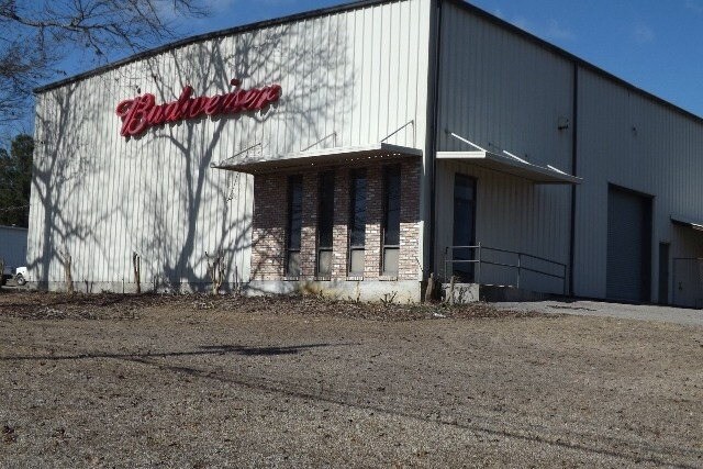
Property Record
Highway 31, Brewton, AL 36426


Property Detail
Highway 31
23-01-01-0-000-004.002
BEG SE INT OF FOSHEE RD & U S HWY 31 TH E LY 141 TH NE 105 FOR POB. TH NW 300 NE 150 SE 300 SW 150 TO POB. LYING IN
Warehouse
ESCAMBIA
B and X Area of moderate flood hazard, usually the area between the limits of the 100-year and 500-year floods.
Alabama
2025
1 AC
2025
Alabama South Area
970100
Other Market Areas
6,000 SF
NEARBY LISTINGS FOR SALE OR LEASE
-
-
View all Brewton listings for sale on LoopNet.com
DEMOGRAPHICS near Highway 31
1 mile
3 mile
5 mile
2025 Total Population
92
2,217
9,038
2030 Population
92
2,231
9,068
Pop Growth 2025-2030
0.00%
+ 0.63%
+ 0.33%
Average Age
42
41
42
2025 Total Households
38
978
3,746
HH Growth 2025-2030
0.00%
+ 0.72%
+ 0.37%
Median Household Inc
$44,999
$35,871
$45,472
Avg Household Size
2.40
2.30
2.30
2025 Avg HH Vehicles
2.00
1.00
2.00
Median Home Value
$136,363
$101,656
$138,296
Median Year Built
1989
1988
1987
Nearby Places
Map Layers
Map Styles
 Street
 Aerial
Layers
 Traffic
 Biking
Places
Listings with unknown addresses are not visible on the map
- Restaurants
- Banks
- Shops
- Fitness
- Groceries
SALE & LEASE HISTORY
LISTING DATE
SALE/LEASE

Sep 24, 2016
For Sale
Apr 10, 2017
For Sale
Apr 10, 2017
For Sale
Nearby Properties
Address
Land Use
TOTAL SIZE
Lot Size
Zoning
Address
Land Use
TOTAL SIZE
Lot Size
Zoning
841 SF
312 AC
Address
Land Use
TOTAL SIZE
Lot Size
Zoning
125,000 SF
12 AC
Address
Land Use
TOTAL SIZE
Lot Size
Zoning
54,850 SF
77 AC
Address
Land Use
TOTAL SIZE
Lot Size
Zoning
55,500 SF
14 AC
Address
Land Use
TOTAL SIZE
Lot Size
Zoning
8,160 SF
2 AC
Address
Land Use
TOTAL SIZE
Lot Size
Zoning
8,540 SF
5 AC
Address
Land Use
TOTAL SIZE
Lot Size
Zoning
482 AC
Address
Land Use
TOTAL SIZE
Lot Size
Zoning
500 SF
4 AC
Address
Land Use
TOTAL SIZE
Lot Size
Zoning
Address
Land Use
TOTAL SIZE
Lot Size
Zoning
37,110 SF
5 AC
Address
Land Use
TOTAL SIZE
Lot Size
Zoning
19,764 SF
1.51 AC
Address
Land Use
TOTAL SIZE
Lot Size
Zoning
14,640 SF
2 AC
Address
Land Use
TOTAL SIZE
Lot Size
Zoning
9,737 SF
2 AC
Address
Land Use
TOTAL SIZE
Lot Size
Zoning
8,628 SF
9 AC
Address
Land Use
TOTAL SIZE
Lot Size
Zoning
12,610 SF
2.79 AC
Address
Land Use
TOTAL SIZE
Lot Size
Zoning
Address
Land Use
TOTAL SIZE
Lot Size
Zoning
11,159 SF
3 AC
Address
Land Use
TOTAL SIZE
Lot Size
Zoning
6,832 SF
4 AC
Address
Land Use
TOTAL SIZE
Lot Size
Zoning
7,050 SF
3.26 AC
Address
Land Use
TOTAL SIZE
Lot Size
Zoning
13,165 SF
0.35 AC
Address
Land Use
TOTAL SIZE
Lot Size
Zoning
12,973 SF
0.28 AC
Address
Land Use
TOTAL SIZE
Lot Size
Zoning
13,640 SF
5 AC
Address
Land Use
TOTAL SIZE
Lot Size
Zoning
11,050 SF
3 AC
Address
Land Use
TOTAL SIZE
Lot Size
Zoning
3,570 SF
1 AC
Address
Land Use
TOTAL SIZE
Lot Size
Zoning
3,000 SF
4 AC
Address
Land Use
TOTAL SIZE
Lot Size
Zoning
25,500 SF
5 AC
Address
Land Use
TOTAL SIZE
Lot Size
Zoning
7,200 SF
8 AC
Address
Land Use
TOTAL SIZE
Lot Size
Zoning
2,442 SF
1 AC
Address
Land Use
TOTAL SIZE
Lot Size
Zoning
2,544 SF
0.85 AC
Address
Land Use
TOTAL SIZE
Lot Size
Zoning
25,500 SF
7 AC
The World's #1 Commercial Real Estate Marketplace
Connect with us
© 2026 CoStar Group
The information above has been obtained from sources believed reliable. While we do not doubt its accuracy we have not verified it and make no guarantee, warranty or representation about it. It is your responsibility to independently confirm its accuracy and completeness. Any projections, opinions, assumptions, or estimates used are for example only and do not represent the current or future performance of the property. The value of this transaction to you depends on tax and other factors which should be evaluated by your tax, financial, and legal advisors. You and your advisors should conduct a careful, independent investigation of the property to determine to your satisfaction the suitability of the property for your needs.