Property Record
Highway 31, Cullman, AL 35055
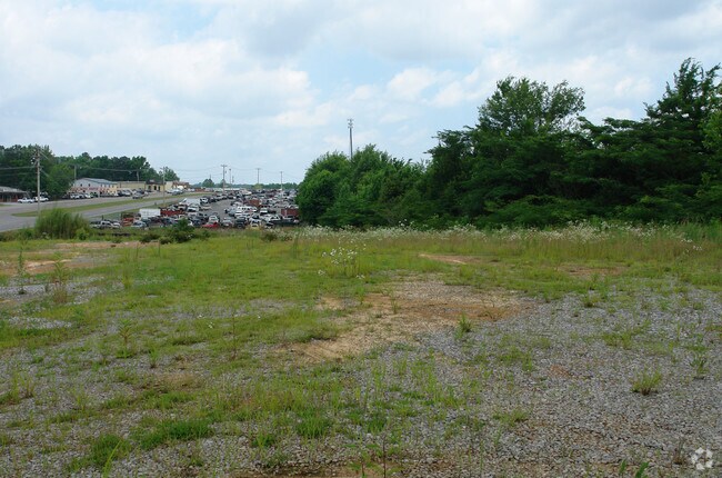


Property Detail
Highway 31
Cullman, AL
1.24 AC- BEG NW 300(S) FROM INT W ROW L&N RR WITH E ROW HWY #31 IN NE 1/4. TH CONT NWLY ALG E SD OF HWY #31 431.85, NE 142.89
17-08-27-1-001-001.002
CULLMAN
Vacantlandnec
Alabama
B and X Area of moderate flood hazard, usually the area between the limits of the 100-year and 500-year floods.
1.36 AC
2025
Alabama North Area
2025
Other Market Areas
965100
NEARBY LISTINGS FOR SALE OR LEASE
DEMOGRAPHICS near Highway 31
1 mile
3 mile
5 mile
2025 Total Population
1,946
16,749
27,970
2030 Population
2,010
17,139
28,716
Pop Growth 2025-2030
+ 3.29%
+ 2.33%
+ 2.67%
Average Age
41
40
40
2025 Total Households
737
6,790
11,113
HH Growth 2025-2030
+ 3.26%
+ 2.21%
+ 2.57%
Median Household Inc
$94,664
$53,663
$58,780
Avg Household Size
2.40
2.30
2.40
2025 Avg HH Vehicles
2.00
2.00
2.00
Median Home Value
$234,459
$215,654
$226,691
Median Year Built
1984
1976
1978
Nearby Places
Map Layers
Map Styles
 Street
 Aerial
Layers
 Traffic
 Biking
Places
Listings with unknown addresses are not visible on the map
- Restaurants
- Banks
- Shops
- Fitness
- Groceries
PUBLIC TRANSPORTATION
AIRPORT
Huntsville International-Carl T Jones Field
Drive
Walk
Distance
Huntsville International-Carl T Jones Field
58 min
46.7 mi
Nearby Properties
Address
Land Use
TOTAL SIZE
Lot Size
Zoning
Address
Land Use
TOTAL SIZE
Lot Size
Zoning
15,658 SF
73 AC
Address
Land Use
TOTAL SIZE
Lot Size
Zoning
10,104 SF
112 AC
Address
Land Use
TOTAL SIZE
Lot Size
Zoning
Address
Land Use
TOTAL SIZE
Lot Size
Zoning
7,302 SF
5.90 AC
Address
Land Use
TOTAL SIZE
Lot Size
Zoning
3,522 SF
100 AC
Address
Land Use
TOTAL SIZE
Lot Size
Zoning
12,260 SF
15.42 AC
Address
Land Use
TOTAL SIZE
Lot Size
Zoning
121,982 SF
72.65 AC
Address
Land Use
TOTAL SIZE
Lot Size
Zoning
226,001 SF
24.74 AC
Address
Land Use
TOTAL SIZE
Lot Size
Zoning
7,344 SF
397 AC
Address
Land Use
TOTAL SIZE
Lot Size
Zoning
127,252 SF
34.44 AC
Address
Land Use
TOTAL SIZE
Lot Size
Zoning
96,000 SF
11.88 AC
Address
Land Use
TOTAL SIZE
Lot Size
Zoning
12,890 SF
22.80 AC
Address
Land Use
TOTAL SIZE
Lot Size
Zoning
Address
Land Use
TOTAL SIZE
Lot Size
Zoning
3,895 SF
17.50 AC
Address
Land Use
TOTAL SIZE
Lot Size
Zoning
Address
Land Use
TOTAL SIZE
Lot Size
Zoning
30,000 SF
7 AC
Address
Land Use
TOTAL SIZE
Lot Size
Zoning
103,446 SF
18.49 AC
Address
Land Use
TOTAL SIZE
Lot Size
Zoning
7,516 SF
1.09 AC
Address
Land Use
TOTAL SIZE
Lot Size
Zoning
7,735 SF
3.94 AC
Address
Land Use
TOTAL SIZE
Lot Size
Zoning
9,764 SF
0.98 AC
Address
Land Use
TOTAL SIZE
Lot Size
Zoning
364 SF
0.69 AC
Address
Land Use
TOTAL SIZE
Lot Size
Zoning
Address
Land Use
TOTAL SIZE
Lot Size
Zoning
46,031 SF
4.97 AC
Address
Land Use
TOTAL SIZE
Lot Size
Zoning
11,887 SF
15.50 AC
Address
Land Use
TOTAL SIZE
Lot Size
Zoning
9,492 SF
1.82 AC
Address
Land Use
TOTAL SIZE
Lot Size
Zoning
60,528 SF
13 AC
Address
Land Use
TOTAL SIZE
Lot Size
Zoning
121,452 SF
9.50 AC
Address
Land Use
TOTAL SIZE
Lot Size
Zoning
2,580 SF
0.39 AC
Address
Land Use
TOTAL SIZE
Lot Size
Zoning
31,146 SF
2.76 AC
Address
Land Use
TOTAL SIZE
Lot Size
Zoning
15,912 SF
1.50 AC
The World's #1 Commercial Real Estate Marketplace
Connect with us
© 2026 CoStar Group
The information above has been obtained from sources believed reliable. While we do not doubt its accuracy we have not verified it and make no guarantee, warranty or representation about it. It is your responsibility to independently confirm its accuracy and completeness. Any projections, opinions, assumptions, or estimates used are for example only and do not represent the current or future performance of the property. The value of this transaction to you depends on tax and other factors which should be evaluated by your tax, financial, and legal advisors. You and your advisors should conduct a careful, independent investigation of the property to determine to your satisfaction the suitability of the property for your needs.