Property Record
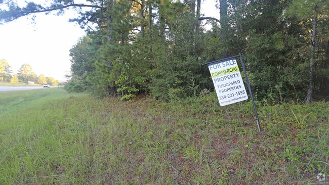
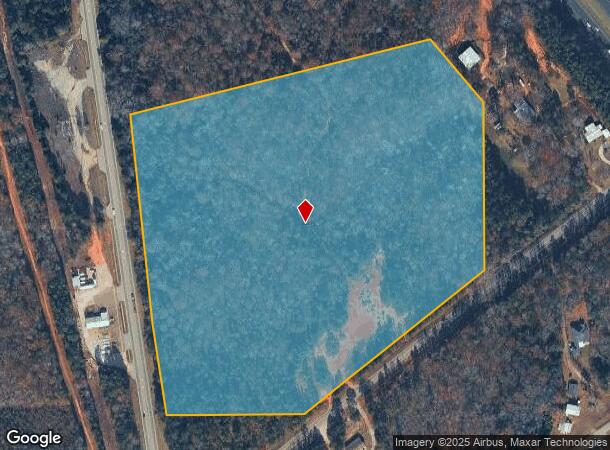
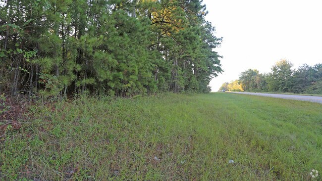
Highway 31 N, Prattville, AL 36067
NEARBY LISTINGS FOR SALE OR LEASE
-
-
View all Prattville listings for sale on LoopNet.com
Property Detail
Highway 31 N
10-05-16-0-001-003-000-0
COM AT THE SE COR OF NE1/4 OF S16 T18N R16E; TH W ALG SD LINE 598.25' TO A PT ONTHE N ROW OF COUNTY RD 85 AND THE POB; TH
Vacantlandnec
Autauga
X
Alabama
01001C0240E
25 AC
2025
Outlying Autauga County
2025
Montgomery
020803
Montgomery, AL
DEMOGRAPHICS near Highway 31 N
1 Mile
3 Mile
5 Mile
2024 Total Population
529
4,851
31,835
2029 Population
553
5,059
32,801
Pop Growth 2024-2029
+ 4.54%
+ 4.29%
+ 3.03%
Average Age
37
38
38
2024 Total Households
183
1,709
11,313
HH Growth 2024-2029
+ 4.37%
+ 4.27%
+ 2.89%
Median Household Inc
$85,869
$85,995
$69,779
Avg Household Size
2.80
2.70
2.70
2024 Avg HH Vehicles
2.00
2.00
2.00
Median Home Value
$189,473
$167,637
$185,603
Median Year Built
2002
1996
1996
Nearby Places
Map Layers
Map Styles
 Street
 Aerial
- Restaurants
- Banks
- Shops
- Fitness
- Groceries
PUBLIC TRANSPORTATION
AIRPORT
Montgomery Regional (Dannelly Field)
DRIVE
WALK
Distance
Montgomery Regional (Dannelly Field)
28 min
23.7 mi
Freight Ports
Port of Mobile
DRIVE
WALK
Distance
Port of Mobile
199 min
182.8 mi
Nearby Properties
Address
Land Use
TOTAL SIZE
Lot Size
Zoning
Address
Land Use
TOTAL SIZE
Lot Size
Zoning
56,026 SF
11.94 AC
Address
Land Use
TOTAL SIZE
Lot Size
Zoning
48,124 SF
5.37 AC
Address
Land Use
TOTAL SIZE
Lot Size
Zoning
51,263 SF
10.80 AC
Address
Land Use
TOTAL SIZE
Lot Size
Zoning
30,610 SF
2.80 AC
Address
Land Use
TOTAL SIZE
Lot Size
Zoning
310 AC
Address
Land Use
TOTAL SIZE
Lot Size
Zoning
Address
Land Use
TOTAL SIZE
Lot Size
Zoning
2,368 SF
6.95 AC
Address
Land Use
TOTAL SIZE
Lot Size
Zoning
6,920 SF
3.43 AC
Address
Land Use
TOTAL SIZE
Lot Size
Zoning
Address
Land Use
TOTAL SIZE
Lot Size
Zoning
15,950 SF
4.70 AC
Address
Land Use
TOTAL SIZE
Lot Size
Zoning
29,016 SF
7.61 AC
Address
Land Use
TOTAL SIZE
Lot Size
Zoning
1.54 AC
Address
Land Use
TOTAL SIZE
Lot Size
Zoning
49,664 SF
58 AC
Address
Land Use
TOTAL SIZE
Lot Size
Zoning
9,056 SF
1.81 AC
Address
Land Use
TOTAL SIZE
Lot Size
Zoning
2,800 SF
2.10 AC
Address
Land Use
TOTAL SIZE
Lot Size
Zoning
1,937 SF
1.25 AC
Address
Land Use
TOTAL SIZE
Lot Size
Zoning
5,034 SF
1.32 AC
Address
Land Use
TOTAL SIZE
Lot Size
Zoning
Address
Land Use
TOTAL SIZE
Lot Size
Zoning
4,200 SF
1.40 AC
Address
Land Use
TOTAL SIZE
Lot Size
Zoning
7,960 SF
10 AC
Address
Land Use
TOTAL SIZE
Lot Size
Zoning
9,020 SF
1 AC
Address
Land Use
TOTAL SIZE
Lot Size
Zoning
Address
Land Use
TOTAL SIZE
Lot Size
Zoning
14,400 SF
0.90 AC
Address
Land Use
TOTAL SIZE
Lot Size
Zoning
2,190 SF
3.14 AC
Address
Land Use
TOTAL SIZE
Lot Size
Zoning
Address
Land Use
TOTAL SIZE
Lot Size
Zoning
1,650 SF
1.20 AC
Address
Land Use
TOTAL SIZE
Lot Size
Zoning
4,536 SF
25 AC
Address
Land Use
TOTAL SIZE
Lot Size
Zoning
2,427 SF
1.50 AC
Address
Land Use
TOTAL SIZE
Lot Size
Zoning
Address
Land Use
TOTAL SIZE
Lot Size
Zoning
30.67 AC
The World's #1 Commercial Real Estate Marketplace
Connect with us
© 2026 CoStar Group
The information above has been obtained from sources believed reliable. While we do not doubt its accuracy we have not verified it and make no guarantee, warranty or representation about it. It is your responsibility to independently confirm its accuracy and completeness. Any projections, opinions, assumptions, or estimates used are for example only and do not represent the current or future performance of the property. The value of this transaction to you depends on tax and other factors which should be evaluated by your tax, financial, and legal advisors. You and your advisors should conduct a careful, independent investigation of the property to determine to your satisfaction the suitability of the property for your needs.