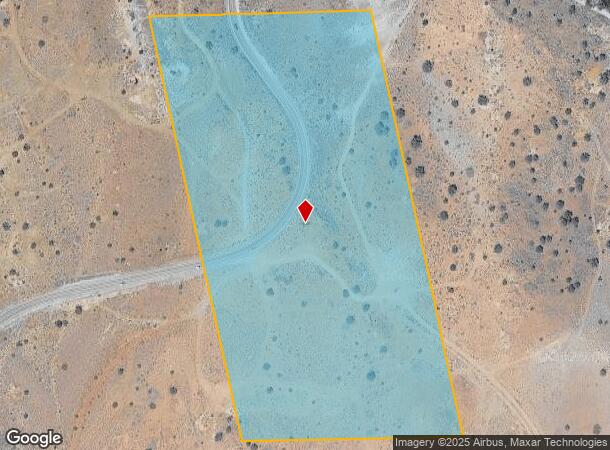
Property Record
Highway 341, Mound House, NV 89706

NEARBY LISTINGS FOR SALE OR LEASE
Property Detail
Highway 341
016-121-25
PAR 4 ADJ
Residentialacreage
Lyon
X
Nevada
32031C3370G
20 AC
2026
Lyon County
2025
Reno/Sparks
000900
Fernley, NV
DEMOGRAPHICS near Highway 341
1 Mile
3 Mile
5 Mile
2024 Total Population
95
3,029
10,511
2029 Population
99
3,243
11,290
Pop Growth 2024-2029
+ 4.21%
+ 7.07%
+ 7.41%
Average Age
43
42
44
2024 Total Households
37
1,196
4,248
HH Growth 2024-2029
+ 5.41%
+ 6.94%
+ 7.32%
Median Household Inc
$67,500
$76,655
$79,717
Avg Household Size
2.60
2.50
2.40
2024 Avg HH Vehicles
2.00
2.00
2.00
Median Home Value
$266,666
$293,668
$367,159
Median Year Built
1986
1991
1994
Nearby Places
Map Layers
Map Styles
 Street
 Aerial
- Restaurants
- Banks
- Shops
- Fitness
- Groceries
PUBLIC TRANSPORTATION
AIRPORT
Reno/Tahoe International
DRIVE
WALK
Distance
Reno/Tahoe International
57 min
29.4 mi
Freight Ports
Port of Stockton
DRIVE
WALK
Distance
Port of Stockton
232 min
161.7 mi
Nearby Properties
Address
Land Use
TOTAL SIZE
Lot Size
Zoning
Address
Land Use
TOTAL SIZE
Lot Size
Zoning
9,804 SF
3.31 AC
MFR
Address
Land Use
TOTAL SIZE
Lot Size
Zoning
64,532 SF
7 AC
C2
Address
Land Use
TOTAL SIZE
Lot Size
Zoning
100,947 SF
15 AC
M1
Address
Land Use
TOTAL SIZE
Lot Size
Zoning
83,961 SF
10 AC
M1
Address
Land Use
TOTAL SIZE
Lot Size
Zoning
1,590 SF
10.16 AC
M1
Address
Land Use
TOTAL SIZE
Lot Size
Zoning
28,000 SF
7.78 AC
M1
Address
Land Use
TOTAL SIZE
Lot Size
Zoning
22,200 SF
4.27 AC
M1
Address
Land Use
TOTAL SIZE
Lot Size
Zoning
69,600 SF
5.85 AC
M1
Address
Land Use
TOTAL SIZE
Lot Size
Zoning
20,100 SF
6.58 AC
C1
Address
Land Use
TOTAL SIZE
Lot Size
Zoning
21,119 SF
3.10 AC
C2
Address
Land Use
TOTAL SIZE
Lot Size
Zoning
2,989 SF
3.21 AC
C2
Address
Land Use
TOTAL SIZE
Lot Size
Zoning
15,264 SF
1.60 AC
C2
Address
Land Use
TOTAL SIZE
Lot Size
Zoning
86,500 SF
6.41 AC
M1
Address
Land Use
TOTAL SIZE
Lot Size
Zoning
4,950 SF
2.69 AC
M1
Address
Land Use
TOTAL SIZE
Lot Size
Zoning
21,349 SF
1.82 AC
C2
Address
Land Use
TOTAL SIZE
Lot Size
Zoning
42.04 AC
C2
Address
Land Use
TOTAL SIZE
Lot Size
Zoning
15,543 SF
1.44 AC
C2
Address
Land Use
TOTAL SIZE
Lot Size
Zoning
28,425 SF
3.85 AC
M1
Address
Land Use
TOTAL SIZE
Lot Size
Zoning
34,700 SF
5.35 AC
M1
Address
Land Use
TOTAL SIZE
Lot Size
Zoning
4,350 SF
2.50 AC
M1
Address
Land Use
TOTAL SIZE
Lot Size
Zoning
33,600 SF
3.90 AC
M1
Address
Land Use
TOTAL SIZE
Lot Size
Zoning
12,644 SF
0.37 AC
C2
Address
Land Use
TOTAL SIZE
Lot Size
Zoning
16,256 SF
2.26 AC
C2
Address
Land Use
TOTAL SIZE
Lot Size
Zoning
3,739 SF
26.66 AC
RR3
Address
Land Use
TOTAL SIZE
Lot Size
Zoning
6,250 SF
2 AC
M1
Address
Land Use
TOTAL SIZE
Lot Size
Zoning
7,542 SF
7.43 AC
M1
Address
Land Use
TOTAL SIZE
Lot Size
Zoning
6,553 SF
3 AC
C2
Address
Land Use
TOTAL SIZE
Lot Size
Zoning
3,737 SF
1.38 AC
C2
Address
Land Use
TOTAL SIZE
Lot Size
Zoning
18,000 SF
1.99 AC
M1
Address
Land Use
TOTAL SIZE
Lot Size
Zoning
9,600 SF
4.66 AC
M1
The World's #1 Commercial Real Estate Marketplace
Connect with us
© 2025 CoStar Group
The information above has been obtained from sources believed reliable. While we do not doubt its accuracy we have not verified it and make no guarantee, warranty or representation about it. It is your responsibility to independently confirm its accuracy and completeness. Any projections, opinions, assumptions, or estimates used are for example only and do not represent the current or future performance of the property. The value of this transaction to you depends on tax and other factors which should be evaluated by your tax, financial, and legal advisors. You and your advisors should conduct a careful, independent investigation of the property to determine to your satisfaction the suitability of the property for your needs.