Property Record
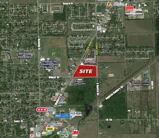
Highway 35, Angleton, TX 77515


NEARBY LISTINGS FOR SALE OR LEASE
Property Detail
Highway 35
Houston-Pasadena-The Woodlands, TX
Angleton Commercial Sub No 7 (A0380 J De
1313-7000-002
ANGLETON COMMERCIAL SUB NO 7 (A0380 J DE J VALDERAS) LOT 2 ACRES 11.683
Agriculturalland
Brazoria
X
Texas
48039C0435K
2
2024
11.68 AC
2025
South Hwy 35
662100
Houston
DEMOGRAPHICS near Highway 35
1 Mile
3 Mile
5 Mile
2024 Total Population
6,895
21,028
25,859
2029 Population
7,685
23,507
28,895
Pop Growth 2024-2029
+ 11.46%
+ 11.79%
+ 11.74%
Average Age
37
38
38
2024 Total Households
2,619
7,753
9,446
HH Growth 2024-2029
+ 11.61%
+ 11.98%
+ 11.94%
Median Household Inc
$58,230
$70,072
$71,807
Avg Household Size
2.60
2.70
2.70
2024 Avg HH Vehicles
2.00
2.00
2.00
Median Home Value
$147,346
$171,674
$181,457
Median Year Built
1976
1979
1981
Nearby Places
Map Layers
Map Styles
 Street
 Aerial
- Restaurants
- Banks
- Shops
- Fitness
- Groceries
PUBLIC TRANSPORTATION
AIRPORT
William P Hobby
DRIVE
WALK
Distance
William P Hobby
61 min
43.2 mi
Freight Ports
Port Freeport
DRIVE
WALK
Distance
Port Freeport
31 min
19.1 mi
SALE & LEASE HISTORY
LISTING DATE
SALE/LEASE

Sep 24, 2016
For Sale
Jan 26, 2017
For Sale
Feb 21, 2017
For Sale
Feb 05, 2019
For Sale
Nearby Properties
Address
Land Use
TOTAL SIZE
Lot Size
Zoning
Address
Land Use
TOTAL SIZE
Lot Size
Zoning
77.68 AC
0066
Address
Land Use
TOTAL SIZE
Lot Size
Zoning
305,581 SF
8.28 AC
Address
Land Use
TOTAL SIZE
Lot Size
Zoning
318,545 SF
50.52 AC
Address
Land Use
TOTAL SIZE
Lot Size
Zoning
349,628 SF
40 AC
Address
Land Use
TOTAL SIZE
Lot Size
Zoning
4,953 SF
19.41 AC
0151
Address
Land Use
TOTAL SIZE
Lot Size
Zoning
128,857 SF
10.65 AC
0140
Address
Land Use
TOTAL SIZE
Lot Size
Zoning
398,610 SF
119.90 AC
Address
Land Use
TOTAL SIZE
Lot Size
Zoning
138,430 SF
8.85 AC
Address
Land Use
TOTAL SIZE
Lot Size
Zoning
140,993 SF
5.79 AC
Address
Land Use
TOTAL SIZE
Lot Size
Zoning
145,006 SF
6.97 AC
Address
Land Use
TOTAL SIZE
Lot Size
Zoning
45,000 SF
13.30 AC
0062
Address
Land Use
TOTAL SIZE
Lot Size
Zoning
12,221 SF
13.76 AC
0165
Address
Land Use
TOTAL SIZE
Lot Size
Zoning
89,808 SF
8.80 AC
Address
Land Use
TOTAL SIZE
Lot Size
Zoning
14.46 AC
0138
Address
Land Use
TOTAL SIZE
Lot Size
Zoning
128,247 SF
17.49 AC
0114
Address
Land Use
TOTAL SIZE
Lot Size
Zoning
80,718 SF
5.92 AC
Address
Land Use
TOTAL SIZE
Lot Size
Zoning
96,487 SF
1 AC
0011
Address
Land Use
TOTAL SIZE
Lot Size
Zoning
36,320 SF
10 AC
098A
Address
Land Use
TOTAL SIZE
Lot Size
Zoning
6.52 AC
Address
Land Use
TOTAL SIZE
Lot Size
Zoning
4.60 AC
Address
Land Use
TOTAL SIZE
Lot Size
Zoning
65,752 SF
Address
Land Use
TOTAL SIZE
Lot Size
Zoning
95,358 SF
4.78 AC
0140
Address
Land Use
TOTAL SIZE
Lot Size
Zoning
60.29 AC
0068
Address
Land Use
TOTAL SIZE
Lot Size
Zoning
77,295 SF
6.63 AC
0056
Address
Land Use
TOTAL SIZE
Lot Size
Zoning
90,957 SF
5 AC
Address
Land Use
TOTAL SIZE
Lot Size
Zoning
Address
Land Use
TOTAL SIZE
Lot Size
Zoning
33,546 SF
13.28 AC
Address
Land Use
TOTAL SIZE
Lot Size
Zoning
112,149 SF
35.71 AC
Address
Land Use
TOTAL SIZE
Lot Size
Zoning
69,265 SF
3.25 AC
Address
Land Use
TOTAL SIZE
Lot Size
Zoning
52,342 SF
8.63 AC
The World's #1 Commercial Real Estate Marketplace
Connect with us
© 2026 CoStar Group
The information above has been obtained from sources believed reliable. While we do not doubt its accuracy we have not verified it and make no guarantee, warranty or representation about it. It is your responsibility to independently confirm its accuracy and completeness. Any projections, opinions, assumptions, or estimates used are for example only and do not represent the current or future performance of the property. The value of this transaction to you depends on tax and other factors which should be evaluated by your tax, financial, and legal advisors. You and your advisors should conduct a careful, independent investigation of the property to determine to your satisfaction the suitability of the property for your needs.