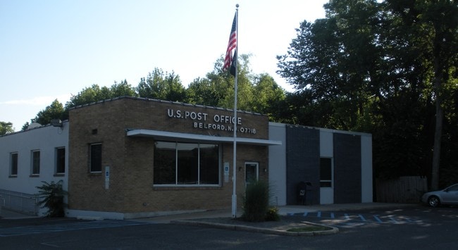
Property Record
Highway 36, Belford, NJ 07718

Property Detail
Highway 36
32-00309-0000-00010-02
MONMOUTH
Federalproperty
New Jersey
C125
10.2
B and X Area of moderate flood hazard, usually the area between the limits of the 100-year and 500-year floods.
1.10 AC
2024
Eastern Monmouth
2025
Northern New Jersey
800500
Lakewood-New Brunswick, NJ
4,202 SF
NEARBY LISTINGS FOR SALE OR LEASE
-
-
View all Belford listings for sale on LoopNet.com
DEMOGRAPHICS near Highway 36
1 mile
3 mile
5 mile
2025 Total Population
7,617
48,946
105,024
2030 Population
7,547
48,685
104,511
Pop Growth 2025-2030
(0.92%)
(0.53%)
(0.49%)
Average Age
41
42
43
2025 Total Households
2,661
17,907
39,584
HH Growth 2025-2030
(1.16%)
(0.71%)
(0.59%)
Median Household Inc
$137,364
$128,470
$124,584
Avg Household Size
2.70
2.60
2.60
2025 Avg HH Vehicles
2.00
2.00
2.00
Median Home Value
$553,262
$567,421
$614,810
Median Year Built
1957
1964
1967
Nearby Places
Map Layers
Map Styles
 Street
 Aerial
Layers
 Traffic
 Biking
Places
Listings with unknown addresses are not visible on the map
- Restaurants
- Banks
- Shops
- Fitness
- Groceries
PUBLIC TRANSPORTATION
COMMUTER RAIL
Drive
Walk
Distance
8 min
3.5 mi
Red Bank (North Jersey Coast Line - NJ Transit Commuter Rail (NJ Transit))
Drive
Walk
Distance
Red Bank (North Jersey Coast Line - NJ Transit Commuter Rail (NJ Transit))
11 min
6.6 mi
AIRPORT
Newark Liberty International
Drive
Walk
Distance
Newark Liberty International
48 min
34.0 mi
Freight Ports
New York Container Terminal
Drive
Walk
Distance
New York Container Terminal
41 min
29.3 mi
Nearby Properties
Address
Land Use
TOTAL SIZE
Lot Size
Zoning
Address
Land Use
TOTAL SIZE
Lot Size
Zoning
838,137 SF
253 AC
R45
Address
Land Use
TOTAL SIZE
Lot Size
Zoning
596.51 AC
CONREC
Address
Land Use
TOTAL SIZE
Lot Size
Zoning
231,505 SF
21.75 AC
MU15
Address
Land Use
TOTAL SIZE
Lot Size
Zoning
147,236 SF
20.01 AC
MU15
Address
Land Use
TOTAL SIZE
Lot Size
Zoning
22.51 AC
MF08
Address
Land Use
TOTAL SIZE
Lot Size
Zoning
118,375 SF
18.20 AC
MU15
Address
Land Use
TOTAL SIZE
Lot Size
Zoning
83,449 SF
0.57 AC
SF05
Address
Land Use
TOTAL SIZE
Lot Size
Zoning
77,396 SF
11.47 AC
SF20
Address
Land Use
TOTAL SIZE
Lot Size
Zoning
237,821 SF
38.92 AC
SF20
Address
Land Use
TOTAL SIZE
Lot Size
Zoning
133,184 SF
14.10 AC
MU15
Address
Land Use
TOTAL SIZE
Lot Size
Zoning
127,410 SF
6.02 AC
MF15
Address
Land Use
TOTAL SIZE
Lot Size
Zoning
3,864 SF
260 AC
R15
Address
Land Use
TOTAL SIZE
Lot Size
Zoning
91,520 SF
21.37 AC
MF08
Address
Land Use
TOTAL SIZE
Lot Size
Zoning
96.54 AC
I10
Address
Land Use
TOTAL SIZE
Lot Size
Zoning
83,416 SF
44.01 AC
R22
Address
Land Use
TOTAL SIZE
Lot Size
Zoning
141,313 SF
23.19 AC
SF20
Address
Land Use
TOTAL SIZE
Lot Size
Zoning
67,832 SF
10.46 AC
RGA
Address
Land Use
TOTAL SIZE
Lot Size
Zoning
43.97 AC
PD
Address
Land Use
TOTAL SIZE
Lot Size
Zoning
25,705 SF
7.15 AC
B-2
Address
Land Use
TOTAL SIZE
Lot Size
Zoning
117,594 SF
11.49 AC
MU15
Address
Land Use
TOTAL SIZE
Lot Size
Zoning
145,070 SF
8.64 AC
B2
Address
Land Use
TOTAL SIZE
Lot Size
Zoning
80,618 SF
6.59 AC
MU15
Address
Land Use
TOTAL SIZE
Lot Size
Zoning
75,292 SF
6.77 AC
B4
Address
Land Use
TOTAL SIZE
Lot Size
Zoning
67,982 SF
7.05 AC
MU15
Address
Land Use
TOTAL SIZE
Lot Size
Zoning
95,328 SF
1.46 AC
I0
Address
Land Use
TOTAL SIZE
Lot Size
Zoning
65,449 SF
3.30 AC
MF15
Address
Land Use
TOTAL SIZE
Lot Size
Zoning
1.77 AC
MF-2
Address
Land Use
TOTAL SIZE
Lot Size
Zoning
23,090 SF
10.60 AC
C125
Address
Land Use
TOTAL SIZE
Lot Size
Zoning
67,999 SF
13.43 AC
B4
Address
Land Use
TOTAL SIZE
Lot Size
Zoning
36,948 SF
8.89 AC
R30
The World's #1 Commercial Real Estate Marketplace
Connect with us
© 2026 CoStar Group
The information above has been obtained from sources believed reliable. While we do not doubt its accuracy we have not verified it and make no guarantee, warranty or representation about it. It is your responsibility to independently confirm its accuracy and completeness. Any projections, opinions, assumptions, or estimates used are for example only and do not represent the current or future performance of the property. The value of this transaction to you depends on tax and other factors which should be evaluated by your tax, financial, and legal advisors. You and your advisors should conduct a careful, independent investigation of the property to determine to your satisfaction the suitability of the property for your needs.