Property Record
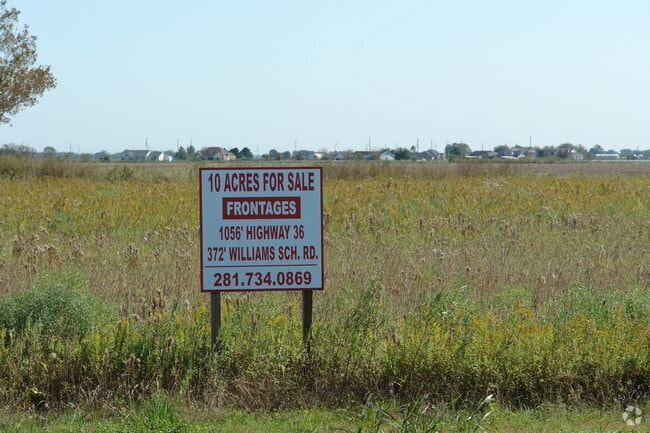
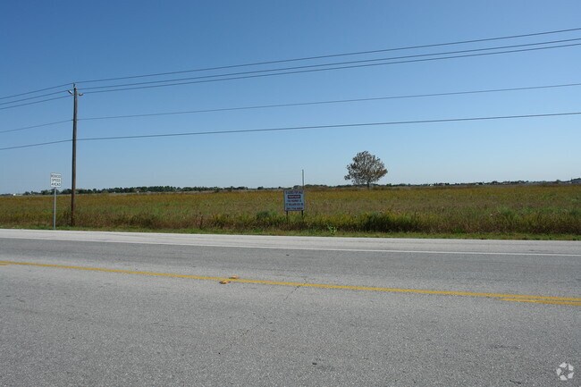
Highway 36, Needville, TX 77461

Property Detail
Highway 36
0239-00-000-0028-906
0239 H AND TC RY, ACRES 9.046
Commercialnec
FORT BEND
SY
Texas
B and X Area of moderate flood hazard, usually the area between the limits of the 100-year and 500-year floods.
9.05 AC
2024
Southwest Outlier
2025
Houston
675600
Houston-Pasadena-The Woodlands, TX
NEARBY LISTINGS FOR SALE OR LEASE
DEMOGRAPHICS near Highway 36
1 mile
3 mile
5 mile
2025 Total Population
421
6,243
30,558
2030 Population
485
7,206
35,272
Pop Growth 2025-2030
+ 15.20%
+ 15.43%
+ 15.43%
Average Age
40
38
37
2025 Total Households
136
1,929
9,805
HH Growth 2025-2030
+ 16.18%
+ 15.86%
+ 15.79%
Median Household Inc
$71,538
$72,890
$81,161
Avg Household Size
3.00
3.10
3.10
2025 Avg HH Vehicles
2.00
2.00
2.00
Median Home Value
$439,473
$361,363
$301,074
Median Year Built
1996
2007
2010
Nearby Places
Map Layers
Map Styles
 Street
 Aerial
Transit
 Traffic
 Biking
Places
Listings with unknown addresses are not visible on the map
- Restaurants
- Banks
- Shops
- Fitness
- Groceries
Nearby Properties
Address
Land Use
TOTAL SIZE
Lot Size
Zoning
Address
Land Use
TOTAL SIZE
Lot Size
Zoning
Address
Land Use
TOTAL SIZE
Lot Size
Zoning
30.46 AC
S
Address
Land Use
TOTAL SIZE
Lot Size
Zoning
109.89 AC
YQ
Address
Land Use
TOTAL SIZE
Lot Size
Zoning
111.59 AC
QOY
Address
Land Use
TOTAL SIZE
Lot Size
Zoning
864 SF
80.11 AC
QYSN
Address
Land Use
TOTAL SIZE
Lot Size
Zoning
45.10 AC
STR
Address
Land Use
TOTAL SIZE
Lot Size
Zoning
93.42 AC
Address
Land Use
TOTAL SIZE
Lot Size
Zoning
3.90 AC
Address
Land Use
TOTAL SIZE
Lot Size
Zoning
1.42 AC
Address
Land Use
TOTAL SIZE
Lot Size
Zoning
155.81 AC
Address
Land Use
TOTAL SIZE
Lot Size
Zoning
3,248 SF
89.86 AC
QOY
Address
Land Use
TOTAL SIZE
Lot Size
Zoning
15.50 AC
TY
Address
Land Use
TOTAL SIZE
Lot Size
Zoning
17.59 AC
S
Address
Land Use
TOTAL SIZE
Lot Size
Zoning
6.48 AC
S
Address
Land Use
TOTAL SIZE
Lot Size
Zoning
36,400 SF
2.47 AC
Address
Land Use
TOTAL SIZE
Lot Size
Zoning
800 SF
100.51 AC
OY
Address
Land Use
TOTAL SIZE
Lot Size
Zoning
11,030 SF
12.30 AC
Address
Land Use
TOTAL SIZE
Lot Size
Zoning
98 AC
OS
Address
Land Use
TOTAL SIZE
Lot Size
Zoning
5,862 SF
26.57 AC
Address
Land Use
TOTAL SIZE
Lot Size
Zoning
9.17 AC
Address
Land Use
TOTAL SIZE
Lot Size
Zoning
4,000 SF
10.74 AC
Address
Land Use
TOTAL SIZE
Lot Size
Zoning
77.07 AC
OTS
Address
Land Use
TOTAL SIZE
Lot Size
Zoning
18.27 AC
Address
Land Use
TOTAL SIZE
Lot Size
Zoning
Address
Land Use
TOTAL SIZE
Lot Size
Zoning
4,552 SF
9.34 AC
Address
Land Use
TOTAL SIZE
Lot Size
Zoning
786 SF
30.62 AC
YSOTS
Address
Land Use
TOTAL SIZE
Lot Size
Zoning
2,500 SF
19.21 AC
SOR
Address
Land Use
TOTAL SIZE
Lot Size
Zoning
40 AC
Address
Land Use
TOTAL SIZE
Lot Size
Zoning
30.83 AC
Address
Land Use
TOTAL SIZE
Lot Size
Zoning
5,000 SF
4.70 AC
SH
The World's #1 Commercial Real Estate Marketplace
Connect with us
© 2026 CoStar Group
The information above has been obtained from sources believed reliable. While we do not doubt its accuracy we have not verified it and make no guarantee, warranty or representation about it. It is your responsibility to independently confirm its accuracy and completeness. Any projections, opinions, assumptions, or estimates used are for example only and do not represent the current or future performance of the property. The value of this transaction to you depends on tax and other factors which should be evaluated by your tax, financial, and legal advisors. You and your advisors should conduct a careful, independent investigation of the property to determine to your satisfaction the suitability of the property for your needs.