Property Record
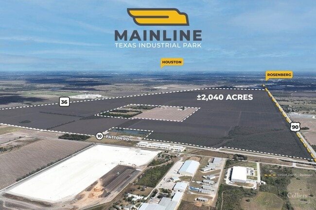
Highway 36, Rosenberg, TX 77471

This Property Is For Sale
Property Detail
Highway 36
Houston-Pasadena-The Woodlands, TX
0377 YANDELL FERRIS, TRACT 2, (TRACT 4), ACRES 234.636
0377-00-016-0020-901
FORT BEND
Farms
Texas
B and X Area of moderate flood hazard, usually the area between the limits of the 100-year and 500-year floods.
2,
2024
234.64 AC
2025
Sugar Land
675300
Houston
NEARBY LISTINGS FOR SALE OR LEASE
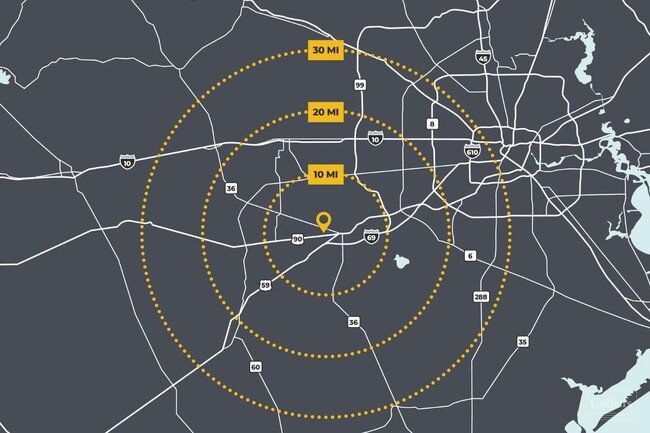
DEMOGRAPHICS near Highway 36
1 mile
3 mile
5 mile
2025 Total Population
5
3,695
30,754
2030 Population
6
4,195
35,038
Pop Growth 2025-2030
+ 20.00%
+ 13.53%
+ 13.93%
Average Age
0
36
37
2025 Total Households
2
1,104
10,187
HH Growth 2025-2030
0.00%
+ 14.04%
+ 14.29%
Median Household Inc
$0
$71,841
$71,867
Avg Household Size
2.00
3.30
3.00
2025 Avg HH Vehicles
2.00
2.00
2.00
Median Home Value
$750,000
$115,164
$241,546
Median Year Built
2011
1994
1992
Nearby Places
Map Layers
Map Styles
 Street
 Aerial
Layers
 Traffic
 Biking
Places
Listings with unknown addresses are not visible on the map
- Restaurants
- Banks
- Shops
- Fitness
- Groceries
Nearby Properties
Address
Land Use
TOTAL SIZE
Lot Size
Zoning
Address
Land Use
TOTAL SIZE
Lot Size
Zoning
672,112 SF
81.77 AC
YHN
Address
Land Use
TOTAL SIZE
Lot Size
Zoning
54.25 AC
L
Address
Land Use
TOTAL SIZE
Lot Size
Zoning
37.08 AC
Address
Land Use
TOTAL SIZE
Lot Size
Zoning
66,896 SF
18.60 AC
ZNY
Address
Land Use
TOTAL SIZE
Lot Size
Zoning
19.57 AC
OY
Address
Land Use
TOTAL SIZE
Lot Size
Zoning
9.51 AC
Address
Land Use
TOTAL SIZE
Lot Size
Zoning
11,800 SF
9.26 AC
S
Address
Land Use
TOTAL SIZE
Lot Size
Zoning
105,350 SF
11.50 AC
R
Address
Land Use
TOTAL SIZE
Lot Size
Zoning
220,453 SF
142.24 AC
SQ
Address
Land Use
TOTAL SIZE
Lot Size
Zoning
85,000 SF
19.49 AC
SN
Address
Land Use
TOTAL SIZE
Lot Size
Zoning
124,548 SF
13.72 AC
S
Address
Land Use
TOTAL SIZE
Lot Size
Zoning
21,110 SF
4 AC
S
Address
Land Use
TOTAL SIZE
Lot Size
Zoning
40,260 SF
10.82 AC
S
Address
Land Use
TOTAL SIZE
Lot Size
Zoning
51,250 SF
10.01 AC
S
Address
Land Use
TOTAL SIZE
Lot Size
Zoning
10,737 SF
8.26 AC
Address
Land Use
TOTAL SIZE
Lot Size
Zoning
67.93 AC
Address
Land Use
TOTAL SIZE
Lot Size
Zoning
139,047 SF
49.85 AC
Address
Land Use
TOTAL SIZE
Lot Size
Zoning
30,777 SF
12 AC
S
Address
Land Use
TOTAL SIZE
Lot Size
Zoning
120,196 SF
17.85 AC
S
Address
Land Use
TOTAL SIZE
Lot Size
Zoning
40,876 SF
7.69 AC
S
Address
Land Use
TOTAL SIZE
Lot Size
Zoning
32,760 SF
40.37 AC
Address
Land Use
TOTAL SIZE
Lot Size
Zoning
20,785 SF
10 AC
QS
Address
Land Use
TOTAL SIZE
Lot Size
Zoning
15,396 SF
3.27 AC
Address
Land Use
TOTAL SIZE
Lot Size
Zoning
68.41 AC
Y
Address
Land Use
TOTAL SIZE
Lot Size
Zoning
1.47 AC
L
Address
Land Use
TOTAL SIZE
Lot Size
Zoning
53,005 SF
3.25 AC
Address
Land Use
TOTAL SIZE
Lot Size
Zoning
19,694 SF
8.30 AC
SM
Address
Land Use
TOTAL SIZE
Lot Size
Zoning
23.42 AC
Address
Land Use
TOTAL SIZE
Lot Size
Zoning
1,260 SF
36.99 AC
YOQT
Address
Land Use
TOTAL SIZE
Lot Size
Zoning
The World's #1 Commercial Real Estate Marketplace
Connect with us
© 2026 CoStar Group
The information above has been obtained from sources believed reliable. While we do not doubt its accuracy we have not verified it and make no guarantee, warranty or representation about it. It is your responsibility to independently confirm its accuracy and completeness. Any projections, opinions, assumptions, or estimates used are for example only and do not represent the current or future performance of the property. The value of this transaction to you depends on tax and other factors which should be evaluated by your tax, financial, and legal advisors. You and your advisors should conduct a careful, independent investigation of the property to determine to your satisfaction the suitability of the property for your needs.